Greyrock Mountain Trail, National Recreation Trail in Larimer County, US
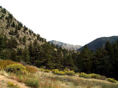
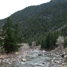
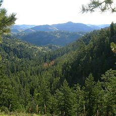
Greyrock Mountain Trail is a hiking route in Roosevelt National Forest that covers about 3 miles with nearly 2,000 feet of elevation gain. It starts from a parking area near the Cache La Poudre River and ascends to an open summit with wide views of the surrounding peaks and valleys.
The path was built in the 1930s by workers of the Civilian Conservation Corps, a New Deal program that created jobs while developing forest lands. It later gained recognition as a National Recreation Trail, making it part of a network of important hiking routes across the country.
The route draws hikers from across the region and reflects how outdoor recreation shapes local identity and leisure time. It connects visitors directly with the natural landscape that defines the area's character.
The parking area fills quickly on nice days, so arriving early in the morning is advisable. Bring plenty of water as no sources exist along the route, and turn back if weather deteriorates or thunderstorms approach.
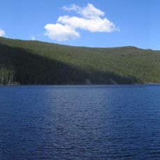
An alpine lake sits at the summit, surrounded by rocky terrain and reflecting the sky on clear days in a way that surprises many hikers. Few visitors expect to find water at this elevation, making the lake a memorable discovery for those reaching the top.
The community of curious travelers
AroundUs brings together thousands of curated places, local tips, and hidden gems, enriched daily by 60,000 contributors worldwide.