Enable Location

We need your location to show you interesting places around you

Discover nearby places

Find interesting locations and hidden gems around you

Precise directions

Get accurate directions and distances to places

Your location is never shared with other users. It's only used when you tap the location button.

Prewitt Reservoir

Log in to your account

Start exploring — it's free

Trusted by 63,531 travelers worldwide

Continue with Google
Continue with Apple
or

We will send you a code to connect

By continuing, you accept our Terms and Conditions and our Privacy Policy

Check your inbox

We've sent a pincode in your inbox. Please enter the code below.

Prewitt Reservoir
Discussion Reviews 1 Photos
2.7k Popularity

Prewitt Reservoir, dam in Washington and Logan counties, Colorado

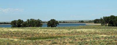
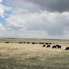
Prewitt Reservoir is a large body of water in northeastern Colorado surrounded by grasslands and wetlands that support various outdoor activities. The lake covers about 2,400 acres with calm water suitable for fishing, boating, and camping along the shoreline.

The area was established many years ago by authorities to protect wildlife and provide opportunities for fishing and hunting. Colorado Parks and Wildlife now manages the location, and it has long served as an important outdoor recreation destination for the local community.

The area attracts visitors from nearby towns and surrounding regions who seek outdoor recreation and wildlife watching. Families and hunters value the place for its quiet setting and chances to observe waterfowl, geese, and deer in their natural habitat.

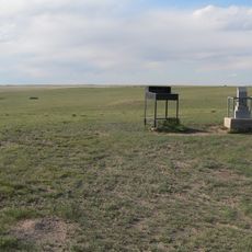
A hunting or fishing license is required to visit, or a special SWA pass for visitors over 15 years old. The area is accessible by car via maintained gravel roads with no official campgrounds; bring your own water as the site has vault toilets but no drinking water supply.

Visitors often share stories about flocks of ducks landing at sunset or catching fish early in the morning in pristine conditions. Spring and fall migrations bring large numbers of birds overhead and on the water, creating memorable moments for those watching the seasonal movement.

The community of curious travelers

AroundUs brings together thousands of curated places, local tips, and hidden gems, enriched daily by 60,000 contributors worldwide.

Start exploring
Location
GPS coordinates
40.42250,-103.36200
Latest update
February 9, 2026 08:22
Around this place
Panorama Point
United States of America

Panorama Point

86.2 km
Pawnee Buttes
United States of America

Pawnee Buttes

68 km
North Sterling State Park
United States of America

North Sterling State Park

41.6 km
Hoyt Radio Tower
United States of America

Hoyt Radio Tower

76.1 km
Central Plains
United States of America

Central Plains

92.6 km
St. Anthony's Roman Catholic Church
United States of America

St. Anthony's Roman Catholic Church

25.5 km
Sioux Ordnance Depot Fire & Guard Headquarters
United States of America

Sioux Ordnance Depot Fire & Guard Headquarters

90.8 km
Sterling Public Library
United States of America

Sterling Public Library

25.7 km
All Saints Church of Eben Ezer
United States of America

All Saints Church of Eben Ezer

30.4 km
Fort Morgan State Armory
United States of America

Fort Morgan State Armory

41.6 km
Fraternal Hall
United States of America

Fraternal Hall

94.1 km
Phillips County Courthouse
United States of America

Phillips County Courthouse

91.6 km
West Plum Bush Creek Bridge
United States of America

West Plum Bush Creek Bridge

78.9 km
Plum Bush Creek Bridge
United States of America

Plum Bush Creek Bridge

77.6 km
First United Presbyterian Church
United States of America

First United Presbyterian Church

25.8 km
Christ Episcopal Church
United States of America

Christ Episcopal Church

86.4 km
German Evangelical Immanuel Congregational Church
United States of America

German Evangelical Immanuel Congregational Church

28.4 km
Conrad Luft Sr. House
United States of America

Conrad Luft Sr. House

25 km
W. E. Heginbotham House
United States of America

W. E. Heginbotham House

91.4 km
First National Bank of Haxtun
United States of America

First National Bank of Haxtun

66.7 km
Logan County Courthouse
United States of America

Logan County Courthouse

25.9 km
Sidney Carnegie Library
United States of America

Sidney Carnegie Library

86.9 km
Knearl School
United States of America

Knearl School

29.3 km
Downtown Sterling Historic District
United States of America

Downtown Sterling Historic District

25.8 km
Lincoln School
United States of America

Lincoln School

41.4 km
Millage Farm Rural Historic District
United States of America

Millage Farm Rural Historic District

90.6 km
Central Plains Experimental Range
United States of America

Central Plains Experimental Range

92.6 km
Rainbow Arch Bridge
United States of America

Rainbow Arch Bridge

41 km
Show the full map
Reviews
Share your experience

No review yet

Discussions
Start a discussion...

No discussion yet

« Prewitt Reservoir - dam in Washington and Logan counties, Colorado » is provided by Around Us (aroundus.com). Images and texts are derived from Wikimedia project under a Creative Commons license. You are allowed to copy, distribute, and modify copies of this page, under the conditions set by the license, as long as this note is clearly visible.

Discover hidden gems everywhere you go!

From secret cafés to breathtaking viewpoints, skip the crowded tourist spots and find places that match your style. Our app makes it easy with voice search, smart filtering, route optimization, and insider tips from travelers worldwide. Download now for the complete mobile experience.

Around Us App Screenshot

A unique approach to discovering new places

Le Figaro

All the places worth exploring

France Info

A tailor-made excursion in just a few clicks

20 Minutes

Around Us
Travel Guide & Maps
Download

Send to your phone

QR Code
1

Open the camera app on your mobile.

2

Point at the QR code with your camera. A notification will appear.

3

Tap the notification to open the link.