Chest opened
+${chestReward.xp} XP
Explorer
NOUVEAU ×${chestReward.collectible.quantity}
tapez pour fermer

See the monuments around you in AR Open chests in the app

Around Us is built for your phone — point your camera at the streets and discover the monuments and places around you in augmented reality. Around Us is built for your phone — chests unlock when you walk, explore and capture nearby places.

•

Enable Location

We need your location to show you interesting places around you

Discover nearby places

Find interesting locations and hidden gems around you

Precise directions

Get accurate directions and distances to places

Your location is never shared with other users. It's only used when you tap the location button.

Panorama Point

Log in to your account

Start exploring — it's free

Trusted by 94,726 travelers worldwide

Continue with Google
Continue with Apple
or

We will send you a code to connect

By continuing, you accept our Terms and Conditions and our Privacy Policy

Check your inbox

We've sent a pincode in your inbox. Please enter the code below.

Panorama Point, High point at Nebraska-Wyoming border, US.

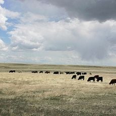
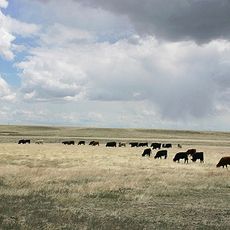
Panorama Point is Nebraska's highest natural elevation, rising 5,429 feet (1,654 m) above sea level in southwestern Kimball County. The landscape consists of rolling grasslands topped by a marked summit where visitors can stand at this high point.

Panorama Point is a low rise on the High Plains, not a mountain or hill, and its summit is marked by a stone marker giving an elevation of 5,424 feet (1,653 m). The marker was placed to make the highest point of Nebraska findable in the wide plain, one mile from the Colorado and Wyoming state lines. The site lies on the High Point Bison Ranch, whose owners allow visitors to drive up to the marker and register.

The summit register sits beside the stone marker at the end of the drive; the marker gives the elevation as 5,424 feet, while the accepted figure is 5,429 feet. Signing it is the customary act of arrival at Nebraska's highest natural point, a low rise on the High Plains rather than a peak.

Access is through High Point Bison Ranch, where a small fee is required, and driving carefully is important since free-roaming bison occupy the area. Wear sturdy shoes and arrive early on warm days to avoid the intense heat that can build up across the open grassland.

The stone marker at the summit gives the elevation as 5,424 feet, while the accepted figure is 5,429 feet; the two numbers differ by five feet. The marker stands beside a guest register where visitors sign in, and the state corner marker for Nebraska, Wyoming and Colorado lies a short distance away.

The community of curious travelers

AroundUs brings together thousands of curated places, local tips, and hidden gems, enriched daily by 94,726 contributors worldwide.

Start exploring
Location
GPS coordinates
41.00780,-104.03160
Latest update
November 11, 2026 18:48
Around this place
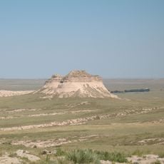
Pawnee Buttes
United States of America

Pawnee Buttes

13.2 mi
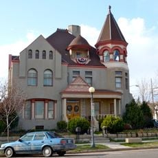
Nagle Warren Mansion
United States of America

Nagle Warren Mansion

41.6 mi
Downtown Cheyenne Historic District
United States of America

Downtown Cheyenne Historic District

41.8 mi
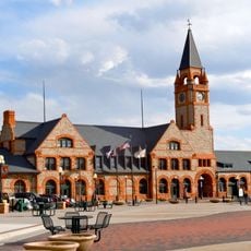
Cheyenne Depot Museum
United States of America

Cheyenne Depot Museum

41.7 mi
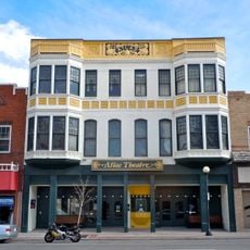
Atlas Theatre
United States of America

Atlas Theatre

41.8 mi
Saint Marks
United States of America

Saint Marks

41.9 mi
William Sturgis House
United States of America

William Sturgis House

41.3 mi
Rainsford Historic District
United States of America

Rainsford Historic District

41.5 mi
Central Plains
United States of America

Central Plains

41.4 mi
Texas Trail Museum
United States of America

Texas Trail Museum

12.2 mi
Crook House
United States of America

Crook House

41.8 mi
Lakeview Historic District
United States of America

Lakeview Historic District

41.9 mi
Masonic Temple
United States of America

Masonic Temple

41.9 mi
Fraternal Hall
United States of America

Fraternal Hall

24.9 mi
Cheyenne South Side Historic District
United States of America

Cheyenne South Side Historic District

41.1 mi
Capitol North Historic District
United States of America

Capitol North Historic District

41.6 mi
Moreton Frewen House
United States of America

Moreton Frewen House

41.8 mi
McCord-Brady Company
United States of America

McCord-Brady Company

41.9 mi
Castle on 19th Street
United States of America

Castle on 19th Street

41.2 mi
Albin
United States of America

Albin

34.2 mi
Whipple-Lacey House
United States of America

Whipple-Lacey House

41.6 mi
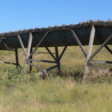
Maginnis Irrigation Aqueduct
United States of America

Maginnis Irrigation Aqueduct

20.2 mi
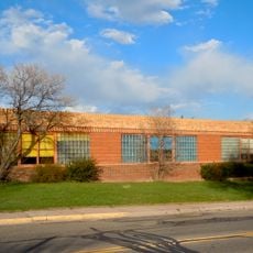
Mabel Fincher School
United States of America

Mabel Fincher School

41.5 mi
Baxter Ranch Headquarters Buildings
United States of America

Baxter Ranch Headquarters Buildings

41.4 mi
Ferdinand Lafrentz House
United States of America

Ferdinand Lafrentz House

41.8 mi
Central Plains Experimental Range
United States of America

Central Plains Experimental Range

41.4 mi
Lincoln $ Saver
United States of America

Lincoln $ Saver

41.7 mi
Historic Governor's Mansion
United States of America

Historic Governor's Mansion

41.8 mi
Show the full map
Reviews
Share your experience

No review yet

Discussions
Start a discussion...

No discussion yet

« Panorama Point - High point at Nebraska-Wyoming border, US » is provided by Around Us (aroundus.com). Images and texts are derived from Wikimedia project under a Creative Commons license. You are allowed to copy, distribute, and modify copies of this page, under the conditions set by the license, as long as this note is clearly visible.

Discover hidden gems everywhere you go!

From secret cafés to breathtaking viewpoints, skip the crowded tourist spots and find places that match your style. Our app makes it easy with voice search, smart filtering, route optimization, and insider tips from travelers worldwide. Download now for the complete mobile experience.
Around Us App Screenshot
❝

A unique approach to discovering new places❞

— Le Figaro

❝

All the places worth exploring❞

— France Info

❝

A tailor-made excursion in just a few clicks❞

— 20 Minutes

Around Us
Travel Guide & Maps
Download

Send to your phone

QR Code
1

Open the camera app on your mobile.

2

Point at the QR code with your camera. A notification will appear.

3

Tap the notification to open the link.