Sioux County

Log in to your account

AroundUs is a community-driven map of interesting places, built by curious explorers like you. It grows with every review, story, and photo you share.
Connect to save your favorite spots, contribute locations, and create personalized routes.
Continue with Google
Continue with Apple
Continue with X
Continue with Facebook
Continue with email
By continuing, you accept our Terms and Conditions and our Privacy Policy
Create an account
Add to collection
Map
Suggest a change
Share

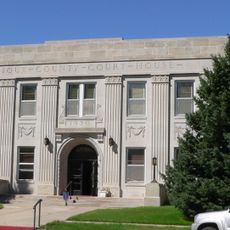
Sioux County, County in northwestern Nebraska, United States.

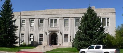
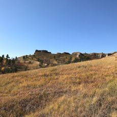
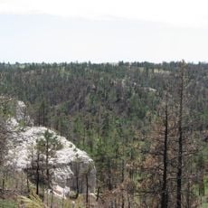
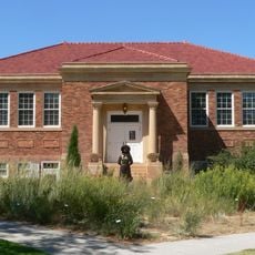
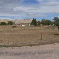
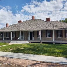
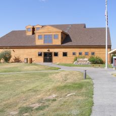
Sioux County is an administrative area in northwestern Nebraska featuring grasslands and rolling terrain crossed by the Niobrara River. The county includes small towns like Harrison, where most public services are centered.

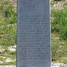
Nebraska State Legislature established this county in 1877, naming it after the Sioux people who had lived in the region for generations. Its creation took place during a period of major change for native inhabitants and incoming settlers.

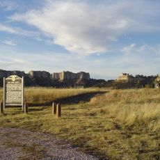
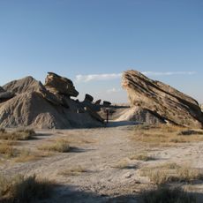
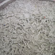
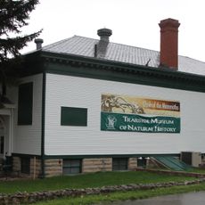
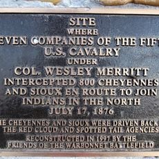
The land holds the Agate Fossil Beds National Monument, where you can see objects and remains that tell the story of people who lived here long ago. The place shows how nature and human history are connected in this region.

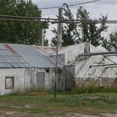
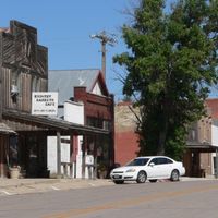
The area is sparsely populated with limited services spread across small towns. Visitors should plan ahead for trips to remote parts and ensure they have enough fuel and supplies before traveling into outlying areas.

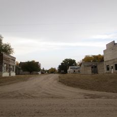
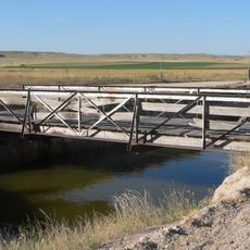
The territory is one of Nebraska's most sparsely populated areas, with fewer than one person per square mile spread across its vast expanse. This extreme remoteness makes it a place where you can experience nature without typical crowds.

Location: Nebraska

Inception: 1877

Capital city: Harrison

Shares border with: Fall River County, Scotts Bluff County, Dawes County, Box Butte County, Niobrara County, Goshen County

GPS coordinates: 42.48000,-103.77000

Latest update: December 10, 2025 15:56

Photos
Around this place
Fort Robinson
United States of America

Fort Robinson

32.5 km
Toadstool Geologic Park
United States of America

Toadstool Geologic Park

45.7 km
Hudson-Meng Bison Kill
United States of America

Hudson-Meng Bison Kill

41.6 km
Chadron State Park
United States of America

Chadron State Park

66.7 km
Pine Ridge National Recreation Area
United States of America

Pine Ridge National Recreation Area

55.1 km
Cheyenne-Black Hills Stage Route and Rawhide Buttes and Running Water Stage Stations
United States of America

Cheyenne-Black Hills Stage Route and Rawhide Buttes and Running Water Stage Stations

66.2 km
Lake Minatare Lighthouse
United States of America

Lake Minatare Lighthouse

65.1 km
Trailside Museum of Natural History at Fort Robinson State Park
United States of America

Trailside Museum of Natural History at Fort Robinson State Park

32.4 km
Mari Sandoz High Plains Heritage Center
United States of America

Mari Sandoz High Plains Heritage Center

73.3 km
C and H Refinery Historic District
United States of America

C and H Refinery Historic District

64 km
Jay Em Historic District
United States of America

Jay Em Historic District

49.3 km
Lusk Water Tower
United States of America

Lusk Water Tower

63.5 km
Fort Robinson State Park
United States of America

Fort Robinson State Park

32.3 km
Dawes County Courthouse
United States of America

Dawes County Courthouse

53.2 km
Chadron Commercial Historic District
United States of America

Chadron Commercial Historic District

74.1 km
Site of Ferdinand Branstetter Post No. 1, American Legion
United States of America

Site of Ferdinand Branstetter Post No. 1, American Legion

33.4 km
Crites Hall
United States of America

Crites Hall

73.5 km
Sioux County Courthouse
United States of America

Sioux County Courthouse

25 km
Sparks Hall
United States of America

Sparks Hall

73.5 km
Chadron Public Library
United States of America

Chadron Public Library

74 km
Edna Work Hall
United States of America

Edna Work Hall

73.4 km
Fort Robinson Museum & History Center
United States of America

Fort Robinson Museum & History Center

32.5 km
Scottsbluff Carnegie Library
United States of America

Scottsbluff Carnegie Library

69.1 km
M.B. Quivey House
United States of America

M.B. Quivey House

59.9 km
Army Theatre
United States of America

Army Theatre

32.4 km
Agate Fossil Beds Visitor Center
United States of America

Agate Fossil Beds Visitor Center

6.8 km
Interstate Canal Bridge
United States of America

Interstate Canal Bridge

54.8 km
Warbonnet Battlefield Monument
United States of America

Warbonnet Battlefield Monument

49.9 km
Show the full map
Reviews

Visited this place? Tap the stars to rate it and share your experience / photos with the community! Try now! You can cancel it anytime.

Administrative divisions
« Sioux County - County in northwestern Nebraska, United States » is provided by Around Us (aroundus.com). Images and texts are derived from Wikimedia project under a Creative Commons license. You are allowed to copy, distribute, and modify copies of this page, under the conditions set by the license, as long as this note is clearly visible.

Discover hidden gems everywhere you go!

From secret cafés to breathtaking viewpoints, skip the crowded tourist spots and find places that match your style. Our app makes it easy with voice search, smart filtering, route optimization, and insider tips from travelers worldwide. Download now for the complete mobile experience.

Around Us App Screenshot

A unique approach to discovering new places

Le Figaro

All the places worth exploring

France Info

A tailor-made excursion in just a few clicks

20 Minutes