Enable Location

We need your location to show you interesting places around you

Discover nearby places

Find interesting locations and hidden gems around you

Precise directions

Get accurate directions and distances to places

Your location is never shared with other users. It's only used when you tap the location button.

North Fork Umatilla Wilderness

Log in to your account

Start exploring — it's free

Trusted by 64,881 travelers worldwide

Continue with Google
Continue with Apple
or

We will send you a code to connect

By continuing, you accept our Terms and Conditions and our Privacy Policy

Check your inbox

We've sent a pincode in your inbox. Please enter the code below.

North Fork Umatilla Wilderness
Discussion Reviews 1 Photos
3k Popularity

North Fork Umatilla Wilderness, Protected wilderness area in Umatilla National Forest, Oregon, United States.

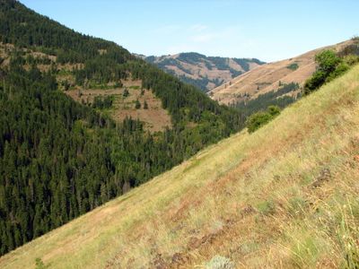
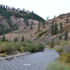
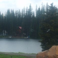
North Fork Umatilla Wilderness is a protected wilderness area within Umatilla National Forest in northeastern Oregon. It is made up of deep canyons, forested slopes, and open plateaus, all crossed by a network of hiking trails.

The area was designated a protected wilderness by the US Forest Service in 1984, as part of a wider national effort to safeguard natural landscapes through the Wilderness Act. Before that, the land had been used for logging and grazing, which shaped parts of the terrain still visible today.

The Nez Perce and other Native peoples traveled and hunted across these lands for generations. Many of the hiking trails today follow the same routes those communities used through the canyons and across the plateaus.

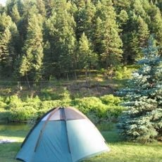
The lower canyon trails tend to open earlier in spring, while the higher routes stay accessible well into fall. Weather can shift quickly at any elevation, so layered clothing and sturdy footwear are worth bringing regardless of the season.

The North Fork Umatilla River, which runs through the area, is home to bull trout and steelhead salmon that live under strict catch-and-release rules. This makes the river one of the few in the region where fishing is allowed but the fish population is still carefully protected.

The community of curious travelers

AroundUs brings together thousands of curated places, local tips, and hidden gems, enriched daily by 60,000 contributors worldwide.

Start exploring
Location
GPS coordinates
45.71670,-118.14900
Latest update
March 3, 2026 13:52
Around this place
Fort Walla Walla
United States of America

Fort Walla Walla

40.2 km
Emigrant Springs State Heritage Area
United States of America

Emigrant Springs State Heritage Area

31.2 km
Tamástslikt Cultural Institute
United States of America

Tamástslikt Cultural Institute

40.6 km
Jubilee Lake
United States of America

Jubilee Lake

19.4 km
Borleske Stadium
United States of America

Borleske Stadium

42.6 km
Wallowa Lake Highway Forest State Scenic Corridor
United States of America

Wallowa Lake Highway Forest State Scenic Corridor

37.6 km
Hilgard Junction State Recreation Area
United States of America

Hilgard Junction State Recreation Area

42.5 km
Minam State Recreation Area
United States of America

Minam State Recreation Area

34.3 km
Eagle Cap Excursion Train
United States of America

Eagle Cap Excursion Train

24.5 km
Wallowa River Rest Area
United States of America

Wallowa River Rest Area

42.3 km
Kirkman House
United States of America

Kirkman House

42.1 km
Elgin Opera House
United States of America

Elgin Opera House

24.6 km
Electric Light Works Building
United States of America

Electric Light Works Building

41.8 km
Langdon Lake
United States of America

Langdon Lake

8.4 km
RiverBend Alternative Education School
United States of America

RiverBend Alternative Education School

42.8 km
John Anthony House
United States of America

John Anthony House

43.7 km
Greasewood Finnish Apostolic Lutheran Church
United States of America

Greasewood Finnish Apostolic Lutheran Church

40.5 km
Inlow Hall
United States of America

Inlow Hall

44.2 km
Liberty Theater
United States of America

Liberty Theater

43.3 km
Hoodoo Ridge Lookout
United States of America

Hoodoo Ridge Lookout

49 km
Anthony–Buckley House
United States of America

Anthony–Buckley House

43.7 km
Walla Walla Valley Traction Company Car Barn
United States of America

Walla Walla Valley Traction Company Car Barn

42.3 km
U.S. Post Office and Federal Building
United States of America

U.S. Post Office and Federal Building

43.3 km
Children's Museum of Walla Walla
United States of America

Children's Museum of Walla Walla

41.1 km
Liberty Theatre
United States of America

Liberty Theatre

41.7 km
Gardner Building
United States of America

Gardner Building

43.5 km
Granada 3 Theatre
United States of America

Granada 3 Theatre

43.5 km
Athena City Park
United States of America

Athena City Park

28.3 km
Show the full map
Reviews
Share your experience

No review yet

Discussions
Start a discussion...

No discussion yet

« North Fork Umatilla Wilderness - Protected wilderness area in Umatilla National Forest, Oregon, United States » is provided by Around Us (aroundus.com). Images and texts are derived from Wikimedia project under a Creative Commons license. You are allowed to copy, distribute, and modify copies of this page, under the conditions set by the license, as long as this note is clearly visible.

Discover hidden gems everywhere you go!

From secret cafés to breathtaking viewpoints, skip the crowded tourist spots and find places that match your style. Our app makes it easy with voice search, smart filtering, route optimization, and insider tips from travelers worldwide. Download now for the complete mobile experience.

Around Us App Screenshot

A unique approach to discovering new places

Le Figaro

All the places worth exploring

France Info

A tailor-made excursion in just a few clicks

20 Minutes

Around Us
Travel Guide & Maps
Download

Send to your phone

QR Code
1

Open the camera app on your mobile.

2

Point at the QR code with your camera. A notification will appear.

3

Tap the notification to open the link.