Enable Location

We need your location to show you interesting places around you

Discover nearby places

Find interesting locations and hidden gems around you

Precise directions

Get accurate directions and distances to places

Your location is never shared with other users. It's only used when you tap the location button.

Jubilee Lake

Log in to your account

Start exploring — it's free

Trusted by 62,363 travelers worldwide

Continue with Google
Continue with Apple
or

We will send you a code to connect

By continuing, you accept our Terms and Conditions and our Privacy Policy

Check your inbox

We've sent a pincode in your inbox. Please enter the code below.

Jubilee Lake

Jubilee Lake, body of water in Oregon, USA

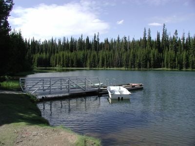
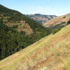
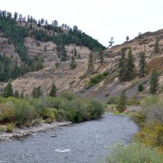
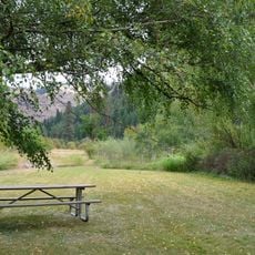
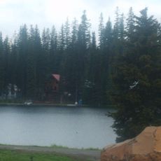
Jubilee Lake is a reservoir in Oregon's Umatilla National Forest, nestled high in the mountains among spruce and fir trees. The lake covers about 90 acres and is formed by an earthen dam built across Motett Creek, reaching depths of up to 45 feet in some areas.

The lake was created in the late 1960s when workers built an earthen dam across Motett Creek to hold water for recreation. In 1981, the trail circling the lake was officially recognized as a National Recreation Trail, affirming its importance as a destination for outdoor activities.

The name Jubilee Lake reflects the celebration and enjoyment this place offers visitors. Today, people use it for fishing, paddling, and camping, showing how the community views this spot as a gathering place for leisure and connection with nature.

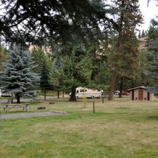
The area is open from July through October and offers facilities like restrooms, potable water, and picnic tables at more than fifty campsites. Access is via gravel forest roads, and advance reservations are recommended, especially during busy weekends and holidays.

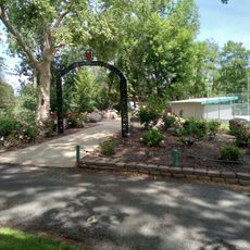
The lake is stocked with rainbow trout each year and hosts a special kids fishing day where children learn fishing skills and win prizes. A two-mile loop trail circles the water, allowing hikers to spot birds and explore the shoreline on foot or by paddleboard.

The community of curious travelers

AroundUs brings together thousands of curated places, local tips, and hidden gems, enriched daily by 60,000 contributors worldwide.

Start exploring
Location
GPS coordinates
45.83150,-117.96100
Latest update
February 9, 2026 08:23
Around this place
Fort Walla Walla
United States of America

Fort Walla Walla

39 km
Wenaha–Tucannon Wilderness
United States of America

Wenaha–Tucannon Wilderness

33.6 km
Emigrant Springs State Heritage Area
United States of America

Emigrant Springs State Heritage Area

50.6 km
North Fork Umatilla Wilderness
United States of America

North Fork Umatilla Wilderness

19.4 km
Borleske Stadium
United States of America

Borleske Stadium

39.9 km
Wallowa Lake Highway Forest State Scenic Corridor
United States of America

Wallowa Lake Highway Forest State Scenic Corridor

31.6 km
Minam State Recreation Area
United States of America

Minam State Recreation Area

19.6 km
Eagle Cap Excursion Train
United States of America

Eagle Cap Excursion Train

29.6 km
Wenaha Wildlife Area
United States of America

Wenaha Wildlife Area

35.2 km
Wallowa River Rest Area
United States of America

Wallowa River Rest Area

36.1 km
Kirkman House
United States of America

Kirkman House

39.6 km
Elgin Opera House
United States of America

Elgin Opera House

29.8 km
Electric Light Works Building
United States of America

Electric Light Works Building

39.6 km
Langdon Lake
United States of America

Langdon Lake

11.4 km
Greasewood Finnish Apostolic Lutheran Church
United States of America

Greasewood Finnish Apostolic Lutheran Church

54.8 km
Wallowa Ranger Station
United States of America

Wallowa Ranger Station

44.1 km
Liberty Theater
United States of America

Liberty Theater

56.9 km
Preston Hall
United States of America

Preston Hall

50.6 km
Hoodoo Ridge Lookout
United States of America

Hoodoo Ridge Lookout

30 km
Hunter–Morelock House
United States of America

Hunter–Morelock House

44.7 km
Walla Walla Valley Traction Company Car Barn
United States of America

Walla Walla Valley Traction Company Car Barn

40.4 km
U.S. Post Office and Federal Building
United States of America

U.S. Post Office and Federal Building

56.9 km
Children's Museum of Walla Walla
United States of America

Children's Museum of Walla Walla

39.6 km
Liberty Theatre
United States of America

Liberty Theatre

39.2 km
Gardner Building
United States of America

Gardner Building

57 km
Granada 3 Theatre
United States of America

Granada 3 Theatre

57 km
Athena City Park
United States of America

Athena City Park

41 km
Athena Public Library
United States of America

Athena Public Library

41 km
Show the full map
« Jubilee Lake - body of water in Oregon, USA » is provided by Around Us (aroundus.com). Images and texts are derived from Wikimedia project under a Creative Commons license. You are allowed to copy, distribute, and modify copies of this page, under the conditions set by the license, as long as this note is clearly visible.

Discover hidden gems everywhere you go!

From secret cafés to breathtaking viewpoints, skip the crowded tourist spots and find places that match your style. Our app makes it easy with voice search, smart filtering, route optimization, and insider tips from travelers worldwide. Download now for the complete mobile experience.

Around Us App Screenshot

A unique approach to discovering new places

Le Figaro

All the places worth exploring

France Info

A tailor-made excursion in just a few clicks

20 Minutes

Around Us
Travel Guide & Maps
Download

Send to your phone

QR Code
1

Open the camera app on your mobile.

2

Point at the QR code with your camera. A notification will appear.

3

Tap the notification to open the link.