Rock Creek, Brook in Adams County, United States
Rock Creek is a stream flowing through farmland in Adams County that supports brook, brown, and rainbow trout. The water moves through several sections with varying conditions, offering different habitats for fish populations.
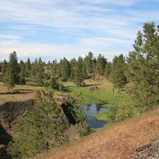
Rock Creek's valley, including the Hole in the Ground between Bonnie and Rock lakes, was carved by the Missoula Floods at the end of the last ice age, roughly 10,000 years ago. The floods cut through the Columbia River Basalt of the Channeled Scablands, and the creek now follows one of those flood paths southwest to the Palouse River.
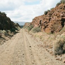
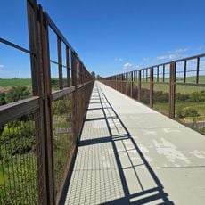
Rock Creek's name comes from the basalt outcrops the water cuts through in the Channeled Scablands. The creek and its lakes, Rock and Bonnie, are managed fisheries, and the Palouse to Cascades State Park Trail runs alongside part of the drainage, so walkers and cyclists see the water and the scabland rock from the old rail grade.
The Palouse to Cascades State Park Trail runs alongside Rock Creek for part of its course, giving walkers and cyclists a way to follow the water and reach Rock Lake. The creek rises at Pine Lakes in the Turnbull National Wildlife Refuge and joins the Palouse River about 6 miles downstream of Winona.
Rock Creek's valley between Bonnie and Rock lakes is called Hole in the Ground, carved by the Missoula Floods about 10,000 years ago at the end of the last ice age. Rock Lake, on the creek's course, reaches a maximum depth of 350 feet (110 m).
The community of curious travelers
AroundUs brings together thousands of curated places, local tips, and hidden gems, enriched daily by 94,192 contributors worldwide.