Log in to your account

AroundUs is a community-driven map of interesting places, built by curious explorers like you. It grows with every review, story, and photo you share.
Connect to save your favorite spots, contribute locations, and create personalized routes.
Continue with Google
Continue with Apple
Continue with X
Continue with Facebook
Continue with email
By continuing, you accept our Terms and Conditions and our Privacy Policy
Create an account

Rattlesnake National Recreation Area

Add to collection
Map
Suggest a change
Share

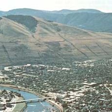
Rattlesnake National Recreation Area, National recreation area near Missoula, Montana.

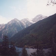
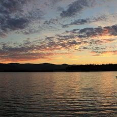
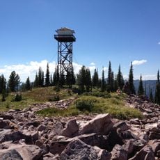
Rattlesnake National Recreation Area is a large protected landscape north of Missoula spanning about 28,000 acres with forests, meadows, and mountain lakes throughout. The terrain includes over 100 kilometers of marked trails and extends to alpine zones with several peaks.

The area was established as a recreation area by Congress in 1980 alongside the adjacent Rattlesnake Wilderness to protect the landscape. This legal designation aimed to prevent intensive development while allowing sustainable use of the land.

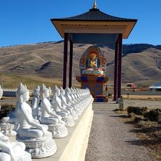
The lands around McLeod Peak held spiritual meaning for the Salish people, who conducted vision quests in this area under Flathead Indian Reservation protection. These sacred places continue to shape the cultural identity of local Native communities today.

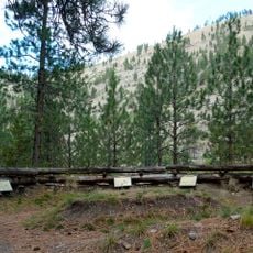
The area offers over 100 kilometers of hiking trails in various difficulty levels that are also used for horseback riding, mountain biking, and cross-country skiing in winter. Accessibility varies by season, as higher elevations receive heavy snow and some trails open late in spring.

Shoo Fly Meadows contains one of the few Sphagnum bogs in the western United States and supports rare native orchid species within a diverse plant community. This specialized environment is accessible to visitors and offers insight into a rare ecosystem.

Location: Montana

Inception: 1980

Website: http://fs.usda.gov/wps/portal/fsinternet/!ut/p/c4/04_SB8K8xLLM9MSSzPy8xBz9CP0os3gDfxMDT8MwRydLA1cj72BTJw8jAwjQL8h2VAQAzHJMsQ!!/?ss=110116&navtype=BROWSEBYSUBJECT&cid=FSE_003741&navid=110000000000000&pnavid=null&position=BROWSEBYSUBJECT&recid=10277&ttype=recarea

GPS coordinates: 47.03750,-113.87800

Latest update: December 12, 2025 14:20

Photos
Around this place
Lake Missoula
United States of America

Lake Missoula

23 km
Washington–Grizzly Stadium
United States of America

Washington–Grizzly Stadium

20.8 km
The Garden of One Thousand Buddhas
United States of America

The Garden of One Thousand Buddhas

23.5 km
Traveler's Rest
United States of America

Traveler's Rest

36.6 km
Wilma Theater
United States of America

Wilma Theater

20.8 km
McDonald Peak
United States of America

McDonald Peak

38.6 km
Fort Fizzle
United States of America

Fort Fizzle

40.3 km
Placid Lake State Park
United States of America

Placid Lake State Park

29.9 km
Missoula Public Library
United States of America

Missoula Public Library

20.5 km
Florence Hotel
United States of America

Florence Hotel

20.6 km
United States of America

Council Grove State Park

25.2 km
The Payne Family Native American Center
United States of America

The Payne Family Native American Center

21.4 km
KettleHouse Amphitheater
United States of America

KettleHouse Amphitheater

18.1 km
Millennium Building
United States of America

Millennium Building

20.7 km
Missoula County Courthouse
United States of America

Missoula County Courthouse

20.3 km
Scenic Bridge
United States of America

Scenic Bridge

31.2 km
Masonic Lodge
United States of America

Masonic Lodge

20.4 km
Milltown State Park
United States of America

Milltown State Park

18.6 km
First Interstate Center
United States of America

First Interstate Center

20.7 km
Splash Montana
United States of America

Splash Montana

23.9 km
A Carousel for Missoula
United States of America

A Carousel for Missoula

20.7 km
Marent Gulch Trestle
United States of America

Marent Gulch Trestle

19 km
Currents Water Park
United States of America

Currents Water Park

20.7 km
Fred T. Sterling House
United States of America

Fred T. Sterling House

21.8 km
Mrs. Lydia McCaffery's Furnished Rooms
United States of America

Mrs. Lydia McCaffery's Furnished Rooms

20.1 km
Bellows Residence
United States of America

Bellows Residence

22.2 km
Apartment Building at 116 Spruce Street
United States of America

Apartment Building at 116 Spruce Street

20.1 km
Mineral Peak Lookout
United States of America

Mineral Peak Lookout

6.2 km
Show the full map
Reviews

Visited this place? Tap the stars to rate it and share your experience / photos with the community! Try now! You can cancel it anytime.

« Rattlesnake National Recreation Area - National recreation area near Missoula, Montana » is provided by Around Us (aroundus.com). Images and texts are derived from Wikimedia project under a Creative Commons license. You are allowed to copy, distribute, and modify copies of this page, under the conditions set by the license, as long as this note is clearly visible.

Discover hidden gems everywhere you go!

From secret cafés to breathtaking viewpoints, skip the crowded tourist spots and find places that match your style. Our app makes it easy with voice search, smart filtering, route optimization, and insider tips from travelers worldwide. Download now for the complete mobile experience.

Around Us App Screenshot

A unique approach to discovering new places

Le Figaro

All the places worth exploring

France Info

A tailor-made excursion in just a few clicks

20 Minutes