Chest opened
+${chestReward.xp} XP
Explorer
NOUVEAU ×${chestReward.collectible.quantity}
tapez pour fermer
Chest locked

Open chests in the app

Around Us is built for your phone — chests unlock when you walk, explore and capture nearby places.

Enable Location

We need your location to show you interesting places around you

Discover nearby places

Find interesting locations and hidden gems around you

Precise directions

Get accurate directions and distances to places

Your location is never shared with other users. It's only used when you tap the location button.

Log in to your account

Start exploring — it's free

Trusted by 72,889 travelers worldwide

Continue with Google
Continue with Apple
or

We will send you a code to connect

By continuing, you accept our Terms and Conditions and our Privacy Policy

Check your inbox

We've sent a pincode in your inbox. Please enter the code below.

Kellogg High School
Discussion Reviews Photo
1.9k Popularity

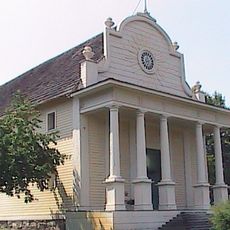
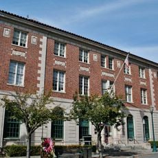
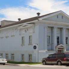
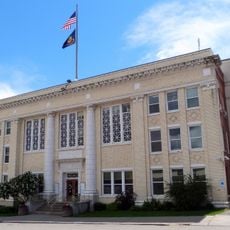
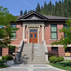
Kellogg High School, Public high school in Shoshone County, US

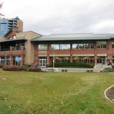
Kellogg High School is a public school serving students in grades 9 through 12 in rural Shoshone County. The facility includes classrooms, athletic areas, and learning spaces that support academic programs for the local community.

The school was established to provide secondary education for students in Idaho's mining region during its economic development period. It has served the community's educational needs for many decades.

The student population reflects the regional demographics with 293 White students and 32 students from diverse ethnic backgrounds participating in educational programs.

The school is situated along Jacobs Gulch Road and can be reached by car from town. Visitors should check ahead about any public events or access policies before visiting.

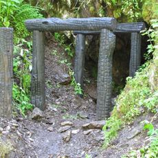
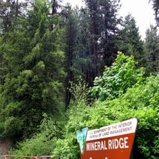
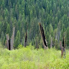
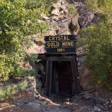
The school sits in a region historically shaped by silver and lead mining, with remnants of that industrial past still visible in the landscape today. The surrounding area reflects the character of Idaho's resource-extraction heritage.

The community of curious travelers

AroundUs brings together thousands of curated places, local tips, and hidden gems, enriched daily by 60,000 contributors worldwide.

Start exploring
Location
GPS coordinates
47.55099,-116.12831
Latest update
December 14, 2025 11:24
Around this place
Old Mission State Park
United States of America

Old Mission State Park

17.5 km
Edward Pulaski Tunnel and Placer Creek Escape Route
United States of America

Edward Pulaski Tunnel and Placer Creek Escape Route

23.5 km
Idaho Panhandle National Forests
United States of America

Idaho Panhandle National Forests

19.6 km
Veterans Memorial Centennial Bridge
United States of America

Veterans Memorial Centennial Bridge

45.3 km
Chicago, Milwaukee, St. Paul and Pacific Railroad Company Historic District
United States of America

Chicago, Milwaukee, St. Paul and Pacific Railroad Company Historic District

41.1 km
Clark House
United States of America

Clark House

50.3 km
United States of America

Burke Canyon

21 km
Wallace Historic District
United States of America

Wallace Historic District

17.5 km
St. Thomas Catholic Church
United States of America

St. Thomas Catholic Church

50.3 km
Mineral Ridge National Recreation Trail, Idaho
United States of America

Mineral Ridge National Recreation Trail, Idaho

39.3 km
First United Methodist Church
United States of America

First United Methodist Church

50.3 km
Coeur d'Alene Masonic Temple
United States of America

Coeur d'Alene Masonic Temple

50.6 km
Coeur d'Alene Federal Building
United States of America

Coeur d'Alene Federal Building

50.8 km
St. Maries Masonic Temple No. 63
United States of America

St. Maries Masonic Temple No. 63

42.2 km
Wallace 1910 Fire Memorial
United States of America

Wallace 1910 Fire Memorial

17.5 km
Benewah County Courthouse
United States of America

Benewah County Courthouse

42.1 km
Wallace Carnegie Library
United States of America

Wallace Carnegie Library

17.4 km
St. Maries 1910 Fire Memorial
United States of America

St. Maries 1910 Fire Memorial

43.3 km
John P. and Stella Gray House
United States of America

John P. and Stella Gray House

49.7 km
Silas W. and Elizabeth Crane House
United States of America

Silas W. and Elizabeth Crane House

50.6 km
Coeur d'Alene City Hall
United States of America

Coeur d'Alene City Hall

50.7 km
Cedar Snags
United States of America

Cedar Snags

33.8 km
Crystal Gold Mine
United States of America

Crystal Gold Mine

3.4 km
Northern Pacific Railroad Depot Museum
United States of America

Northern Pacific Railroad Depot Museum

17.7 km
Sanders Beach
United States of America

Sanders Beach

49.9 km
Coeur d'Alene Public Library
United States of America

Coeur d'Alene Public Library

50.5 km
Chatcolet Bridge
United States of America

Chatcolet Bridge

50.8 km
Preston Beach
United States of America

Preston Beach

47.9 km
Show the full map
Reviews
Share your experience

No review yet

Discussions
Start a discussion...

No discussion yet

« Kellogg High School - Public high school in Shoshone County, US » is provided by Around Us (aroundus.com). Images and texts are derived from Wikimedia project under a Creative Commons license. You are allowed to copy, distribute, and modify copies of this page, under the conditions set by the license, as long as this note is clearly visible.

Discover hidden gems everywhere you go!

From secret cafés to breathtaking viewpoints, skip the crowded tourist spots and find places that match your style. Our app makes it easy with voice search, smart filtering, route optimization, and insider tips from travelers worldwide. Download now for the complete mobile experience.

Around Us App Screenshot

A unique approach to discovering new places

Le Figaro

All the places worth exploring

France Info

A tailor-made excursion in just a few clicks

20 Minutes

Around Us
Travel Guide & Maps
Download

Send to your phone

QR Code
1

Open the camera app on your mobile.

2

Point at the QR code with your camera. A notification will appear.

3

Tap the notification to open the link.