Enable Location

We need your location to show you interesting places around you

Discover nearby places

Find interesting locations and hidden gems around you

Precise directions

Get accurate directions and distances to places

Your location is never shared with other users. It's only used when you tap the location button.

Boundary County

Log in to your account

Start exploring — it's free

Trusted by 61,769 travelers worldwide

Continue with Google
Continue with Apple
or

We will send you a code to connect

By continuing, you accept our Terms and Conditions and our Privacy Policy

Check your inbox

We've sent a pincode in your inbox. Please enter the code below.

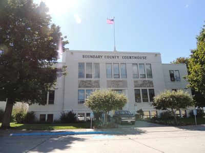
Boundary County, Administrative county in northern Idaho, United States

Description

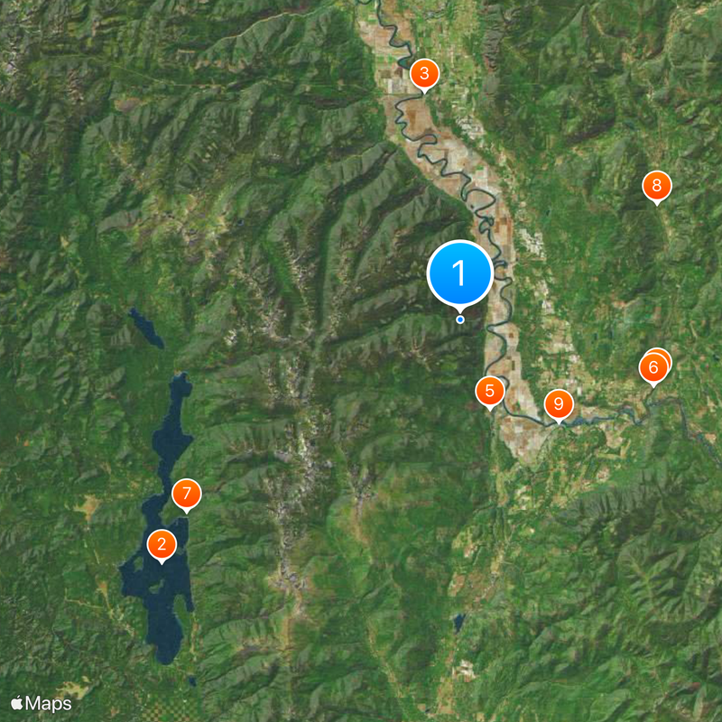
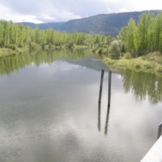
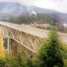
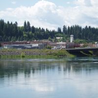
Boundary County spans across northern Idaho with the Selkirk Mountains running through it and borders with Canada, Montana, and Washington forming its edges. The landscape includes dense forests, river valleys, and scattered communities, with Bonners Ferry serving as the main administrative hub.

History

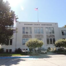
This county was created in 1915 when the Idaho Legislature separated it from Bonner County, establishing the state's northernmost administrative division. The split reflected the need for local governance in the remote border region.

Culture

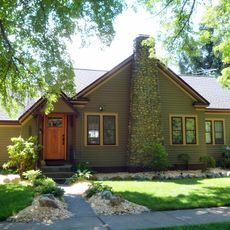
The community here values outdoor traditions and the heritage tied to logging and frontier settlement, visible in how people use local gathering spaces and celebrate seasonal events. These practices reflect a way of life shaped by the region's mountain geography and remote location.

Practical

Visitors can find county services and local facilities centered in Bonners Ferry, the main community in the region. Travel during warmer months is recommended since mountain roads can be difficult in winter.

Did you know?

This is one of only three counties in the United States that borders two different states and an international boundary all at once. This unusual geographic position creates a distinctive setting found nowhere else in the country.

Location
Inception
January 23, 1915
Capital city
Bonners Ferry
Shares border with
Lincoln County, Bonner County, Pend Oreille County, Regional District of Central Kootenay
GPS coordinates
48.79000,-116.45000
Latest update
December 20, 2025 12:02

AroundUs brings together thousands of curated places, local tips, and hidden gems, enriched daily by 60,000 contributors worldwide. Discover all places nearby (Idaho).

Around this place
Priest Lake
United States of America

Priest Lake

39.4 km
Porthill-Rykerts Border Crossing
United States of America

Porthill-Rykerts Border Crossing

23.6 km
United States of America

Moyie Dam

21.1 km
Kootenai National Wildlife Refuge
United States of America

Kootenai National Wildlife Refuge

9.6 km
Moyie River Canyon Bridge
United States of America

Moyie River Canyon Bridge

20.9 km
United States of America

Priest Lake State Park

34.3 km
United States of America

Moyie Falls

23.4 km
Boundary County Courthouse
United States of America

Boundary County Courthouse

14.5 km
United States of America

McArthur Lake Wildlife Corridor

31.2 km
United States of America

Lamb Creek School

46.4 km
Russell and Pearl Soderling House
United States of America

Russell and Pearl Soderling House

14.6 km
United States of America

Snyder Guard Station Historical District

23.2 km
United States of America

Spokane & International Railroad Construction Camp

28.4 km
United States of America

McArthur Lake

30.8 km
United States of America

Smith Lake

13.9 km
United States of America

Priest Lake Golf Course

46.1 km
United States of America

Indian Rock

40.4 km
United States of America

Cavanughs

40.5 km
United States of America

Hill's Resort

44.6 km
United States of America

The Cantina and Beach Bar

43.4 km
United States of America

Refuge Headquarters and Visitor Center

9.6 km
United States of America

Scenic viewpoint

13.7 km
United States of America

Moyie River overlook

21.3 km
United States of America

Scenic viewpoint

31.5 km
United States of America

Scenic viewpoint

47 km
United States of America

Cascade Pond Overlook

7 km
United States of America

Island Pond Overlook

11 km
United States of America

Scenic viewpoint

9.5 km
Show the full map
Administrative divisions
« Boundary County - Administrative county in northern Idaho, United States » is provided by Around Us (aroundus.com). Images and texts are derived from Wikimedia project under a Creative Commons license. You are allowed to copy, distribute, and modify copies of this page, under the conditions set by the license, as long as this note is clearly visible.

Discover hidden gems everywhere you go!

From secret cafés to breathtaking viewpoints, skip the crowded tourist spots and find places that match your style. Our app makes it easy with voice search, smart filtering, route optimization, and insider tips from travelers worldwide. Download now for the complete mobile experience.

Around Us App Screenshot

A unique approach to discovering new places

Le Figaro

All the places worth exploring

France Info

A tailor-made excursion in just a few clicks

20 Minutes

Around Us
Travel Guide & Maps
Download

Send to your phone

QR Code
1

Open the camera app on your mobile.

2

Point at the QR code with your camera. A notification will appear.

3

Tap the notification to open the link.