Enable Location

We need your location to show you interesting places around you

Discover nearby places

Find interesting locations and hidden gems around you

Precise directions

Get accurate directions and distances to places

Your location is never shared with other users. It's only used when you tap the location button.

Heavens Peak

Log in to your account

Start exploring — it's free

Trusted by 66,762 travelers worldwide

Continue with Google
Continue with Apple
or

We will send you a code to connect

By continuing, you accept our Terms and Conditions and our Privacy Policy

Check your inbox

We've sent a pincode in your inbox. Please enter the code below.

Heavens Peak
Discussion Reviews 1 Photos
3.6k Popularity

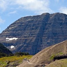
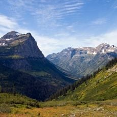
Heavens Peak, Mountain summit in Flathead County, United States.

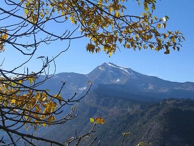
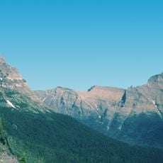
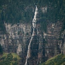
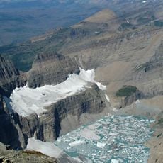
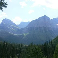
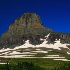
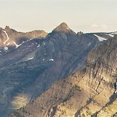
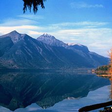
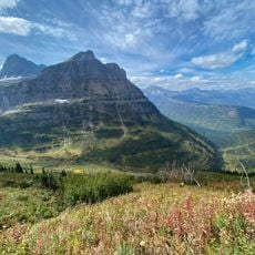
Heavens Peak is a mountain summit in the Livingston Range within Glacier National Park, Montana. The lower slopes are covered in forest while the upper sections are steep and rocky, giving the peak a clear profile when seen from the valleys below.

The peak was first mapped by Lieutenant George P. Ahern between 1888 and 1890, during early survey expeditions through the northern Rockies. It received its official name from the United States Board on Geographic Names in 1929, as part of a wider effort to formalize place names across the region.

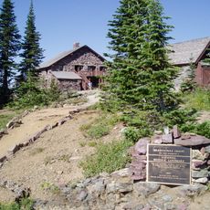
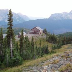
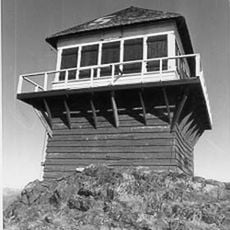
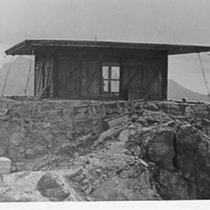
The fire lookout at the top was built in 1945 by conscientious objectors working through a civilian service program open to Mennonites and Quakers. The structure is made of local stone and blends into the rocky surroundings so closely that it becomes visible only at short range.

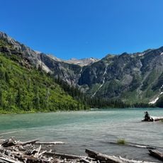
Reaching the summit demands good physical condition and experience with off-trail terrain, as the route involves steep and rocky sections. The area is bear country, so visitors should take standard precautions and check current trail conditions before setting out.

The fire lookout at the summit is one of the few in the United States still in its original condition and is listed on the National Register of Historic Places. It sits on a narrow rocky ledge with drops on three sides, making the approach on foot a careful exercise in balance.

The community of curious travelers

AroundUs brings together thousands of curated places, local tips, and hidden gems, enriched daily by 60,000 contributors worldwide.

Start exploring
Location
GPS coordinates
48.70886,-113.85623
Latest update
March 3, 2026 14:02
Around this place
Going-to-the-Sun Road
United States of America

Going-to-the-Sun Road

3.3 km
Granite Park Chalet
United States of America

Granite Park Chalet

9.2 km
Avalanche Lake
United States of America

Avalanche Lake

7.8 km
Bird Woman Falls
United States of America

Bird Woman Falls

8 km
Mount Brown
United States of America

Mount Brown

8.3 km
Weeping Wall
United States of America

Weeping Wall

9.6 km
Bearhat Mountain
United States of America

Bearhat Mountain

8.2 km
Great Northern Railway Buildings
United States of America

Great Northern Railway Buildings

9.2 km
The Salamander Glacier
United States of America

The Salamander Glacier

10.3 km
Mount Oberlin
United States of America

Mount Oberlin

8.9 km
Clements Mountain
United States of America

Clements Mountain

8.7 km
Kelly's Camp Historic District
United States of America

Kelly's Camp Historic District

9.7 km
Lake McDonald Lodge Historic District
United States of America

Lake McDonald Lodge Historic District

10.3 km
Mount Brown Fire Lookout
United States of America

Mount Brown Fire Lookout

9.1 km
United States of America

Haystack Butte

9.5 km
Heaven's Peak Fire Lookout
United States of America

Heaven's Peak Fire Lookout

4.7 km
Mount Cannon
United States of America

Mount Cannon

6.3 km
Logan Creek Patrol Cabin
United States of America

Logan Creek Patrol Cabin

7 km
United States of America

McPartland Mountain

2.1 km
Longfellow Peak
United States of America

Longfellow Peak

7.3 km
Mount Vaught
United States of America

Mount Vaught

3.4 km
Upper Lake McDonald Ranger Station Historic District
United States of America

Upper Lake McDonald Ranger Station Historic District

7.8 km
Burton and Lulu Wheeler Cabin
United States of America

Burton and Lulu Wheeler Cabin

7.8 km
Wheeler Camp
United States of America

Wheeler Camp

7.7 km
Highline Trailhead South
United States of America

Highline Trailhead South

10.2 km
Avalanche Campground
United States of America

Avalanche Campground

4.4 km
Avalanche Campground Amphitheater
United States of America

Avalanche Campground Amphitheater

4.4 km
Greve's Tourist Cabins
United States of America

Greve's Tourist Cabins

9.6 km
Show the full map
Reviews
Share your experience

No review yet

Discussions
Start a discussion...

No discussion yet

« Heavens Peak - Mountain summit in Flathead County, United States » is provided by Around Us (aroundus.com). Images and texts are derived from Wikimedia project under a Creative Commons license. You are allowed to copy, distribute, and modify copies of this page, under the conditions set by the license, as long as this note is clearly visible.

Discover hidden gems everywhere you go!

From secret cafés to breathtaking viewpoints, skip the crowded tourist spots and find places that match your style. Our app makes it easy with voice search, smart filtering, route optimization, and insider tips from travelers worldwide. Download now for the complete mobile experience.

Around Us App Screenshot

A unique approach to discovering new places

Le Figaro

All the places worth exploring

France Info

A tailor-made excursion in just a few clicks

20 Minutes

Around Us
Travel Guide & Maps
Download

Send to your phone

QR Code
1

Open the camera app on your mobile.

2

Point at the QR code with your camera. A notification will appear.

3

Tap the notification to open the link.