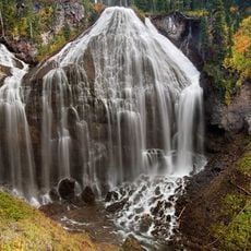
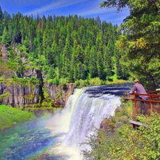
Mesa Falls Tuff, Volcanic tuff formation in eastern Idaho, United States
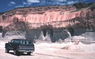
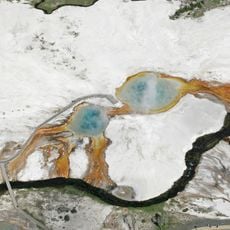
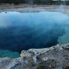
Mesa Falls Tuff is a volcanic rock formation in eastern Idaho that stretches hundreds of meters thick and appears across the Island Park region, the lower slopes of the Centennial Mountains, and the southern Madison Range. The rock is layered in different sections, each showing signs of different volcanic processes and preserving details about the area's geological past.
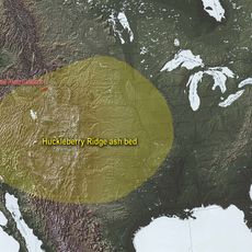
This formation resulted from a massive volcanic eruption roughly 1.3 million years ago, when enormous amounts of material were expelled during the second cycle of volcanic activity in the Yellowstone region. The eruption reshaped the landscape and created the rock layers that scientists still examine today.
Scientists from the U.S. Geological Survey conduct regular research at Mesa Falls Tuff to understand volcanic patterns and regional geological development.
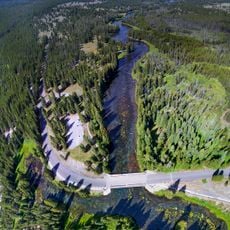
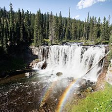
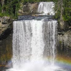
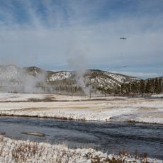
The best spot to view this formation is along U.S. Highway 20, north of Ashton, where the layered rock is clearly visible from roadside locations. Sturdy footwear is recommended since the terrain is uneven and rocky.
The layers reveal an unusual pattern: at the bottom lies a distinct band of air-fall pumice, followed by ash-flow tuff containing large feldspar crystals. This striking arrangement helps geologists identify different phases of a single eruption event.
Location: Idaho
Part of: Yellowstone Group
GPS coordinates: 44.33000,-111.33000
Latest update: December 6, 2025 16:04
Idaho's remote locations offer access to diverse landscapes ranging from alpine lakes nestled in mountain ranges to volcanic formations and high desert terrain. The state contains geological features formed over thousands of years, including lava tubes that preserve ice year-round, sand dunes rising...
Mystic Falls
40.1 km
Huckleberry Ridge Tuff
0 m
Island Park Caldera
0 m
Henry's Fork Caldera
0 m
Henrys Lake
35.5 km
Upper Mesa Falls
15.8 km
Big Springs
19.9 km
Grizzly & Wolf Discovery Center
40.7 km
Black Sand Basin
40.7 km
Lower Mesa Falls
18 km
Union Falls
39.7 km
Jewel Geyser
41.5 km
Iris Falls
32.3 km
Johnny Sack Cabin
19.9 km
Bechler Falls
32.4 km
Bishop Mountain Lookout
17.8 km
Colonnade Falls
32.1 km
Conant Creek Pegram Truss Railroad Bridge
35.2 km
Independent Order of Odd Fellows Hall
31.1 km
West Yellowstone Oregon Shortline Terminus Historic District
40.8 km
Cliff Geyser
40.6 km
Sapphire Pool
41.5 km
Avoca Spring
41.4 km
Jewel Geyser
41.4 km
Union Pacific Dining Lodge
40.8 km
West Yellowstone Public Library
40.9 km
Biscuit Basin
41.5 km
Mesa Falls Scenic Byway
16.2 kmVisited this place? Tap the stars to rate it and share your experience / photos with the community! Try now! You can cancel it anytime.
Discover hidden gems everywhere you go!
From secret cafés to breathtaking viewpoints, skip the crowded tourist spots and find places that match your style. Our app makes it easy with voice search, smart filtering, route optimization, and insider tips from travelers worldwide. Download now for the complete mobile experience.
A unique approach to discovering new places❞
— Le Figaro
All the places worth exploring❞
— France Info
A tailor-made excursion in just a few clicks❞
— 20 Minutes