Henrys Lake

Log in to your account

AroundUs is a community-driven map of interesting places, built by curious explorers like you. It grows with every review, story, and photo you share.
Connect to save your favorite spots, contribute locations, and create personalized routes.
Continue with Google
Continue with Apple
Continue with X
Continue with Facebook
Continue with email
By continuing, you accept our Terms and Conditions and our Privacy Policy
Create an account
Add to collection
Map
Suggest a change
Share

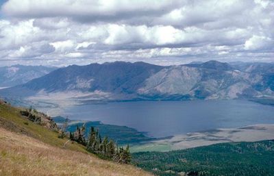
Henrys Lake, Reservoir in Fremont County, Idaho, US.

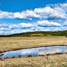
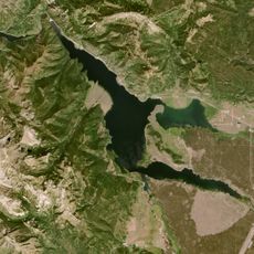
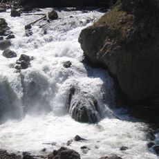
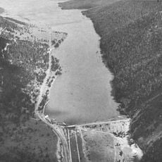
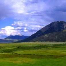
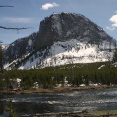
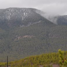
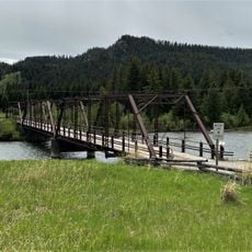
Henrys Lake sits at an elevation of 6,476 feet and is fed by springs that emerge around its shoreline near Staley Springs, Pintail Point, and Kelly Springs. The water body spans roughly 8 square miles and is surrounded by forested terrain.

The lake was named after Andrew Henry, an early American fur trapper and explorer from the early 1800s. The region later saw military movement when troops passed through during conflicts with the Nez Perce.

The area has long held significance for the Nez Perce people who lived and traveled through these lands. Today, the surrounding region continues to reflect this heritage through local traditions and land use patterns.

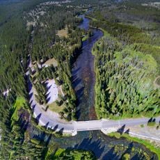
The lake can be accessed from surrounding roads with several entry points along the shoreline. The best time to visit is during warmer months when trails are passable and weather conditions are favorable.

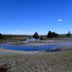
The lake lies just 16 miles west of Yellowstone National Park and serves as a crucial breeding ground for white pelicans, mallards, and trumpeter swans. These bird populations rely on the lake annually for nesting and rearing young.

Location: Fremont County

Elevation above the sea: 1,976 m

GPS coordinates: 44.64400,-111.40600

Latest update: December 6, 2025 17:40

Photos
Hidden gems in Idaho : remote lakes, volcanic landscapes, historic mining towns

Idaho's remote locations offer access to diverse landscapes ranging from alpine lakes nestled in mountain ranges to volcanic formations and high desert terrain. The state contains geological features formed over thousands of years, including lava tubes that preserve ice year-round, sand dunes rising...

Around this place
Mystic Falls
United States of America

Mystic Falls

45.8 km
Huckleberry Ridge Tuff
United States of America

Huckleberry Ridge Tuff

35.5 km
Island Park Caldera
United States of America

Island Park Caldera

35.5 km
Hebgen Lake
United States of America

Hebgen Lake

25.1 km
Henry's Fork Caldera
United States of America

Henry's Fork Caldera

35.5 km
Mesa Falls Tuff
United States of America

Mesa Falls Tuff

35.5 km
Big Springs
United States of America

Big Springs

20 km
Firehole Falls
United States of America

Firehole Falls

43 km
Grizzly & Wolf Discovery Center
United States of America

Grizzly & Wolf Discovery Center

24.4 km
Hebgen Dam
United States of America

Hebgen Dam

25.1 km
Red Rock Lakes National Wildlife Refuge
United States of America

Red Rock Lakes National Wildlife Refuge

30.2 km
Mount Haynes
United States of America

Mount Haynes

36.5 km
Purple Mountain
United States of America

Purple Mountain

43.1 km
Ojo Caliente Spring
United States of America

Ojo Caliente Spring

45.8 km
Hilgard Peak
United States of America

Hilgard Peak

30.6 km
Eagle's Store
United States of America

Eagle's Store

24.4 km
National Park Mountain
United States of America

National Park Mountain

42.2 km
Queen's Laundry Bath House
United States of America

Queen's Laundry Bath House

43.4 km
Madison Museum
United States of America

Madison Museum

43.1 km
United States of America

Mount Jackson

37.8 km
Johnny Sack Cabin
United States of America

Johnny Sack Cabin

20 km
Bishop Mountain Lookout
United States of America

Bishop Mountain Lookout

36.5 km
Lonesomehurst Cabin
United States of America

Lonesomehurst Cabin

18 km
Hutchins Bridge
United States of America

Hutchins Bridge

30.5 km
West Yellowstone Oregon Shortline Terminus Historic District
United States of America

West Yellowstone Oregon Shortline Terminus Historic District

24.1 km
Mather Plaque in Yellowstone National Park
United States of America

Mather Plaque in Yellowstone National Park

43.1 km
Union Pacific Dining Lodge
United States of America

Union Pacific Dining Lodge

24.1 km
West Yellowstone Public Library
United States of America

West Yellowstone Public Library

24.1 km
Show the full map
Reviews

Visited this place? Tap the stars to rate it and share your experience / photos with the community! Try now! You can cancel it anytime.

« Henrys Lake - Reservoir in Fremont County, Idaho, US » is provided by Around Us (aroundus.com). Images and texts are derived from Wikimedia project under a Creative Commons license. You are allowed to copy, distribute, and modify copies of this page, under the conditions set by the license, as long as this note is clearly visible.

Discover hidden gems everywhere you go!

From secret cafés to breathtaking viewpoints, skip the crowded tourist spots and find places that match your style. Our app makes it easy with voice search, smart filtering, route optimization, and insider tips from travelers worldwide. Download now for the complete mobile experience.

Around Us App Screenshot

A unique approach to discovering new places

Le Figaro

All the places worth exploring

France Info

A tailor-made excursion in just a few clicks

20 Minutes