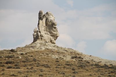
Teapot Rock, Rock formation in Natrona County, Wyoming, United States.
Teapot Rock is a sedimentary rock formation in Natrona County that rises approximately 75 feet (23 meters) high with a circumference of about 300 feet (91 meters). It sits east of Wyoming Highway 259, north of Casper, and has been listed on the National Register of Historic Places.
The formation gained prominence in the 1920s when nearby Teapot Dome oil fields became the center of a major corruption scandal during President Harding's administration. Oil discovery and the ensuing political turmoil made this remote location a symbol of the era's energy policy conflicts.
The formation takes its name from its distinctive shape that once resembled a teapot. Local people and visitors connect this place to the region's early oil industry and view it as a symbol of Wyoming's industrial transformation.
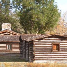
Access requires permission from local landowners since the area is privately owned. There are no designated parking facilities or official viewing areas, so visitors should exercise caution and respect local conditions.
The rock's shape has changed dramatically over time due to natural erosion. The distinctive handle disappeared around 1930, and the spout vanished later in 1962, fundamentally reshaping the formation's appearance.
The community of curious travelers
AroundUs brings together thousands of curated places, local tips, and hidden gems, enriched daily by 60,000 contributors worldwide.