Chest opened
+${chestReward.xp} XP
Explorer
NOUVEAU ×${chestReward.collectible.quantity}
tapez pour fermer

See the monuments around you in AR Open chests in the app

Around Us is built for your phone — point your camera at the streets and discover the monuments and places around you in augmented reality. Around Us is built for your phone — chests unlock when you walk, explore and capture nearby places.

Enable Location

We need your location to show you interesting places around you

Discover nearby places

Find interesting locations and hidden gems around you

Precise directions

Get accurate directions and distances to places

Your location is never shared with other users. It's only used when you tap the location button.

Snowden Bridge

Log in to your account

Start exploring — it's free

Trusted by 85,136 travelers worldwide

Continue with Google
Continue with Apple
or

We will send you a code to connect

By continuing, you accept our Terms and Conditions and our Privacy Policy

Check your inbox

We've sent a pincode in your inbox. Please enter the code below.

Discussion Reviews 1 Photos
2.4k Popularity

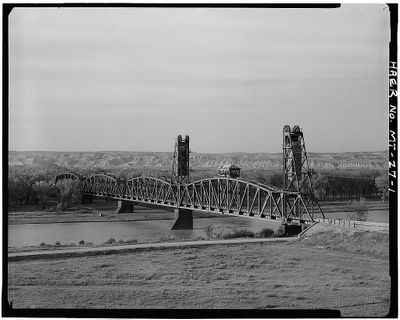
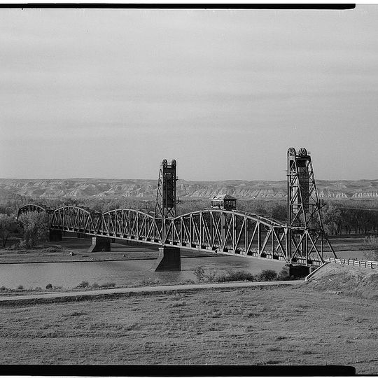
Snowden Bridge, Railway bridge in Richland County, Montana, United States

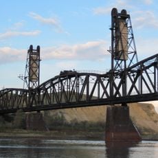
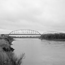
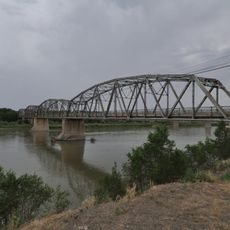
Snowden Bridge is a railway and road crossing over the Missouri River that links two Montana communities. The structure consists of steel frameworks with a lifting mechanism that was once operational but is no longer in use.

The bridge was built in 1913 by the Montana Eastern Railway and was the longest of its kind in the world at that time. The lifting system was later removed as it became unnecessary.

The bridge stands as an early example of how engineers solved the challenge of crossing major rivers. Today it shows visitors the kind of industrial design that shaped rural America in the early 1900s.

You can approach the bridge from either side of the river, and the structure is visible from the surrounding land. Keep in mind this is located in a rural area and requires driving to reach.

The design was based on a well-known Chicago bridge and showed innovative solutions for that era. Combining both railroad and road traffic on a single bridge was unusual for the early 1900s.

The community of curious travelers

AroundUs brings together thousands of curated places, local tips, and hidden gems, enriched daily by 60,000 contributors worldwide.

Start exploring
Location
GPS coordinates
48.00000,-104.09600
Latest update
August 30, 2026 13:05
Around this place
Bakken formation
Canada

Bakken formation

59.8 mi
Elkhorn Ranch
United States of America

Elkhorn Ranch

57.5 mi
Makoshika State Park
United States of America

Makoshika State Park

70.9 mi
Fort Buford
United States of America

Fort Buford

4.5 mi
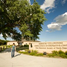
Missouri-Yellowstone Confluence Interpretive Center
United States of America

Missouri-Yellowstone Confluence Interpretive Center

5.1 mi
Fairview Lift Bridge
United States of America

Fairview Lift Bridge

7.8 mi
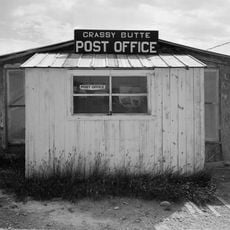
Grassy Butte Post Office
United States of America

Grassy Butte Post Office

57.6 mi
Lewis and Clark Bridge
United States of America

Lewis and Clark Bridge

66.7 mi
Alkabo School
United States of America

Alkabo School

60.7 mi
St. Peter's Catholic Church
United States of America

St. Peter's Catholic Church

70.2 mi
United States of America

Rocky Valley Lutheran Church

62.4 mi
Merrill Avenue Historic District
United States of America

Merrill Avenue Historic District

68.3 mi
Charles Krug House
United States of America

Charles Krug House

68.3 mi
Sacred Heart Church
United States of America

Sacred Heart Church

68.1 mi
James Memorial Library
United States of America

James Memorial Library

24.2 mi
Peoples' Congregational Church
United States of America

Peoples' Congregational Church

19.9 mi
Bell Street Bridge
United States of America

Bell Street Bridge

68.4 mi
Wibaux Commercial Historic District
United States of America

Wibaux Commercial Historic District

70.2 mi
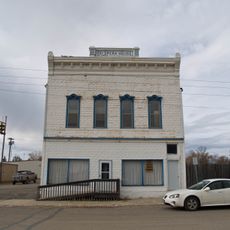
Old U.S. Post Office
United States of America

Old U.S. Post Office

24 mi
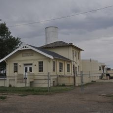
Glendive City Water Filtration Plant
United States of America

Glendive City Water Filtration Plant

68.3 mi
Ray Opera House
United States of America

Ray Opera House

49.1 mi
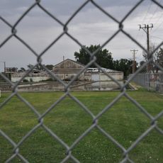
Northern Pacific Railroad Settling Tanks
United States of America

Northern Pacific Railroad Settling Tanks

68.2 mi
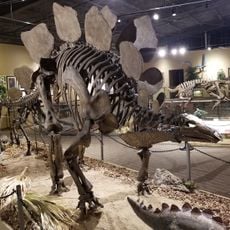
Glendive Dinosaur & Fossil Museum
United States of America

Glendive Dinosaur & Fossil Museum

66.6 mi
Blackstock Residence
United States of America

Blackstock Residence

68.3 mi
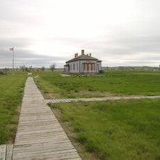
Fort Union Trading Post National Historic Site
United States of America

Fort Union Trading Post National Historic Site

2.6 mi
Fort Buford State Historic Site
United States of America

Fort Buford State Historic Site

4.5 mi
Elkhorn Ranch State Historic Site
United States of America

Elkhorn Ranch State Historic Site

56.2 mi
River Bend Overlook
United States of America

River Bend Overlook

42.9 mi
Show the full map
Reviews
Share your experience

No review yet

Discussions
Start a discussion...

No discussion yet

« Snowden Bridge - Railway bridge in Richland County, Montana, United States » is provided by Around Us (aroundus.com). Images and texts are derived from Wikimedia project under a Creative Commons license. You are allowed to copy, distribute, and modify copies of this page, under the conditions set by the license, as long as this note is clearly visible.

Discover hidden gems everywhere you go!

From secret cafés to breathtaking viewpoints, skip the crowded tourist spots and find places that match your style. Our app makes it easy with voice search, smart filtering, route optimization, and insider tips from travelers worldwide. Download now for the complete mobile experience.
Around Us App Screenshot

A unique approach to discovering new places

Le Figaro

All the places worth exploring

France Info

A tailor-made excursion in just a few clicks

20 Minutes

Around Us
Travel Guide & Maps
Download

Send to your phone

QR Code
1

Open the camera app on your mobile.

2

Point at the QR code with your camera. A notification will appear.

3

Tap the notification to open the link.