Fort Buford

Log in to your account

AroundUs is a community-driven map of interesting places, built by curious explorers like you. It grows with every review, story, and photo you share.
Connect to save your favorite spots, contribute locations, and create personalized routes.
By continuing, you accept our Terms and Conditions and our Privacy Policy
Add to collection
Map
Suggest a change
Share

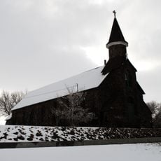
Fort Buford, Military historic district in North Dakota, United States

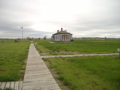
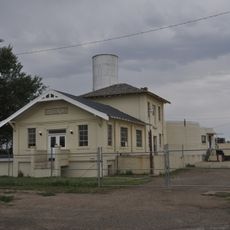
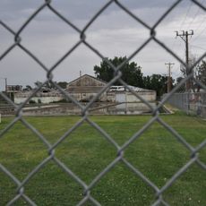
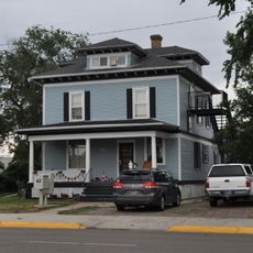
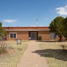
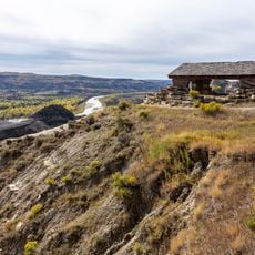
Fort Buford is a preserved military post located where the Missouri and Yellowstone rivers meet, featuring original stone and brick structures from its operational years. The site includes a powder magazine, officers' quarters, and other buildings that outline the fort's physical layout and purpose.

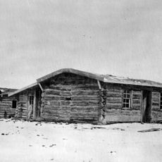
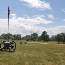
The post was established in 1866 to secure military control of the frontier and serve as a supply hub for regional operations. It remained active until 1895, playing a key role during the period of frontier consolidation and military-Native American relations.

The site represents a pivotal moment in relations between the military and Native Americans, where the Hunkpapa Sioux leader Sitting Bull made his final stand. Visitors can sense the weight of this encounter when walking through the remaining structures.

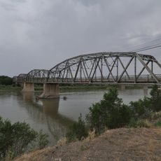
The site sits roughly 35 kilometers southwest of Williston and can be reached via two highways in the area. The grounds are open seasonally, so plan your visit for the warmer months when access is available.

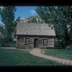
The stone powder magazine still standing on the grounds was built in 1866 and remains one of the few structures to survive over 150 years of frontier weather. This sturdy building reveals the construction methods used for frontier military installations of that era.

Location: Williams County

GPS coordinates: 47.98640,-104.00100

Latest update: December 8, 2025 19:57

Photos
Around this place
Show the full map
Bakken formation
Canada

Bakken formation

90.8 km
Elkhorn Ranch
United States of America

Elkhorn Ranch

88.5 km
Four Bears Bridge
United States of America

Four Bears Bridge

107.2 km
Snowden Bridge
United States of America

Snowden Bridge

7.2 km
Missouri-Yellowstone Confluence Interpretive Center
United States of America

Missouri-Yellowstone Confluence Interpretive Center

908 m
Fairview Lift Bridge
United States of America

Fairview Lift Bridge

6.9 km
Grassy Butte Post Office
United States of America

Grassy Butte Post Office

86.8 km
Crow Flies High State Recreation Area
United States of America

Crow Flies High State Recreation Area

108.4 km
Alkabo School
United States of America

Alkabo School

98.3 km
St. Peter's Catholic Church
United States of America

St. Peter's Catholic Church

112.1 km
Rocky Valley Lutheran Church
United States of America

Rocky Valley Lutheran Church

103.7 km
Merrill Avenue Historic District
United States of America

Merrill Avenue Historic District

111.7 km
Charles Krug House
United States of America

Charles Krug House

111.8 km
Sacred Heart Church
United States of America

Sacred Heart Church

111.5 km
James Memorial Library
United States of America

James Memorial Library

33.4 km
Peoples' Congregational Church
United States of America

Peoples' Congregational Church

32.5 km
Bell Street Bridge
United States of America

Bell Street Bridge

111.9 km
Wibaux Commercial Historic District
United States of America

Wibaux Commercial Historic District

112.2 km
Old U.S. Post Office
United States of America

Old U.S. Post Office

33.2 km
Ray Opera House
United States of America

Ray Opera House

73.7 km
Glendive City Water Filtration Plant
United States of America

Glendive City Water Filtration Plant

111.8 km
Northern Pacific Railroad Settling Tanks
United States of America

Northern Pacific Railroad Settling Tanks

111.7 km
Glendive Dinosaur & Fossil Museum
United States of America

Glendive Dinosaur & Fossil Museum

109 km
Blackstock Residence
United States of America

Blackstock Residence

111.7 km
Fort Union Trading Post National Historic Site
United States of America

Fort Union Trading Post National Historic Site

3.3 km
Fort Buford State Historic Site
United States of America

Fort Buford State Historic Site

147 m
Elkhorn Ranch State Historic Site
United States of America

Elkhorn Ranch State Historic Site

86.4 km
River Bend Overlook
United States of America

River Bend Overlook

62.7 km
Show the full map
Reviews

Visited this place? Tap the stars to rate it and share your experience / photos with the community! Try now! You can cancel it anytime.

« Fort Buford - Military historic district in North Dakota, United States » is provided by Around Us (aroundus.com). Images and texts are derived from Wikimedia project under a Creative Commons license. You are allowed to copy, distribute, and modify copies of this page, under the conditions set by the license, as long as this note is clearly visible.

Discover hidden gems everywhere you go!

From secret cafés to breathtaking viewpoints, skip the crowded tourist spots and find places that match your style. Our app makes it easy with voice search, smart filtering, route optimization, and insider tips from travelers worldwide. Download now for the complete mobile experience.

Around Us App Screenshot

A unique approach to discovering new places

Le Figaro

All the places worth exploring

France Info

A tailor-made excursion in just a few clicks

20 Minutes