Enable Location

We need your location to show you interesting places around you

Discover nearby places

Find interesting locations and hidden gems around you

Precise directions

Get accurate directions and distances to places

Your location is never shared with other users. It's only used when you tap the location button.

Wells Gray Provincial Park

Log in to your account

Start exploring — it's free

Trusted by 62,292 travelers worldwide

Continue with Google
Continue with Apple
or

We will send you a code to connect

By continuing, you accept our Terms and Conditions and our Privacy Policy

Check your inbox

We've sent a pincode in your inbox. Please enter the code below.

Wells Gray Provincial Park, Provincial park in British Columbia, Canada

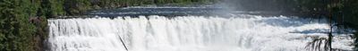
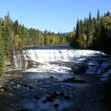
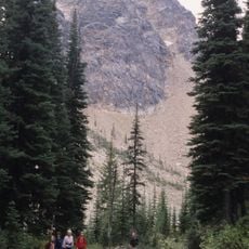
Wells Gray Provincial Park covers 5,250 square kilometers of mountain ranges, deep valleys, lakes, and 41 waterfalls in central British Columbia. The Clearwater River runs through the area from north to south, carving deep canyons with steep rock walls.

The Secwepemc, Tsilhqot'in, and Canim Lake people hunted in this region for centuries before it was protected in 1939. The designation came through the efforts of Walter Wells Gray, a minister of lands and settlements in the provincial government.

The name honors Walter Wells Gray, a pioneer and minister who supported the creation of wilderness areas in British Columbia. Landmarks like Battle Mountain and Fight Lake recall clashes between indigenous communities who competed for caribou hunting grounds in the 19th century.

Clearwater Valley Road leads to the entrance and provides access to several trails and waterfalls. Campgrounds are located at different spots, and most trails are walkable from May to October.

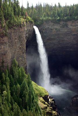
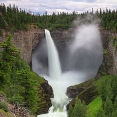
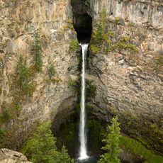
Helmcken Falls, at 141 meters one of the tallest waterfalls in Canada, forms a huge ice cone at the base during winter. This cone can grow up to 50 meters tall and lasts until late spring.

The community of curious travelers

AroundUs brings together thousands of curated places, local tips, and hidden gems, enriched daily by 60,000 contributors worldwide.

Start exploring
Inception
November 28, 1939
Address
Clearwater Valley Rd
GPS coordinates
52.32389,-120.15000
Latest update
December 22, 2025 16:11
« Wells Gray Provincial Park - Provincial park in British Columbia, Canada » is provided by Around Us (aroundus.com). Images and texts are derived from Wikimedia project under a Creative Commons license. You are allowed to copy, distribute, and modify copies of this page, under the conditions set by the license, as long as this note is clearly visible.

Discover hidden gems everywhere you go!

From secret cafés to breathtaking viewpoints, skip the crowded tourist spots and find places that match your style. Our app makes it easy with voice search, smart filtering, route optimization, and insider tips from travelers worldwide. Download now for the complete mobile experience.

Around Us App Screenshot

A unique approach to discovering new places

Le Figaro

All the places worth exploring

France Info

A tailor-made excursion in just a few clicks

20 Minutes

Around Us
Travel Guide & Maps
Download

Send to your phone

QR Code
1

Open the camera app on your mobile.

2

Point at the QR code with your camera. A notification will appear.

3

Tap the notification to open the link.