
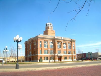
Randall County, County administration center in Canyon, Texas
The county spans 922 square miles of terrain with elevations ranging from 3,000 to 3,800 feet above sea level in the Texas Panhandle region.
The Texas Legislature created Randall County in 1876, naming it after Confederate brigadier general Horace Randal with a spelling error in the official documents.
The Prairie Dog Town Fork of the Red River intersects the county, forming canyons that Native American tribes used as winter camps throughout history.
Interstate 27, U.S. Highway 60, and U.S. Highway 87 connect the county's main population centers, facilitating transportation across the Texas Panhandle region.
Palo Duro Canyon, located within Randall County, stands as the second largest canyon system in the United States with depths reaching 1,750 feet.
Location: Texas
Inception: 1889
Capital city: Canyon
Shares border with: Armstrong County, Swisher County, Potter County, Deaf Smith County, Castro County, Oldham County, Carson County
Website: http://randallcounty.org
GPS coordinates: 34.97000,-101.90000
Latest update: May 27, 2025 10:04

Cadillac Ranch
25.4 km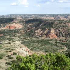
Palo Duro Canyon
21.4 km
American Quarter Horse Hall of Fame
26.3 km
Don Harrington Discovery Center
25.6 km
Amarillo Civic Center
27.3 km
Atchison, Topeka and Santa Fe Railway 5000
27.6 km
Wonderland Park
30.8 km
Buffalo Lake National Wildlife Refuge
22.1 km
Chase Tower
27 km
Santa Fe Building
26.7 km
Panhandle–Plains Historical Museum
1.9 km
Amarillo National Bank Sox Stadium
27.9 km
Texas Air & Space Museum
32.9 km
Texas Tornado
31.1 km
Amarillo Museum of Art
24.9 km
Potter County Courthouse
27.1 km
Sacred Heart Cathedral
26.8 km
J. Marvin Jones Federal Building and United States Courthouse
27.2 km
Courtyard by Marriott, Downtown Amarillo
26.9 km
Deaf Smith County Historical Museum
48.6 km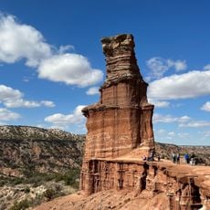
Palo Duro State Park
22.1 km
Llano Cemetery
24.5 km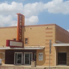
Carlile Theater
60 km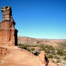
Lighthouse Peak
18.9 km
Randall County Courthouse
2.7 km
Amarillo Natatorium
27 km
Texas Outdoor Musical
20.1 km
Amarillo Globe Dream House
24 kmReviews
Visited this place? Tap the stars to rate it and share your experience / photos with the community! Try now! You can cancel it anytime.

Discover hidden gems everywhere you go!
From secret cafés to breathtaking viewpoints, skip the crowded tourist spots and find places that match your style. Our app makes it easy with voice search, smart filtering, route optimization, and insider tips from travelers worldwide. Download now for the complete mobile experience.

A unique approach to discovering new places❞
— Le Figaro
All the places worth exploring❞
— France Info
A tailor-made excursion in just a few clicks❞
— 20 Minutes