Enable Location

We need your location to show you interesting places around you

Discover nearby places

Find interesting locations and hidden gems around you

Precise directions

Get accurate directions and distances to places

Your location is never shared with other users. It's only used when you tap the location button.

Ellis County

Log in to your account

Start exploring — it's free

Trusted by 62,830 travelers worldwide

Continue with Google
Continue with Apple
or

We will send you a code to connect

By continuing, you accept our Terms and Conditions and our Privacy Policy

Check your inbox

We've sent a pincode in your inbox. Please enter the code below.

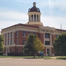
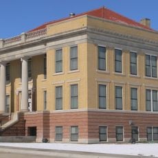
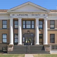
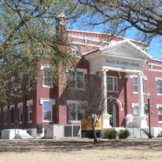
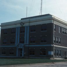
Ellis County, County in western Oklahoma, United States

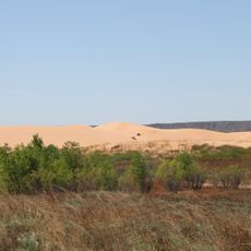
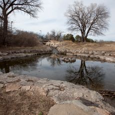
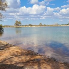
Ellis County is a county in western Oklahoma covering roughly 1,230 square miles (3,190 square kilometers) of land. Wolf Creek, a tributary of the North Canadian River, flows through the territory and forms part of the regional water system.

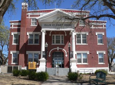
The county was established in 1907 and named after Albert H. Ellis, who served as vice president of Oklahoma's Constitutional Convention. It was formed from portions of the Day and Woodward counties.

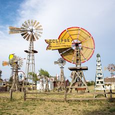
German-speaking settlers from Russia established communities near Shattuck starting in the early 1900s, and their agricultural traditions continue to shape the rural character of the area today. Their influence remains visible in the farming practices and settlement patterns across the region.

The county is accessible through U.S. Highways 60 and 283, along with State Highways 15, 46, and 51 that run across the territory. These routes provide good connections to different parts of the county.

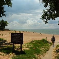
In 1838, Wolf Creek became the site of a major conflict between Cheyenne and Arapaho forces against camps of Kiowa, Comanche, and Plains Apache peoples. This event represents an important moment in the tribal history of the region.

The community of curious travelers

AroundUs brings together thousands of curated places, local tips, and hidden gems, enriched daily by 60,000 contributors worldwide.

Start exploring
Location
Inception
July 16, 1907
Capital city
Arnett
Shares border with
Harper County, Roger Mills County, Woodward County, Dewey County, Beaver County, Hemphill County, Lipscomb County
GPS coordinates
36.21000,-99.75000
Latest update
December 10, 2025 15:57
Around this place
Little Sahara State Park
United States of America

Little Sahara State Park

85.7 km
Foss Reservoir
United States of America

Foss Reservoir

85.9 km
Alabaster Caverns State Park
United States of America

Alabaster Caverns State Park

76.7 km
Gloss Mountain State Park
United States of America

Gloss Mountain State Park

106.5 km
Boiling Springs State Park
United States of America

Boiling Springs State Park

48.8 km
Fort Supply
United States of America

Fort Supply

44.2 km
Fort Elliott
United States of America

Fort Elliott

100 km
Washita National Wildlife Refuge
United States of America

Washita National Wildlife Refuge

80.7 km
Oklahoma Route 66 Museum
United States of America

Oklahoma Route 66 Museum

104.3 km
Storm House
United States of America

Storm House

94 km
Beckham County Courthouse
United States of America

Beckham County Courthouse

102.8 km
Water-Zoo Clinton Indoor Water Park
United States of America

Water-Zoo Clinton Indoor Water Park

105.3 km
L. L. Stine House
United States of America

L. L. Stine House

40.8 km
Sayre Downtown Historic District
United States of America

Sayre Downtown Historic District

102.7 km
Stockgrowers State Bank
United States of America

Stockgrowers State Bank

109 km
National Rt 66 and Transportation Museum
United States of America

National Rt 66 and Transportation Museum

93.2 km
J. W. Danner House
United States of America

J. W. Danner House

102.3 km
Roberts County Courthouse
United States of America

Roberts County Courthouse

98.4 km
Lipscomb County Courthouse
United States of America

Lipscomb County Courthouse

46.8 km
Ashland Grade School
United States of America

Ashland Grade School

109.1 km
Ellis County Courthouse
United States of America

Ellis County Courthouse

8.6 km
Harper County Courthouse
United States of America

Harper County Courthouse

70.2 km
The Artesian Beach
United States of America

The Artesian Beach

12.4 km
Palace Theatre
United States of America

Palace Theatre

65.9 km
Ellis Theatre
United States of America

Ellis Theatre

96.7 km
Boiling Springs State Park Pool Bathhouse
United States of America

Boiling Springs State Park Pool Bathhouse

48.5 km
National Route 66 Museum
United States of America

National Route 66 Museum

93.2 km
Shattuck Windmill Museum
United States of America

Shattuck Windmill Museum

13.3 km
Show the full map
Administrative divisions
« Ellis County - County in western Oklahoma, United States » is provided by Around Us (aroundus.com). Images and texts are derived from Wikimedia project under a Creative Commons license. You are allowed to copy, distribute, and modify copies of this page, under the conditions set by the license, as long as this note is clearly visible.

Discover hidden gems everywhere you go!

From secret cafés to breathtaking viewpoints, skip the crowded tourist spots and find places that match your style. Our app makes it easy with voice search, smart filtering, route optimization, and insider tips from travelers worldwide. Download now for the complete mobile experience.

Around Us App Screenshot

A unique approach to discovering new places

Le Figaro

All the places worth exploring

France Info

A tailor-made excursion in just a few clicks

20 Minutes

Around Us
Travel Guide & Maps
Download

Send to your phone

QR Code
1

Open the camera app on your mobile.

2

Point at the QR code with your camera. A notification will appear.

3

Tap the notification to open the link.