Enable Location

We need your location to show you interesting places around you

Discover nearby places

Find interesting locations and hidden gems around you

Precise directions

Get accurate directions and distances to places

Your location is never shared with other users. It's only used when you tap the location button.

Washita County

Log in to your account

Start exploring — it's free

Trusted by 62,830 travelers worldwide

Continue with Google
Continue with Apple
or

We will send you a code to connect

By continuing, you accept our Terms and Conditions and our Privacy Policy

Check your inbox

We've sent a pincode in your inbox. Please enter the code below.

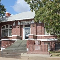
Washita County, Administrative county in western Oklahoma, United States

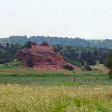
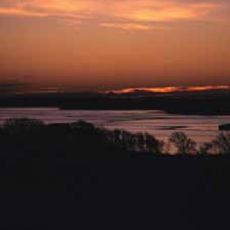
Washita County is an administrative county in western Oklahoma that encompasses rolling grasslands and prairie terrain across its expanse. The territory is home to several small towns, with New Cordell serving as the county seat.

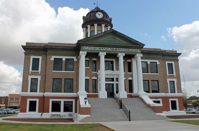
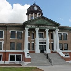
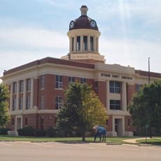
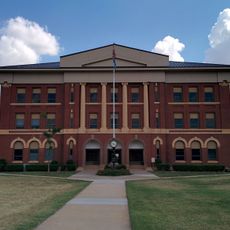
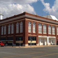
The county was established in 1891 with Cloud Chief as its original seat, but after legal conflicts and federal action, the administrative center moved to New Cordell in 1906. This shift resolved disputes that had marked its early years.

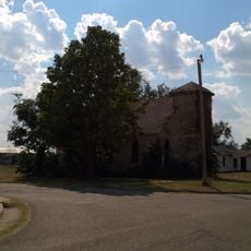
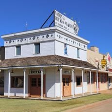
German-American and Russian settlers founded communities here in the late 1800s and built Mennonite churches that still serve as gathering places for their descendants. These buildings remain visible landmarks in several small towns across the county.

County administration is based in New Cordell and handles governmental services for the local population across the region. The area is most accessible during warmer months when roads and outdoor spaces are in good condition.

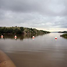
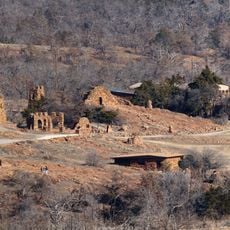
The county was home to one of the first flood control dams built under a federal program in the 1940s within the Cloud Creek watershed. This engineering project reflects an early approach to managing water resources in the region.

The community of curious travelers

AroundUs brings together thousands of curated places, local tips, and hidden gems, enriched daily by 60,000 contributors worldwide.

Start exploring
Location
Inception
1900
Capital city
New Cordell
Shares border with
Custer County, Kiowa County, Caddo County, Beckham County
GPS coordinates
35.29000,-98.99000
Latest update
December 7, 2025 20:47
Around this place
Wichita Mountains Wildlife Refuge
United States of America

Wichita Mountains Wildlife Refuge

64 km
Foss Reservoir
United States of America

Foss Reservoir

37.4 km
Stafford Air & Space Museum
United States of America

Stafford Air & Space Museum

40.6 km
Great Plains State Park
United States of America

Great Plains State Park

57.1 km
United States of America

Fort Cobb

55.8 km
Quartz Mountain Nature Park
United States of America

Quartz Mountain Nature Park

46.5 km
Red Rock Canyon State Park
United States of America

Red Rock Canyon State Park

60.6 km
Tom Steed Reservoir
United States of America

Tom Steed Reservoir

59 km
Rock Mary
United States of America

Rock Mary

54.6 km
Provine Service Station
United States of America

Provine Service Station

45.6 km
United States of America

Charon's Garden Wilderness Area

67.5 km
Washita National Wildlife Refuge
United States of America

Washita National Wildlife Refuge

42.6 km
Oklahoma Route 66 Museum
United States of America

Oklahoma Route 66 Museum

24.1 km
Storm House
United States of America

Storm House

40.7 km
Washita County Courthouse
United States of America

Washita County Courthouse

104 m
Beckham County Courthouse
United States of America

Beckham County Courthouse

58.8 km
First Baptist Church
United States of America

First Baptist Church

72.5 km
Sayre Champlin Service Station
United States of America

Sayre Champlin Service Station

59.2 km
Sayre Downtown Historic District
United States of America

Sayre Downtown Historic District

59 km
Cordell Carnegie Public Library
United States of America

Cordell Carnegie Public Library

284 m
National Rt 66 and Transportation Museum
United States of America

National Rt 66 and Transportation Museum

42.8 km
Canute Service Station
United States of America

Canute Service Station

30.2 km
J. W. Danner House
United States of America

J. W. Danner House

59 km
Greer County Courthouse
United States of America

Greer County Courthouse

66 km
Hobart City Hall
United States of America

Hobart City Hall

30.9 km
Holy City of the Wichitas Historic District
United States of America

Holy City of the Wichitas Historic District

70.9 km
Liberty Theatre
United States of America

Liberty Theatre

40.7 km
National Route 66 Museum
United States of America

National Route 66 Museum

42.8 km
Show the full map
Administrative divisions
« Washita County - Administrative county in western Oklahoma, United States » is provided by Around Us (aroundus.com). Images and texts are derived from Wikimedia project under a Creative Commons license. You are allowed to copy, distribute, and modify copies of this page, under the conditions set by the license, as long as this note is clearly visible.

Discover hidden gems everywhere you go!

From secret cafés to breathtaking viewpoints, skip the crowded tourist spots and find places that match your style. Our app makes it easy with voice search, smart filtering, route optimization, and insider tips from travelers worldwide. Download now for the complete mobile experience.

Around Us App Screenshot

A unique approach to discovering new places

Le Figaro

All the places worth exploring

France Info

A tailor-made excursion in just a few clicks

20 Minutes

Around Us
Travel Guide & Maps
Download

Send to your phone

QR Code
1

Open the camera app on your mobile.

2

Point at the QR code with your camera. A notification will appear.

3

Tap the notification to open the link.