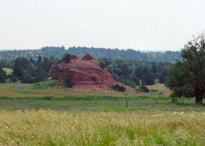
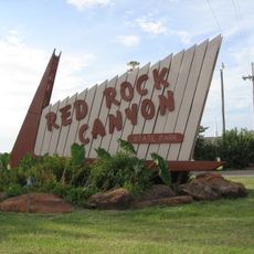
Rock Mary, Rock formation in Caddo County, Oklahoma, United States
Rock Mary is a natural rock formation near Hinton that rises approximately 60 feet (18 m) above the surrounding terrain and spans about 200 feet (61 m) across at its base. The formation displays two prominent tower-like peaks of reddish sandstone capped with a harder dolomite layer.
This rock formation was first documented during Captain Randolph Marcy's 1849 expedition and named after Mary Conway, a woman who traveled with California-bound pioneers. The landmark served as a key navigational reference point along early westbound travel routes through Oklahoma Territory.
The Oklahoma Historical Society placed markers at Rock Mary to document its importance in the state's early transportation routes and indigenous heritage.
This rock formation sits on private property south of Interstate 40 and is accessed via County Road E1060 near Hinton. Visitors should verify access permissions in advance since the site is privately owned and not always open to the public.
German artist Heinrich Balduin Möllhausen visited this formation in 1853 and created detailed drawings that remain the oldest visual record of this geological landmark. These historical artworks show how the rock appeared before natural weathering altered its shape over the following decades.
The community of curious travelers
AroundUs brings together thousands of curated places, local tips, and hidden gems, enriched daily by 60,000 contributors worldwide.