Chest opened
+${chestReward.xp} XP
Explorer
NOUVEAU ×${chestReward.collectible.quantity}
tapez pour fermer
Chest locked

Open chests in the app

Around Us is built for your phone — chests unlock when you walk, explore and capture nearby places.

Enable Location

We need your location to show you interesting places around you

Discover nearby places

Find interesting locations and hidden gems around you

Precise directions

Get accurate directions and distances to places

Your location is never shared with other users. It's only used when you tap the location button.

Log in to your account

Start exploring — it's free

Trusted by 72,888 travelers worldwide

Continue with Google
Continue with Apple
or

We will send you a code to connect

By continuing, you accept our Terms and Conditions and our Privacy Policy

Check your inbox

We've sent a pincode in your inbox. Please enter the code below.

Bertha Rogers
Discussion Reviews Photo
16.6k Popularity

Bertha Rogers, oil-exploratory borehole in Washita County, Oklahoma, United States

The Bertha Rogers is a sealed borehole in Washita County, Oklahoma, drilled between 1972 and 1974. It reached a depth of over 9,600 meters (31,400 feet) and was one of the deepest wells of its time, but it was eventually plugged and remains inactive today.

The borehole was started in 1972 by Lone Star Producing Company using the world's largest land rig at the time to explore for natural gas at extreme depths. During drilling, the crew encountered molten sulfur and extreme pressure conditions that caused setbacks, before the project was completed in 1974.

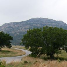
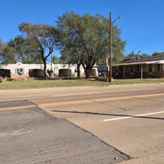
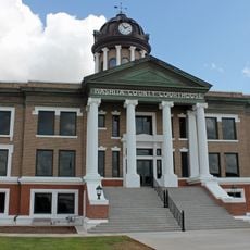
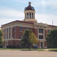
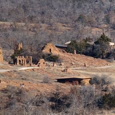
The site is located near Burns Flat in rural Washita County and is now sealed and closed to the public. Visitors can see the location from the road, but direct access to the borehole site itself is not available.

The well encountered liquid sulfur at extreme depth during drilling, which created severe technical challenges for the operation. While it produced little gas, this was one of the most technically demanding drilling attempts of its era.

The community of curious travelers

AroundUs brings together thousands of curated places, local tips, and hidden gems, enriched daily by 60,000 contributors worldwide.

Start exploring
Location
Inception
1972
GPS coordinates
35.31000,-99.19000
Latest update
February 17, 2026 02:01
Around this place
Mount Scott
United States of America

Mount Scott

87 km
Wichita Mountains Wildlife Refuge
United States of America

Wichita Mountains Wildlife Refuge

75.2 km
Foss Reservoir
United States of America

Foss Reservoir

28.9 km
Stafford Air & Space Museum
United States of America

Stafford Air & Space Museum

53.9 km
Great Plains State Park
United States of America

Great Plains State Park

62.2 km
United States of America

Fort Cobb

73.6 km
Quartz Mountain Nature Park
United States of America

Quartz Mountain Nature Park

41.7 km
Red Rock Canyon State Park
United States of America

Red Rock Canyon State Park

77.6 km
Tom Steed Reservoir
United States of America

Tom Steed Reservoir

63.9 km
Rock Mary
United States of America

Rock Mary

71.4 km
United States of America

Charon's Garden Wilderness Area

77.7 km
Washita National Wildlife Refuge
United States of America

Washita National Wildlife Refuge

33.7 km
West Winds Motel
United States of America

West Winds Motel

63 km
Oklahoma Route 66 Museum
United States of America

Oklahoma Route 66 Museum

28.6 km
Storm House
United States of America

Storm House

23.1 km
Washita County Courthouse
United States of America

Washita County Courthouse

18.4 km
Beckham County Courthouse
United States of America

Beckham County Courthouse

40.6 km
Route 66 Bridge over the Chicago, Rock Island and Gulf Railroad
United States of America

Route 66 Bridge over the Chicago, Rock Island and Gulf Railroad

83.7 km
Perryman Ranch Headquarters
United States of America

Perryman Ranch Headquarters

73.5 km
Sayre Downtown Historic District
United States of America

Sayre Downtown Historic District

40.9 km
W.C. Baker House
United States of America

W.C. Baker House

75.8 km
Cordell Carnegie Public Library
United States of America

Cordell Carnegie Public Library

18.3 km
Jackson County Courthouse
United States of America

Jackson County Courthouse

75.9 km
National Rt 66 and Transportation Museum
United States of America

National Rt 66 and Transportation Museum

25.1 km
J. W. Danner House
United States of America

J. W. Danner House

40.9 km
Greer County Courthouse
United States of America

Greer County Courthouse

56.5 km
Hobart City Hall
United States of America

Hobart City Hall

32.9 km
Holy City of the Wichitas Historic District
United States of America

Holy City of the Wichitas Historic District

83.5 km
Show the full map
Reviews
Share your experience

No review yet

Discussions
Start a discussion...

No discussion yet

« Bertha Rogers - oil-exploratory borehole in Washita County, Oklahoma, United States » is provided by Around Us (aroundus.com). Images and texts are derived from Wikimedia project under a Creative Commons license. You are allowed to copy, distribute, and modify copies of this page, under the conditions set by the license, as long as this note is clearly visible.

Discover hidden gems everywhere you go!

From secret cafés to breathtaking viewpoints, skip the crowded tourist spots and find places that match your style. Our app makes it easy with voice search, smart filtering, route optimization, and insider tips from travelers worldwide. Download now for the complete mobile experience.

Around Us App Screenshot

A unique approach to discovering new places

Le Figaro

All the places worth exploring

France Info

A tailor-made excursion in just a few clicks

20 Minutes

Around Us
Travel Guide & Maps
Download

Send to your phone

QR Code
1

Open the camera app on your mobile.

2

Point at the QR code with your camera. A notification will appear.

3

Tap the notification to open the link.