Enable Location

We need your location to show you interesting places around you

Discover nearby places

Find interesting locations and hidden gems around you

Precise directions

Get accurate directions and distances to places

Your location is never shared with other users. It's only used when you tap the location button.

Canadian County

Log in to your account

Start exploring — it's free

Trusted by 61,902 travelers worldwide

Continue with Google
Continue with Apple
or

We will send you a code to connect

By continuing, you accept our Terms and Conditions and our Privacy Policy

Check your inbox

We've sent a pincode in your inbox. Please enter the code below.

Canadian County, Administrative county in central Oklahoma, United States

Canadian County is an administrative region in central Oklahoma with rolling plains and gentle hills throughout. Two major river systems flow through the area and shape the local geography.

The region formed during the 1889 land runs when settlers rushed to claim territory in Oklahoma. Before settlement, the area was home to relocated Cheyenne and Arapaho tribes.

The Cheyenne and Arapaho tribes established their presence in the region after relocating from Colorado in 1869 through the Medicine Lodge Treaty.

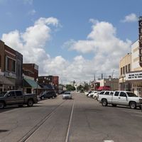
El Reno serves as the main hub for government services and administrative offices serving the local population. Spring and fall offer the most pleasant conditions for visiting and exploring the region.

The North Canadian River creates a natural network of floodplains that continuously reshape the landscape. These river corridors support distinct ecological patterns that shape how the land looks today.

The community of curious travelers

AroundUs brings together thousands of curated places, local tips, and hidden gems, enriched daily by 60,000 contributors worldwide.

Start exploring
Location
Inception
1889
Capital city
El Reno
Shares border with
Kingfisher County, Grady County, Oklahoma County, Cleveland County, Blaine County, Caddo County, Logan County, McClain County
GPS coordinates
35.54000,-97.98000
Latest update
December 19, 2025 23:14
Around this place
Fort Reno
United States of America

Fort Reno

5.5 km
Lake Overholser
United States of America

Lake Overholser

27.6 km
Oklahoma City Oklahoma Temple
United States of America

Oklahoma City Oklahoma Temple

23.7 km
El Reno High School
United States of America

El Reno High School

2.5 km
Darlington Agency
United States of America

Darlington Agency

4.7 km
Mennoville Mennonite Church
United States of America

Mennoville Mennonite Church

11.2 km
Czech Hall
United States of America

Czech Hall

22.9 km
Canadian County Jail and Stable
United States of America

Canadian County Jail and Stable

2.3 km
Yukon Public Library
United States of America

Yukon Public Library

21.1 km
El Reno Municipal Swimming Pool Bath House
United States of America

El Reno Municipal Swimming Pool Bath House

2.1 km
Carnegie Library
United States of America

Carnegie Library

2.8 km
West Point Christian Church
United States of America

West Point Christian Church

19.6 km
El Reno Hotel
United States of America

El Reno Hotel

2.5 km
Henry Lassen House
United States of America

Henry Lassen House

3.2 km
Red Cross Canteen
United States of America

Red Cross Canteen

2.2 km
William I. and Magdalen M. Goff House
United States of America

William I. and Magdalen M. Goff House

2.5 km
Meloy House
United States of America

Meloy House

29 km
Richardson Building
United States of America

Richardson Building

17.6 km
Mulvey Mercantile
United States of America

Mulvey Mercantile

21.8 km
Historic Fort Reno Visitors Center
United States of America

Historic Fort Reno Visitors Center

5.4 km
United States of America

Cottonwood Creek Site 33 Reservoir

26.1 km
United States of America

Gadberry Park

3.7 km
United States of America

Cottonwood Creek Site 16 Reservoir

25 km
United States of America

Uncle John Creek Site 11 Reservoir

17.8 km
United States of America

Uncle John Creek Site 5 Reservoir

13.8 km
United States of America

Uncle John Creek Site 7 Reservoir

15.3 km
United States of America

Crimson Creek Golf Course

1.5 km
United States of America

Work of art

21.5 km
Show the full map
Administrative divisions
« Canadian County - Administrative county in central Oklahoma, United States » is provided by Around Us (aroundus.com). Images and texts are derived from Wikimedia project under a Creative Commons license. You are allowed to copy, distribute, and modify copies of this page, under the conditions set by the license, as long as this note is clearly visible.

Discover hidden gems everywhere you go!

From secret cafés to breathtaking viewpoints, skip the crowded tourist spots and find places that match your style. Our app makes it easy with voice search, smart filtering, route optimization, and insider tips from travelers worldwide. Download now for the complete mobile experience.

Around Us App Screenshot

A unique approach to discovering new places

Le Figaro

All the places worth exploring

France Info

A tailor-made excursion in just a few clicks

20 Minutes

Around Us
Travel Guide & Maps
Download

Send to your phone

QR Code
1

Open the camera app on your mobile.

2

Point at the QR code with your camera. A notification will appear.

3

Tap the notification to open the link.