Enable Location

We need your location to show you interesting places around you

Discover nearby places

Find interesting locations and hidden gems around you

Precise directions

Get accurate directions and distances to places

Your location is never shared with other users. It's only used when you tap the location button.

El Reno

Log in to your account

Start exploring — it's free

Trusted by 61,906 travelers worldwide

Continue with Google
Continue with Apple
or

We will send you a code to connect

By continuing, you accept our Terms and Conditions and our Privacy Policy

Check your inbox

We've sent a pincode in your inbox. Please enter the code below.

El Reno, County seat in Canadian County, Oklahoma, United States

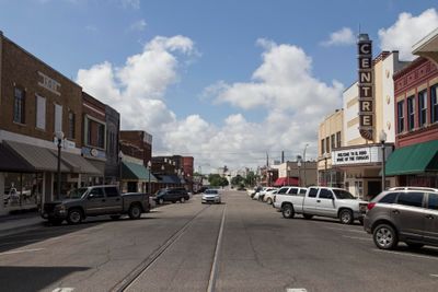
El Reno is a city in Canadian County, Oklahoma, situated about 25 miles west of Oklahoma City where Interstate 40 and U.S. Route 81 meet. The town serves as the administrative center for the county and sits on relatively flat terrain.

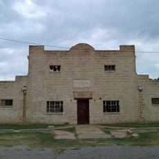
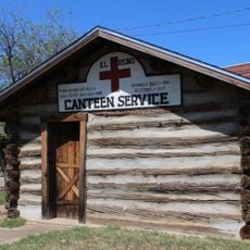
The city grew from several settlements following the 1889 land rush and took its name from Fort Reno, a military post established in 1874. During World War II, the former military grounds became a prisoner of war camp.

A local burger topped with fried onions originated here during the Great Depression and remains central to the town's identity today. An annual festival dedicated to this dish draws visitors who want to taste and celebrate this culinary tradition.

The downtown area is straightforward to navigate, with streets connecting the main shops and public buildings. Visiting during the annual festival or on weekends gives you the best chance to experience the town when local businesses are most active.

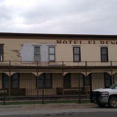
The town sits along a stretch of Interstate 40 that attracts travelers looking for classic roadside dining experiences. Many visitors stop here specifically to try local restaurants rather than chain establishments found elsewhere.

The community of curious travelers

AroundUs brings together thousands of curated places, local tips, and hidden gems, enriched daily by 60,000 contributors worldwide.

Start exploring
Location
Elevation above the sea
414 m
GPS coordinates
35.53028,-97.95750
Latest update
December 14, 2025 18:46
Around this place
Fort Reno
United States of America

Fort Reno

7.8 km
Lake Overholser
United States of America

Lake Overholser

25.4 km
Oklahoma City Oklahoma Temple
United States of America

Oklahoma City Oklahoma Temple

22 km
El Reno High School
United States of America

El Reno High School

245 m
Darlington Agency
United States of America

Darlington Agency

6.8 km
Mennoville Mennonite Church
United States of America

Mennoville Mennonite Church

12.1 km
Canadian County Jail and Stable
United States of America

Canadian County Jail and Stable

592 m
Yukon Public Library
United States of America

Yukon Public Library

18.9 km
El Reno Municipal Swimming Pool Bath House
United States of America

El Reno Municipal Swimming Pool Bath House

835 m
Carnegie Library
United States of America

Carnegie Library

567 m
West Point Christian Church
United States of America

West Point Christian Church

17.3 km
El Reno Hotel
United States of America

El Reno Hotel

249 m
Henry Lassen House
United States of America

Henry Lassen House

939 m
Red Cross Canteen
United States of America

Red Cross Canteen

118 m
William I. and Magdalen M. Goff House
United States of America

William I. and Magdalen M. Goff House

182 m
Richardson Building
United States of America

Richardson Building

16.2 km
Mulvey Mercantile
United States of America

Mulvey Mercantile

19.6 km
Historic Fort Reno Visitors Center
United States of America

Historic Fort Reno Visitors Center

7.7 km
United States of America

Cottonwood Creek Site 33 Reservoir

24.6 km
United States of America

Gadberry Park

2 km
United States of America

Cottonwood Creek Site 16 Reservoir

24.5 km
North Canadian River Bridge
United States of America

North Canadian River Bridge

26.7 km
United States of America

Uncle John Creek Site 11 Reservoir

18 km
United States of America

Uncle John Creek Site 5 Reservoir

14.9 km
United States of America

Uncle John Creek Site 7 Reservoir

15.9 km
United States of America

Uncle John Creek Site 12 Reservoir

26.2 km
United States of America

Uncle John Creek Site 13 Reservoir

27.5 km
United States of America

Work of art

19.3 km
Show the full map
« El Reno - County seat in Canadian County, Oklahoma, United States » is provided by Around Us (aroundus.com). Images and texts are derived from Wikimedia project under a Creative Commons license. You are allowed to copy, distribute, and modify copies of this page, under the conditions set by the license, as long as this note is clearly visible.

Discover hidden gems everywhere you go!

From secret cafés to breathtaking viewpoints, skip the crowded tourist spots and find places that match your style. Our app makes it easy with voice search, smart filtering, route optimization, and insider tips from travelers worldwide. Download now for the complete mobile experience.

Around Us App Screenshot

A unique approach to discovering new places

Le Figaro

All the places worth exploring

France Info

A tailor-made excursion in just a few clicks

20 Minutes

Around Us
Travel Guide & Maps
Download

Send to your phone

QR Code
1

Open the camera app on your mobile.

2

Point at the QR code with your camera. A notification will appear.

3

Tap the notification to open the link.