Chest opened
+${chestReward.xp} XP
Explorer
NOUVEAU ×${chestReward.collectible.quantity}
tapez pour fermer
Chest locked

Open chests in the app

Around Us is built for your phone — chests unlock when you walk, explore and capture nearby places.

Enable Location

We need your location to show you interesting places around you

Discover nearby places

Find interesting locations and hidden gems around you

Precise directions

Get accurate directions and distances to places

Your location is never shared with other users. It's only used when you tap the location button.

Log in to your account

Start exploring — it's free

Trusted by 73,025 travelers worldwide

Continue with Google
Continue with Apple
or

We will send you a code to connect

By continuing, you accept our Terms and Conditions and our Privacy Policy

Check your inbox

We've sent a pincode in your inbox. Please enter the code below.

Beech Creek National Scenic Area
Discussion Reviews Photo
1.3k Popularity

Beech Creek National Scenic Area, National Scenic Area in Le Flore County, Oklahoma.

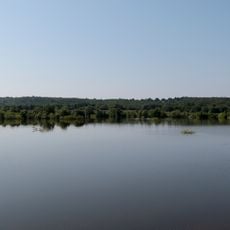
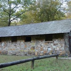
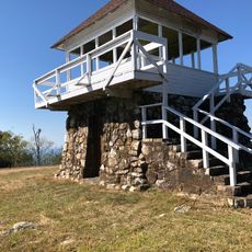
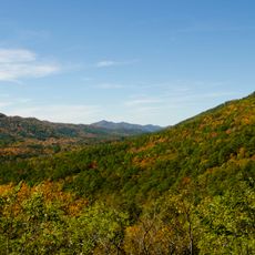
Beech Creek National Scenic Area is a forest preserve within the Ouachita National Forest offering a network of hiking trails through thick woodlands. The landscape includes streams, rocky outcrops, and groves of mature beech trees spread across thousands of acres.

The area was first established in 1988 as a small protected zone for mature beech trees. A federal law in the early 2000s allowed it to expand significantly to its current size.

The area was developed to bring hikers into the forest while protecting old beech trees that grow naturally here. Today visitors walk these paths to experience the mature woodland and see how water shapes the landscape over time.

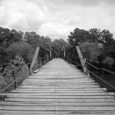
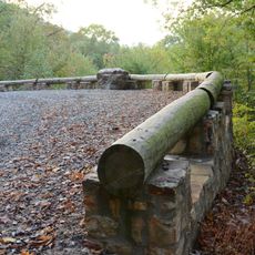
The area has several trails ranging from easy walks to more demanding mountain hikes through rocky terrain. Visitors should wear sturdy shoes and watch for slippery surfaces near streams and cascades.

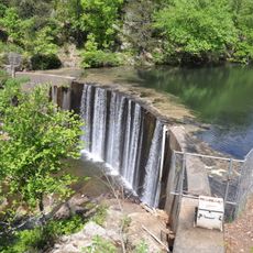
A special section called the Cascades features a rare natural formation where water flows over moss-covered rocks. This hidden feature rewards visitors who make the longer hike to reach it.

The community of curious travelers

AroundUs brings together thousands of curated places, local tips, and hidden gems, enriched daily by 60,000 contributors worldwide.

Start exploring
Location
Inception
1988
GPS coordinates
34.58330,-94.51670
Latest update
December 14, 2025 17:40
Around this place
Broken Bow Lake
United States of America

Broken Bow Lake

47.6 km
Queen Wilhelmina State Park
United States of America

Queen Wilhelmina State Park

17.6 km
Lake Wister
United States of America

Lake Wister

44.1 km
Peter Conser House
United States of America

Peter Conser House

32.6 km
Cossatot River State Park-Natural Area
United States of America

Cossatot River State Park-Natural Area

45.3 km
Lake Wister State Park
United States of America

Lake Wister State Park

44 km
Shady Lake Recreation Area
United States of America

Shady Lake Recreation Area

51 km
Hartford Water Tower
United States of America

Hartford Water Tower

50.8 km
Mountain Fork Bridge
United States of America

Mountain Fork Bridge

12.3 km
C.E. Foster House
United States of America

C.E. Foster House

17.4 km
Jones Memorial Methodist Church
United States of America

Jones Memorial Methodist Church

50.6 km
Ebenezer Monument
United States of America

Ebenezer Monument

25.2 km
Bard Springs Bathhouse
United States of America

Bard Springs Bathhouse

51.2 km
Mena City Hall
United States of America

Mena City Hall

25.5 km
Tall Peak Fire Tower
United States of America

Tall Peak Fire Tower

48.7 km
Janssen Park
United States of America

Janssen Park

25.3 km
Polk County Courthouse
United States of America

Polk County Courthouse

25.4 km
Old Scott County Jail
United States of America

Old Scott County Jail

52.4 km
Judge Benjamin Shaver House
United States of America

Judge Benjamin Shaver House

24.9 km
Bates School
United States of America

Bates School

38.1 km
Sebastian County Road 4G Bridge
United States of America

Sebastian County Road 4G Bridge

46.2 km
Elks Lodge
United States of America

Elks Lodge

25.6 km
Buckeye Vista Overlook
United States of America

Buckeye Vista Overlook

48.2 km
Mena Commercial Historic District
United States of America

Mena Commercial Historic District

25.8 km
Sugar Creek Vista Overlook
United States of America

Sugar Creek Vista Overlook

45.7 km
Hartford Commercial Historic District
United States of America

Hartford Commercial Historic District

50.6 km
Gillham City Jail
United States of America

Gillham City Jail

49.8 km
Scott Theatre
United States of America

Scott Theatre

52.5 km
Show the full map
Reviews
Share your experience

No review yet

Discussions
Start a discussion...

No discussion yet

« Beech Creek National Scenic Area - National Scenic Area in Le Flore County, Oklahoma » is provided by Around Us (aroundus.com). Images and texts are derived from Wikimedia project under a Creative Commons license. You are allowed to copy, distribute, and modify copies of this page, under the conditions set by the license, as long as this note is clearly visible.

Discover hidden gems everywhere you go!

From secret cafés to breathtaking viewpoints, skip the crowded tourist spots and find places that match your style. Our app makes it easy with voice search, smart filtering, route optimization, and insider tips from travelers worldwide. Download now for the complete mobile experience.

Around Us App Screenshot

A unique approach to discovering new places

Le Figaro

All the places worth exploring

France Info

A tailor-made excursion in just a few clicks

20 Minutes

Around Us
Travel Guide & Maps
Download

Send to your phone

QR Code
1

Open the camera app on your mobile.

2

Point at the QR code with your camera. A notification will appear.

3

Tap the notification to open the link.