Chest opened
+${chestReward.xp} XP
Explorer
NOUVEAU ×${chestReward.collectible.quantity}
tapez pour fermer

See the monuments around you in AR Open chests in the app

Around Us is built for your phone — point your camera at the streets and discover the monuments and places around you in augmented reality. Around Us is built for your phone — chests unlock when you walk, explore and capture nearby places.

Enable Location

We need your location to show you interesting places around you

Discover nearby places

Find interesting locations and hidden gems around you

Precise directions

Get accurate directions and distances to places

Your location is never shared with other users. It's only used when you tap the location button.

Log in to your account

Start exploring — it's free

Trusted by 86,295 travelers worldwide

Continue with Google
Continue with Apple
or

We will send you a code to connect

By continuing, you accept our Terms and Conditions and our Privacy Policy

Check your inbox

We've sent a pincode in your inbox. Please enter the code below.

Cherokee State Park
Discussion Reviews Photo
1.5k Popularity

Cherokee State Park, State park in Oklahoma, US

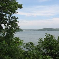
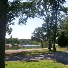
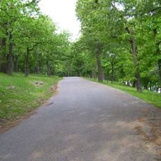
Cherokee State Park spreads along Grand Lake's shoreline, divided into three distinct zones that offer different recreational options and amenities. The landscape blends wooded areas with waterfront sections connected by park roads and facilities.

The park was established to develop recreation around the Grand Lake shoreline, taking advantage of the Pensacola Dam's creation. Its development reflects the region's focus on water-based recreation and resource management.

The name reflects the Cherokee Nation's historical presence in this region of Oklahoma, which visitors can sense through the park's identity and purpose. This connection shapes how the place is understood by locals and travelers alike.

The park offers camping, swimming beaches, and boat ramps spread across its three main zones, each with restroom facilities and showers. Water conditions and facility availability may vary by season, so checking ahead helps plan activities accordingly.

The Riverside section sits below Pensacola Dam, creating unusual water conditions and fishing opportunities different from the typical lake environment. The water flow and temperature patterns in this area attract both local anglers and visitors seeking a distinct experience.

The community of curious travelers

AroundUs brings together thousands of curated places, local tips, and hidden gems, enriched daily by 60,000 contributors worldwide.
Start exploring
Location
GPS coordinates
36.48036,-95.05080
Latest update
September 12, 2026 03:43
Around this place
Grand Lake o' the Cherokees
United States of America

Grand Lake o' the Cherokees

14.8 mi
Natural Falls State Park
United States of America

Natural Falls State Park

30.1 mi
Ed Galloway's Totem Pole Park
United States of America

Ed Galloway's Totem Pole Park

22.3 mi
Lake Eucha
United States of America

Lake Eucha

14.4 mi
Twin Bridges State Park
United States of America

Twin Bridges State Park

27.7 mi
Claremore Lake
United States of America

Claremore Lake

30.2 mi
Afton Station Packard Museum
United States of America

Afton Station Packard Museum

15.6 mi
Ozark Plateau National Wildlife Refuge
United States of America

Ozark Plateau National Wildlife Refuge

22 mi
Splitlog Church
United States of America

Splitlog Church

23.2 mi
Honey Creek State Park
United States of America

Honey Creek State Park

16.2 mi
Attucks School
United States of America

Attucks School

11.8 mi
Bernice State Park
United States of America

Bernice State Park

13 mi
First Methodist Episcopal Church, South
United States of America

First Methodist Episcopal Church, South

12.4 mi
George L. Coleman Sr. House
United States of America

George L. Coleman Sr. House

29.8 mi
Lendonwood Gardens
United States of America

Lendonwood Gardens

16.4 mi
OKARMO Corner
United States of America

OKARMO Corner

24.1 mi
Coon Creek Bridge
United States of America

Coon Creek Bridge

29.7 mi
Hildebrand Mill
United States of America

Hildebrand Mill

28.8 mi
Ed Galloway's Totem Pole Park
United States of America

Ed Galloway's Totem Pole Park

22.3 mi
Randall Tire Company
United States of America

Randall Tire Company

12.5 mi
Claremore Lake Splash Pad
United States of America

Claremore Lake Splash Pad

31.4 mi
Splash Park
United States of America

Splash Park

17.9 mi
Eastern Trails Museum
United States of America

Eastern Trails Museum

12.5 mi
Pryor Creek Bridge
United States of America

Pryor Creek Bridge

20.6 mi
United States of America

Recreation Area Number 3

2.2 mi
United States of America

Recreation Area Number 1

1.5 mi
United States of America

Chelsea Motel Ghost Sign

21.3 mi
United States of America

Scenic viewpoint

30.1 mi
Show the full map
Reviews
Share your experience

No review yet

Discussions
Start a discussion...

No discussion yet

« Cherokee State Park - State park in Oklahoma, US » is provided by Around Us (aroundus.com). Images and texts are derived from Wikimedia project under a Creative Commons license. You are allowed to copy, distribute, and modify copies of this page, under the conditions set by the license, as long as this note is clearly visible.

Discover hidden gems everywhere you go!

From secret cafés to breathtaking viewpoints, skip the crowded tourist spots and find places that match your style. Our app makes it easy with voice search, smart filtering, route optimization, and insider tips from travelers worldwide. Download now for the complete mobile experience.

Around Us App Screenshot

A unique approach to discovering new places

Le Figaro

All the places worth exploring

France Info

A tailor-made excursion in just a few clicks

20 Minutes

Around Us
Travel Guide & Maps
Download

Send to your phone

QR Code
1

Open the camera app on your mobile.

2

Point at the QR code with your camera. A notification will appear.

3

Tap the notification to open the link.