Enable Location

We need your location to show you interesting places around you

Discover nearby places

Find interesting locations and hidden gems around you

Precise directions

Get accurate directions and distances to places

Your location is never shared with other users. It's only used when you tap the location button.

Log in to your account

Start exploring — it's free

Trusted by 62,838 travelers worldwide

Continue with Google
Continue with Apple
or

We will send you a code to connect

By continuing, you accept our Terms and Conditions and our Privacy Policy

Check your inbox

We've sent a pincode in your inbox. Please enter the code below.

Bernice State Park

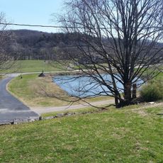
Bernice State Park, State park in Oklahoma, United States.

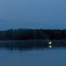
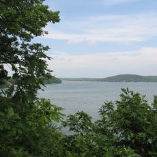
Bernice State Park is an 88-acre park located at the northwestern corner of Grand Lake with two towers for wildlife viewing. The grounds offer numerous camping and accommodation options right on the water's edge.

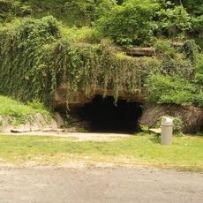
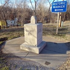
The region served as a key route during the Civil War, with the Cabin Creek Battle Site marking important military movements through Indian Territory. These locations today remind visitors of the area's complex past during that period.

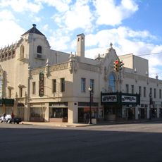
The nearby Eastern Trails Museum displays exhibits about how pioneers lived and what traditions shaped northeastern Oklahoma's early communities. Visitors can learn how the first settlers worked and built their lives in this region.

The park has 33 RV sites with water and electrical hookups, two restroom buildings with hot showers, and a dump station in the center. Visitors should check in at the visitor center when arriving to learn about trail access and fishing areas.

The park is recognized as the Crappie Capital of the World, providing access to Grand Lake's expansive water. The calm waters make it a favorite spot for anglers seeking this popular fish species.

The community of curious travelers

AroundUs brings together thousands of curated places, local tips, and hidden gems, enriched daily by 60,000 contributors worldwide.

Start exploring
Location
GPS coordinates
36.62670,-94.90190
Latest update
December 14, 2025 14:24
Around this place
Ghost light
United States of America

Ghost light

42.2 km
Grand Lake o' the Cherokees
United States of America

Grand Lake o' the Cherokees

5.6 km
Pensacola Dam
United States of America

Pensacola Dam

20.8 km
Old Spanish Treasure Cave
United States of America

Old Spanish Treasure Cave

42.6 km
Lake Eucha
United States of America

Lake Eucha

31.9 km
Ozark Plateau National Wildlife Refuge
United States of America

Ozark Plateau National Wildlife Refuge

38.4 km
Coleman Theatre
United States of America

Coleman Theatre

27.9 km
Splitlog Church
United States of America

Splitlog Church

19.9 km
Old McDonald County Courthouse
United States of America

Old McDonald County Courthouse

46.4 km
Attucks School
United States of America

Attucks School

22.3 km
John Patrick McNaughton Barn
United States of America

John Patrick McNaughton Barn

32 km
First Methodist Episcopal Church, South
United States of America

First Methodist Episcopal Church, South

22.9 km
George L. Coleman Sr. House
United States of America

George L. Coleman Sr. House

28.8 km
Bluff Dwellers Cave
United States of America

Bluff Dwellers Cave

39 km
Kindley House
United States of America

Kindley House

46.7 km
OKARMO Corner
United States of America

OKARMO Corner

29.1 km
Coon Creek Bridge
United States of America

Coon Creek Bridge

46 km
Wee Pine Knot
United States of America

Wee Pine Knot

42.3 km
Shiloh House
United States of America

Shiloh House

43.4 km
Sulphur Springs Park Reserve
United States of America

Sulphur Springs Park Reserve

43 km
Coats School
United States of America

Coats School

42.8 km
Kansas City Southern Railway Caboose No. 383
United States of America

Kansas City Southern Railway Caboose No. 383

46.2 km
Statue of Mickey Mantle
United States of America

Statue of Mickey Mantle

33.3 km
Adar House
United States of America

Adar House

41 km
Sulphur Springs Old School Complex Historic District
United States of America

Sulphur Springs Old School Complex Historic District

42.8 km
Corey House/Hotel
United States of America

Corey House/Hotel

12.4 km
Jones House
United States of America

Jones House

42.8 km
Splash Park
United States of America

Splash Park

13.8 km
Show the full map
« Bernice State Park - State park in Oklahoma, United States » is provided by Around Us (aroundus.com). Images and texts are derived from Wikimedia project under a Creative Commons license. You are allowed to copy, distribute, and modify copies of this page, under the conditions set by the license, as long as this note is clearly visible.

Discover hidden gems everywhere you go!

From secret cafés to breathtaking viewpoints, skip the crowded tourist spots and find places that match your style. Our app makes it easy with voice search, smart filtering, route optimization, and insider tips from travelers worldwide. Download now for the complete mobile experience.

Around Us App Screenshot

A unique approach to discovering new places

Le Figaro

All the places worth exploring

France Info

A tailor-made excursion in just a few clicks

20 Minutes

Around Us
Travel Guide & Maps
Download

Send to your phone

QR Code
1

Open the camera app on your mobile.

2

Point at the QR code with your camera. A notification will appear.

3

Tap the notification to open the link.