Delaware County

Log in to your account

AroundUs is a community-driven map of interesting places, built by curious explorers like you. It grows with every review, story, and photo you share.
Connect to save your favorite spots, contribute locations, and create personalized routes.
Continue with Google
Continue with Apple
Continue with X
Continue with Facebook
Continue with email
By continuing, you accept our Terms and Conditions and our Privacy Policy
Create an account
Add to collection
Map
Suggest a change
Share

Delaware County, County in Oklahoma, United States

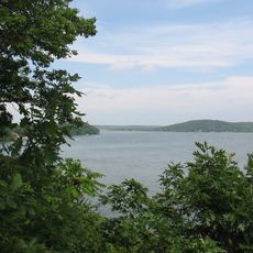
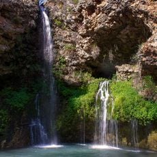
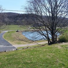
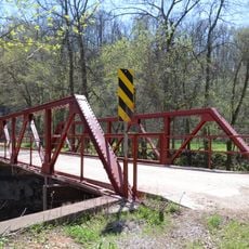
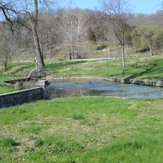
Delaware County is a county in northeastern Oklahoma that covers rolling terrain with thick forests and multiple large reservoirs throughout the landscape. The region sits on the western slope of the Ozark Plateau and combines natural features with small rural communities.

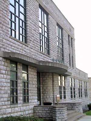
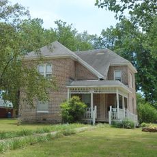
The area was originally a district of the Cherokee Nation and became an official county in 1907 when Oklahoma achieved statehood. Jay developed as the administrative center of the newly formed county.

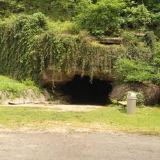
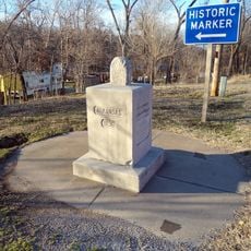
Archaeological studies reveal three prehistoric settlement periods in the region, with artifacts from Eastern Villager, Woodland, and Archaic civilizations dating back 2000 years.

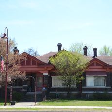
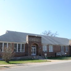
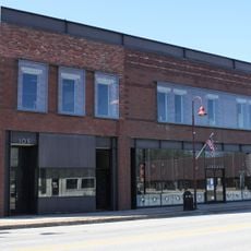
The county is best explored by car since attractions and lakes are spread throughout the region. Most facilities and visitor information are located in Jay, the administrative center.

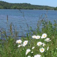
The construction of Grand Lake o' the Cherokees in the 1940s flooded many archaeological sites across the region. These lakes now hide underwater remains of settlements thousands of years old.

Location: Oklahoma

Inception: July 16, 1907

Capital city: Jay

Shares border with: Ottawa County, Adair County, Cherokee County, McDonald County, Benton County, Craig County, Mayes County

Website: https://delaware.okcounties.org

GPS coordinates: 36.41000,-94.80000

Latest update: December 14, 2025 20:23

Photos
Around this place
Grand Lake o' the Cherokees
United States of America

Grand Lake o' the Cherokees

22.8 km
Natural Falls State Park
United States of America

Natural Falls State Park

28.9 km
Old Spanish Treasure Cave
United States of America

Old Spanish Treasure Cave

31.5 km
Lake Eucha
United States of America

Lake Eucha

9.2 km
Ozark Plateau National Wildlife Refuge
United States of America

Ozark Plateau National Wildlife Refuge

13 km
Splitlog Church
United States of America

Splitlog Church

27.1 km
Bluff Dwellers Cave
United States of America

Bluff Dwellers Cave

30.5 km
Kindley House
United States of America

Kindley House

31.6 km
OKARMO Corner
United States of America

OKARMO Corner

19.1 km
Carl House
United States of America

Carl House

32.4 km
Coon Creek Bridge
United States of America

Coon Creek Bridge

24.1 km
Wee Pine Knot
United States of America

Wee Pine Knot

31.5 km
Hildebrand Mill
United States of America

Hildebrand Mill

26.3 km
Bratt-Smiley House
United States of America

Bratt-Smiley House

34 km
Kansas City Southern Railway Locomotive No. 73D and Caboose No. 385
United States of America

Kansas City Southern Railway Locomotive No. 73D and Caboose No. 385

31.4 km
Railroad Cottage
United States of America

Railroad Cottage

32.3 km
Connelly-Harrington House
United States of America

Connelly-Harrington House

34 km
Shiloh House
United States of America

Shiloh House

31.8 km
Sulphur Springs Park Reserve
United States of America

Sulphur Springs Park Reserve

31.9 km
Kansas City Southern Railway Caboose No. 383
United States of America

Kansas City Southern Railway Caboose No. 383

31.1 km
Oak Hill Mausoleum
United States of America

Oak Hill Mausoleum

32.8 km
Simon Sager Cabin
United States of America

Simon Sager Cabin

32.6 km
Adar House
United States of America

Adar House

30.5 km
Mitchell House
United States of America

Mitchell House

32.5 km
Sulphur Springs Old School Complex Historic District
United States of America

Sulphur Springs Old School Complex Historic District

31.2 km
Mitchell-Ward House
United States of America

Mitchell-Ward House

32.2 km
Jones House
United States of America

Jones House

31.5 km
Gentry Public Library
United States of America

Gentry Public Library

32.5 km
Show the full map
Reviews

Visited this place? Tap the stars to rate it and share your experience / photos with the community! Try now! You can cancel it anytime.

Administrative divisions
« Delaware County - County in Oklahoma, United States » is provided by Around Us (aroundus.com). Images and texts are derived from Wikimedia project under a Creative Commons license. You are allowed to copy, distribute, and modify copies of this page, under the conditions set by the license, as long as this note is clearly visible.

Discover hidden gems everywhere you go!

From secret cafés to breathtaking viewpoints, skip the crowded tourist spots and find places that match your style. Our app makes it easy with voice search, smart filtering, route optimization, and insider tips from travelers worldwide. Download now for the complete mobile experience.

Around Us App Screenshot

A unique approach to discovering new places

Le Figaro

All the places worth exploring

France Info

A tailor-made excursion in just a few clicks

20 Minutes