Port of Bridgetown, Main seaport in Bridgetown, Barbados
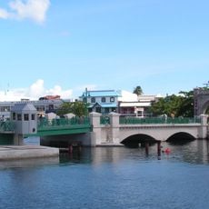
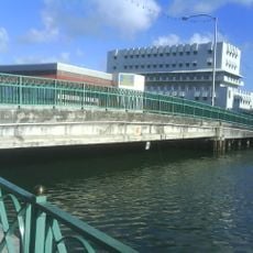
The Port of Bridgetown, officially the Deep Water Harbour, lies at the north-western end of Carlisle Bay. It was formed in 1956–1961 by a man-made isthmus linking the Fontabelle shore to the former quarantine island of Pelican Island, creating 90 acres of new land. Dredging in 2002 took the depth to 11.6 metres.
The port was built between 1956 and 1961 by a British construction company and was created by building an artificial causeway across a coastal waterway. This approach allowed a modern harbor to be established at this location.
The terminal building is filled with small shops arranged like traditional local houses, where you can find items such as rum and leather goods made in Barbados. These shops shape the feeling of the place and show what matters to the local economy.
The Deep Water Harbour sits at the north-western end of Carlisle Bay, and its time zone is GMT −4. Dredging in 2002 took the depth from 9.6 to 11.6 metres so the largest cruise ships could berth alongside rather than anchor offshore. Cruise traffic is given preference over container ships, which can wait offshore for a free berth.
The harbour was formed by building a man-made isthmus from the Fontabelle shore out to Pelican Island, a small uninhabited former quarantine island. The 90 acres of new land created this way became the port's site. In 2002 Belgian firm Jan De Nul Group dredged the harbour to 11.6 metres so the largest cruise ships could berth instead of anchoring offshore.
The community of curious travelers
AroundUs brings together thousands of curated places, local tips, and hidden gems, enriched daily by 93,607 contributors worldwide.