Cova, Stratovolcano in Paul, Cape Verde
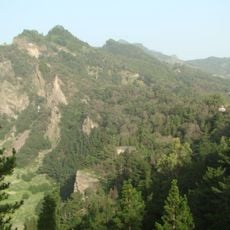
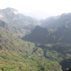
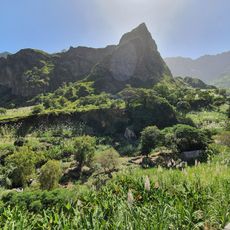
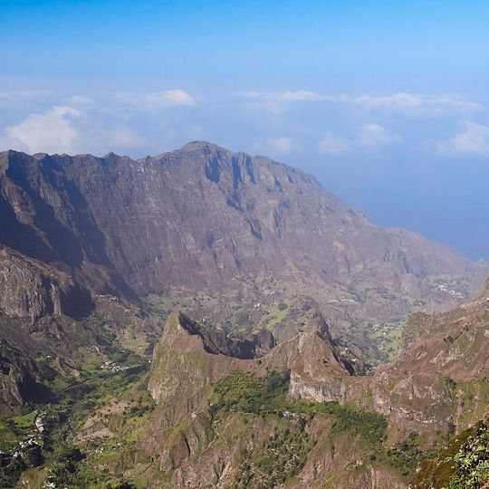
Cova is a volcanic caldera in the east-central part of Santo Antão, at the southwestern end of the municipality of Paul. Its rim rises to about 1,500 m and its floor lies at 1,166 m, with a diameter of roughly 1.0 km. Maize and beans are grown on the crater floor, north- and northeast-facing walls carry natural and semi-natural vegetation, and south-facing walls are planted with Pinus and Cupressus.
Cova is a volcanic caldera whose formation dates from between 1.4 million and 700,000 years ago. It lies at the southwestern end of the municipality of Paul, in the east-central part of Santo Antão, and today forms part of the Cova-Paul-Ribeira da Torre Natural Park. A small village of 10 inhabitants (2010 census), part of Cabo da Ribeira, stands inside the crater.
A small village of 10 residents (2010 census) sits inside the crater, part of the settlement Cabo da Ribeira in Paul municipality. Maize and beans are grown on the caldera floor, while the north- and northeast-facing walls keep natural and semi-natural vegetation and the south-facing walls are planted with Pinus and Cupressus.
Cova lies at the southwestern end of the municipality of Paul, in the east-central part of Santo Antão, inside Cova-Paul-Ribeira da Torre Natural Park. The crater floor sits at 1,166 m and the rim rises to about 1,500 m, so expect cooler, wetter conditions than on the coast. A small village of 10 residents (2010 census), part of Cabo da Ribeira, stands inside the caldera.
The crater floor holds a small village, part of Cabo da Ribeira, with 10 residents at the 2010 census. Maize and beans are grown on the caldera bottom, while the north- and northeast-facing walls keep natural and semi-natural vegetation and the south-facing walls carry a forest of Pinus and Cupressus.
The community of curious travelers
AroundUs brings together thousands of curated places, local tips, and hidden gems, enriched daily by 92,800 contributors worldwide.