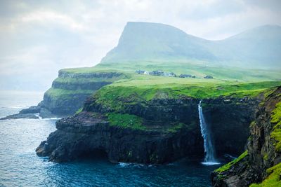
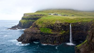
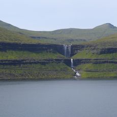
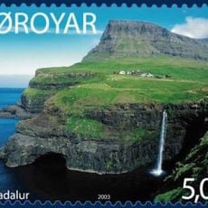
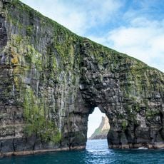
Múlafossur, Coastal waterfall in Sørvágs Municipality, Faroe Islands.
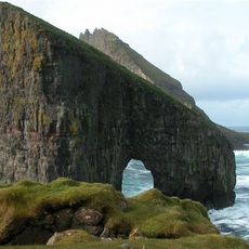
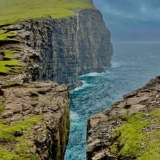
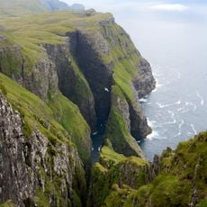
Múlafossur is a coastal waterfall in Sørvágs Municipality that plunges 30 meters down steep cliffs directly into the Atlantic Ocean. The water drops between the mountains Árnafjall and Eysturtindur, creating a dramatic meeting point where freshwater falls into the sea.
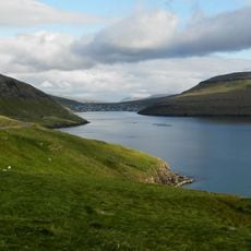
The waterfall marks the endpoint where the Dalsá River reaches the sea after flowing through the Gásadalur valley for thousands of years. This long water erosion carved the steep landscape that creates the dramatic drop seen today.
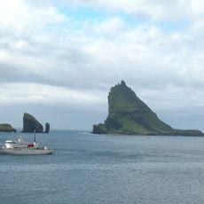
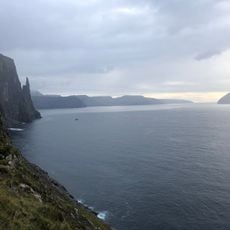
The natural formation represents the raw power of Faroese elements, drawing photographers and nature enthusiasts from across the globe.
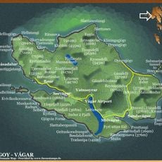
A marked trail connects the village of Gásadalur to the waterfall, with a small parking area just two minutes' walk away. The route is fairly straightforward, though weather can change quickly and the terrain can be slippery near the edge.
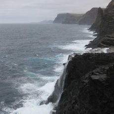
The water cascades directly into saltwater, with no beach or estuary between the fall and the open ocean – a rare sight where river and sea meet head-on. This direct encounter gives the place an unusual character that many visitors find memorable.
Location: Sørvágs Municipality
Height: 30 m
Address: 4H57+2QG, Gasadalur 387, Faroe Islands
GPS coordinates: 62.10748,-7.43578
Latest update: December 6, 2025 16:03
The Faroe Islands feature natural landscapes with waterfalls pouring into the ocean, sheer cliffs, elevated lakes, and coastal villages with traditional houses. The archipelago includes notable geological sites like Lake Sorvagsvatn and the Drangarnir rock formations. The villages retain their architecture with turf roofs, natural harbors, and historic churches. Hiking trails provide access to viewpoints over the fjords and mountains.
Streymin bridge
25 km
Drangarnir
3.7 km
Bøsdalafossur
13.8 km
Fossá
24.5 km
Sandavágur stone
16 km
Sørvágsfjørður
5 km
Árnafjall
2.7 km
Sandavágur Church
16 km
Vørðufelli
8.2 km
Eysturtindur
2.2 km
Saksun Church
20.4 km
Tjørnuvík Church
25.2 km
Stóri Drangur
3.8 km
Haldórsvíkar kirkja
25.9 km
Lítli Drangur
2.9 km
Slave Cliff
14.3 km
Kvívík Church
18.8 km
Bíggjar church
4.1 km
Mykines Church
10.8 km
Hvalvíkar kirkja
22.6 km
Vestmanna kirkja
14.6 km
Hósvíkar kirkja
26.1 km
Sørvágs kirkja
7.6 km
Mykineshólmur Lighthouse
12.9 km
Norðskála kirkja
25.4 km
Miðvágs kirkja
14.2 km
Dunnesdrangar
8.8 km
Trøllkonufingur
19.2 kmVisited this place? Tap the stars to rate it and share your experience / photos with the community! Try now! You can cancel it anytime.
Discover hidden gems everywhere you go!
From secret cafés to breathtaking viewpoints, skip the crowded tourist spots and find places that match your style. Our app makes it easy with voice search, smart filtering, route optimization, and insider tips from travelers worldwide. Download now for the complete mobile experience.
A unique approach to discovering new places❞
— Le Figaro
All the places worth exploring❞
— France Info
A tailor-made excursion in just a few clicks❞
— 20 Minutes