Betung Kerihun National Park, National park in West Kalimantan, Indonesia.
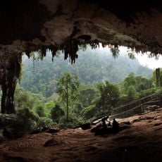
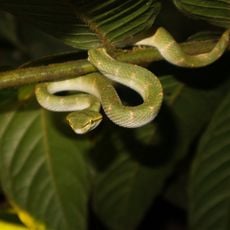
Betung Kerihun National Park is a protected area in West Kalimantan that covers extensive mountainous terrain with peaks reaching 1,800 meters. The landscape contains both lowland and montane rainforests with diverse plant and animal life.
The area was protected in 1982 as a 600,000-hectare nature reserve under a Ministry of Agriculture decree, and enlarged to 800,000 hectares in 1992. It became a national park in 1995, and its management unit was launched by the Minister of Forestry in 1997. The park is now staffed by 57 full-time employees and 20 honorary members, including 24 rangers covering four field posts.
Twelve villages lie in and around the park, two of them inside its boundaries: Nanga Bungan and Tanjung Lokang. The Dayak Iban, Taman and Bukat living there hunt, gather non-timber forest products such as agarwood and honey, and farm by shifting cultivation. The Kapuas Hulu communities also depend on the forest for fish like the arowana.
The terrain is steep and demands good physical fitness for hiking through the different forest zones. Starting early helps visitors make the most of daylight and navigate the changing weather conditions that occur in the mountains.
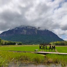
The park sits at the headwaters of the Kapuas River, the longest river in West Kalimantan, not at the source of three separate rivers. Its two highest peaks are Mount Kerihun at 1,790 m and Mount Lawit at 1,767 m, and more than half the park has slopes over 45%.
The community of curious travelers
AroundUs brings together thousands of curated places, local tips, and hidden gems, enriched daily by 92,893 contributors worldwide.