Enable Location

We need your location to show you interesting places around you

Discover nearby places

Find interesting locations and hidden gems around you

Precise directions

Get accurate directions and distances to places

Your location is never shared with other users. It's only used when you tap the location button.

Namur

Log in to your account

Start exploring — it's free

Trusted by 61,453 travelers worldwide

Continue with Google
Continue with Apple
or

We will send you a code to connect

By continuing, you accept our Terms and Conditions and our Privacy Policy

Check your inbox

We've sent a pincode in your inbox. Please enter the code below.

Namur, Administrative capital in Wallonia, Belgium

Description

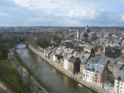
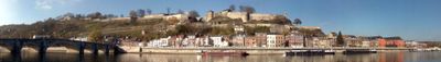
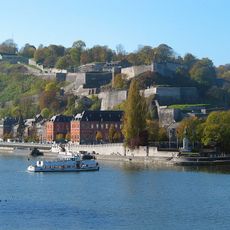
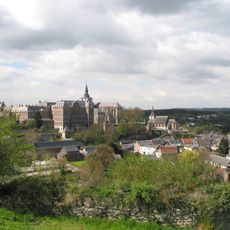
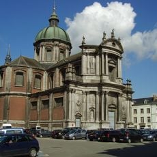
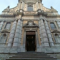
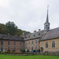
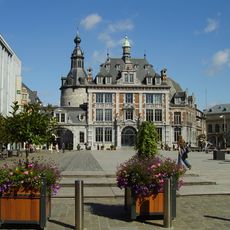
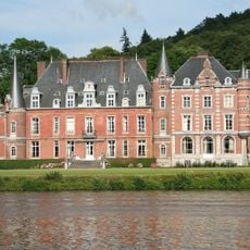
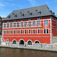
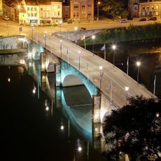
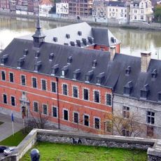
Namur is the capital of Wallonia at the point where the Meuse and Sambre rivers join, with a fortified hill rising steeply between them. The old town spreads below the fortress and shows narrow streets lined with brick houses, small squares and bridges linking the left and right banks.

History

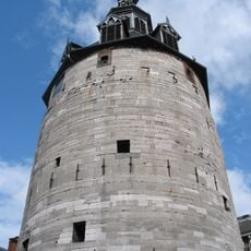
A Celtic settlement on the river grew into a county in the tenth century and later passed between Flemish and Burgundian rulers. The fortress faced repeated sieges and changes in the seventeenth and eighteenth centuries before losing importance in the nineteenth.

Culture

The name comes from a Celtic word meaning bend or curve, pointing to its position where two rivers meet. Today you see walkers and cyclists using the riverside paths, while the old town shows cafés and shops filling the streets.

Practical

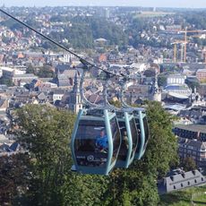
The old town is easy to walk around, while the hilltop fortress requires a climb or a short ride. Many museums and public buildings lie within walking distance of each other, and the riverside paths offer flat routes for strolling.

Did you know?

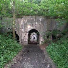
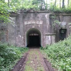
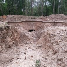
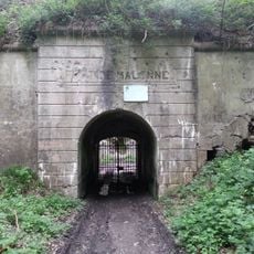
Below the fortress run around 500 meters (1640 feet) of tunnels and passages that visitors can walk through. These underground spaces show different building phases of the fortifications and offer a look at earlier defense methods.

Inception
January 1, 1977
Capital city
Namur
Elevation above the sea
83 m
Operator
Ville de Namur
Part of
Emergency zone Nage, Zone de police Namur Capitale
Shares border with
Profondeville, Assesse, Fernelmont, Gembloux, Éghezée, Andenne, Gesves, Floreffe, La Bruyère, Jemeppe-sur-Sambre
Phone
GPS coordinates
50.46653,4.86619
Latest update
December 15, 2025 05:03

AroundUs brings together thousands of curated places, local tips, and hidden gems, enriched daily by 60,000 contributors worldwide. Discover all places nearby (Arrondissement of Namur).

Visit Wallonia: historic towns, castles and nature in Belgium

Wallonia brings together a range of places that tell the story of the south of Belgium. You will find historic towns like Mons, Namur, Liege or Tournai, with their bell towers, cathedrals and cobbled squares. Castles and monasteries show the region’s medieval past, while citadels overlook valleys...

« Namur - Administrative capital in Wallonia, Belgium » is provided by Around Us (aroundus.com). Images and texts are derived from Wikimedia project under a Creative Commons license. You are allowed to copy, distribute, and modify copies of this page, under the conditions set by the license, as long as this note is clearly visible.

Discover hidden gems everywhere you go!

From secret cafés to breathtaking viewpoints, skip the crowded tourist spots and find places that match your style. Our app makes it easy with voice search, smart filtering, route optimization, and insider tips from travelers worldwide. Download now for the complete mobile experience.

Around Us App Screenshot

A unique approach to discovering new places

Le Figaro

All the places worth exploring

France Info

A tailor-made excursion in just a few clicks

20 Minutes

Around Us
Travel Guide & Maps
Download

Send to your phone

QR Code
1

Open the camera app on your mobile.

2

Point at the QR code with your camera. A notification will appear.

3

Tap the notification to open the link.