Capital Pathway, Recreational pathway network in Ottawa and Gatineau, Canada
The Capital Pathway is a shared-use path network in Ottawa and Gatineau, running along rivers, through parks, and past city landmarks on both sides of the Ottawa River. The surface is mostly paved and wide enough to accommodate cyclists, inline skaters, and pedestrians at the same time.
The Capital Pathway was built by the National Capital Commission, a crown corporation created by an act of parliament in 1959. Its first section, the Ottawa River Pathway, was laid out in the early 1970s, and the NCC still maintains most of the network. The stretch between Acres Road and Moodie Drive was paved in 2009.
The Capital Pathway links neighborhoods on both sides of the Ottawa River, so it brings together people from two provinces in one shared space. Along the route, it is common to see commuters, joggers, and families side by side on the same path.
Some sections of the pathway are groomed for cross-country skiing or snow biking in winter, so conditions change depending on the season. Using the bridges and intersections as landmarks helps with orientation, since the network covers a large area across two cities.
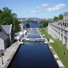
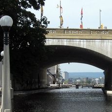
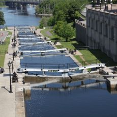
The Rideau Canal section is the best known of the Capital Pathway's routes, drawing tourists and residents for walking, cycling and running. In winter the canal itself becomes one of the world's longest skating rinks, with 6 to 8 km of skatable surface on most days in January. Two separate paths run on each side of the canal, and users often cross near Carleton University, just south of Dow's Lake.
The community of curious travelers
AroundUs brings together thousands of curated places, local tips, and hidden gems, enriched daily by 92,753 contributors worldwide.