Chest opened
+${chestReward.xp} XP
Explorer
NOUVEAU ×${chestReward.collectible.quantity}
tapez pour fermer
Chest locked

Open chests in the app

Around Us is built for your phone — chests unlock when you walk, explore and capture nearby places.

Enable Location

We need your location to show you interesting places around you

Discover nearby places

Find interesting locations and hidden gems around you

Precise directions

Get accurate directions and distances to places

Your location is never shared with other users. It's only used when you tap the location button.

Log in to your account

Start exploring — it's free

Trusted by 72,922 travelers worldwide

Continue with Google
Continue with Apple
or

We will send you a code to connect

By continuing, you accept our Terms and Conditions and our Privacy Policy

Check your inbox

We've sent a pincode in your inbox. Please enter the code below.

Lake Arkona
Discussion Reviews Photo
2.2k Popularity

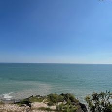
Lake Arkona, Prehistoric glacial lake in Ontario, Canada

Lake Arkona was a prehistoric glacial lake that covered the Erie basin, stretching across parts of Ohio, Ontario, Michigan, and Pennsylvania. The water body measured roughly 388 kilometers long and 92 kilometers wide, reshaping the landscape across multiple states and provinces.

The lake formed roughly 13,600 years ago when the Laurentide Ice Sheet melted during the last glaciation period and filled the Huron-Erie-Ontario basin. This glacial meltwater event marked a major shift in the post-ice age geological history of the region.

Archaeological findings near Lake Arkona indicate the presence of early civilizations that depended on its resources for survival and development.

This former lake site is accessible today for those interested in geology and understanding past environmental changes through visible landscape features. Visitors can observe sediment deposits and geological markers that reveal how ice age processes shaped the current terrain.

Three separate gravel ridges from this ancient lake remain visible today, extending southward toward Lenox across the landscape. These deposits consist of stiff clay that forms distinctive consolidated layers over considerable distances.

The community of curious travelers

AroundUs brings together thousands of curated places, local tips, and hidden gems, enriched daily by 60,000 contributors worldwide.

Start exploring
GPS coordinates
42.20000,-81.20000
Latest update
December 13, 2025 17:07
Around this place
Madison Seminary
United States of America

Madison Seminary

47.4 km
Headlands Beach State Park
United States of America

Headlands Beach State Park

49.8 km
Smolen–Gulf Bridge
United States of America

Smolen–Gulf Bridge

52.7 km
Geneva State Park
United States of America

Geneva State Park

42.9 km
Ashtabula lift bridge
United States of America

Ashtabula lift bridge

47.1 km
Harpersfield Covered Bridge
United States of America

Harpersfield Covered Bridge

53.8 km
West Liberty Covered Bridge
United States of America

West Liberty Covered Bridge

49.2 km
Fairport Harbor Lighthouse
United States of America

Fairport Harbor Lighthouse

49.7 km
Fairport Harbor West Breakwater Light
United States of America

Fairport Harbor West Breakwater Light

48.6 km
Morley Library
United States of America

Morley Library

52.7 km
Ashtabula Harbor Light
United States of America

Ashtabula Harbor Light

45.8 km
Mother of Sorrows Church
United States of America

Mother of Sorrows Church

47.1 km
Shandy Hall
United States of America

Shandy Hall

49.9 km
Ashtabula Harbour Commercial District
United States of America

Ashtabula Harbour Commercial District

47.1 km
Backus-Page House Museum
Canada

Backus-Page House Museum

49.6 km
CSX Bridge
United States of America

CSX Bridge

51.5 km
Finnish Heritage Museum
United States of America

Finnish Heritage Museum

49.9 km
Adventure Zone
United States of America

Adventure Zone

43 km
Lake County Courthouse
United States of America

Lake County Courthouse

53 km
Addison Kimball House
United States of America

Addison Kimball House

49.2 km
Riverview Covered Bridge
United States of America

Riverview Covered Bridge

52.7 km
Administration Building
United States of America

Administration Building

53.9 km
St. James Episcopal Church
United States of America

St. James Episcopal Church

52.7 km
Hawk Cliff
Canada

Hawk Cliff

52 km
Ashtabula Bowling Center
United States of America

Ashtabula Bowling Center

50.6 km
Karl A. Staley House
United States of America

Karl A. Staley House

42.6 km
Ashtabula Maritime & Surface Transportation Museum
United States of America

Ashtabula Maritime & Surface Transportation Museum

46.9 km
Kettle Creek Inn
Canada

Kettle Creek Inn

51.9 km
Show the full map
Reviews
Share your experience

No review yet

Discussions
Start a discussion...

No discussion yet

« Lake Arkona - Prehistoric glacial lake in Ontario, Canada » is provided by Around Us (aroundus.com). Images and texts are derived from Wikimedia project under a Creative Commons license. You are allowed to copy, distribute, and modify copies of this page, under the conditions set by the license, as long as this note is clearly visible.

Discover hidden gems everywhere you go!

From secret cafés to breathtaking viewpoints, skip the crowded tourist spots and find places that match your style. Our app makes it easy with voice search, smart filtering, route optimization, and insider tips from travelers worldwide. Download now for the complete mobile experience.

Around Us App Screenshot

A unique approach to discovering new places

Le Figaro

All the places worth exploring

France Info

A tailor-made excursion in just a few clicks

20 Minutes

Around Us
Travel Guide & Maps
Download

Send to your phone

QR Code
1

Open the camera app on your mobile.

2

Point at the QR code with your camera. A notification will appear.

3

Tap the notification to open the link.