Enable Location

We need your location to show you interesting places around you

Discover nearby places

Find interesting locations and hidden gems around you

Precise directions

Get accurate directions and distances to places

Your location is never shared with other users. It's only used when you tap the location button.

Naters

Log in to your account

Start exploring — it's free

Trusted by 64,307 travelers worldwide

Continue with Google
Continue with Apple
or

We will send you a code to connect

By continuing, you accept our Terms and Conditions and our Privacy Policy

Check your inbox

We've sent a pincode in your inbox. Please enter the code below.

Discussion Reviews 1 Photos
16.7k Popularity

Naters, municipality in the canton of Valais, Switzerland

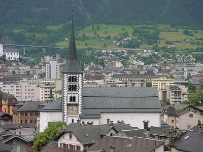
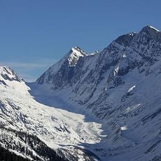
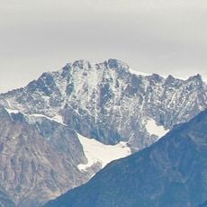
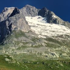
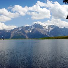
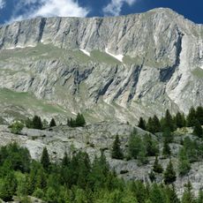
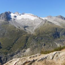
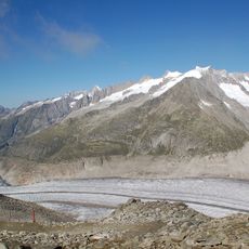
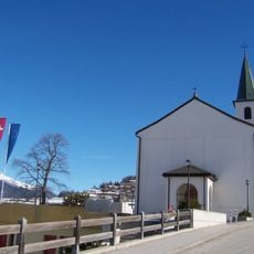
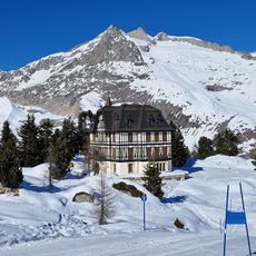
Naters is a Swiss municipality in the Brig District that stretches through a valley fold of the Rhone, with a village center preserving traditional architecture featuring Walser houses made of wood and stone connected by lanes leading toward the river. The community extends upward into the mountains, reaching elevations above 13,800 feet (4,200 meters).

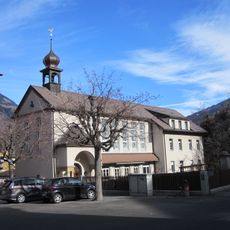
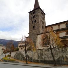
Naters was first documented in 1018 under the name 'Nares' and developed slowly as a farming settlement in the valleys. By the 14th century, the area was fortified with a defensive wall between Brig and nearby Brigerbad, built to protect against floods and military attacks, now preserved as a monument to medieval defense history.

The name Naters comes from the Latin 'Nares', first recorded in 1018. Today, residents speak German as their main language, and walking through the old village center, you see traditional Walser houses with wood siding, colorful shutters, and wide roof overhangs that have shaped daily life for centuries.

Naters is easily reached by train and bus, with the Matterhorn-Gotthard railway connecting the community to larger Swiss cities. Small hotels and guesthouses are available in town, and well-maintained roads make it simple to explore the village center and surrounding slopes on foot.

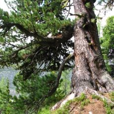
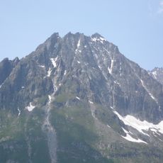
Naters holds the largest elevation difference of any Swiss municipality, stretching from about 2,000 feet (600 meters) to above 13,800 feet (4,200 meters). This extreme landscape diversity allows for both peaceful valley walks and alpine mountain tours through snowy heights, all within a single community.

The community of curious travelers

AroundUs brings together thousands of curated places, local tips, and hidden gems, enriched daily by 60,000 contributors worldwide.

Start exploring
Location
Elevation above the sea
673 m
Shares border with
Betten, Bitsch, Blatten, Eggerberg, Fieschertal, Riederalp, Termen
GPS coordinates
46.32370,7.98860
Latest update
February 17, 2026 01:40
Reviews
Share your experience

No review yet

Discussions
Start a discussion...

No discussion yet

« Naters - municipality in the canton of Valais, Switzerland » is provided by Around Us (aroundus.com). Images and texts are derived from Wikimedia project under a Creative Commons license. You are allowed to copy, distribute, and modify copies of this page, under the conditions set by the license, as long as this note is clearly visible.

Discover hidden gems everywhere you go!

From secret cafés to breathtaking viewpoints, skip the crowded tourist spots and find places that match your style. Our app makes it easy with voice search, smart filtering, route optimization, and insider tips from travelers worldwide. Download now for the complete mobile experience.

Around Us App Screenshot

A unique approach to discovering new places

Le Figaro

All the places worth exploring

France Info

A tailor-made excursion in just a few clicks

20 Minutes

Around Us
Travel Guide & Maps
Download

Send to your phone

QR Code
1

Open the camera app on your mobile.

2

Point at the QR code with your camera. A notification will appear.

3

Tap the notification to open the link.