Enable Location

We need your location to show you interesting places around you

Discover nearby places

Find interesting locations and hidden gems around you

Precise directions

Get accurate directions and distances to places

Your location is never shared with other users. It's only used when you tap the location button.

Tai To Yan

Log in to your account

Start exploring — it's free

Trusted by 64,834 travelers worldwide

Continue with Google
Continue with Apple
or

We will send you a code to connect

By continuing, you accept our Terms and Conditions and our Privacy Policy

Check your inbox

We've sent a pincode in your inbox. Please enter the code below.

Tai To Yan
Discussion Reviews 1 Photos
5.6k Popularity

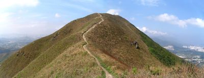
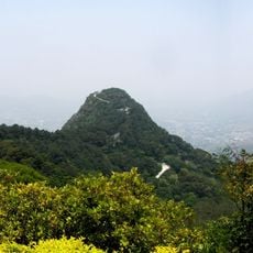
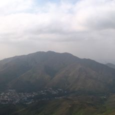
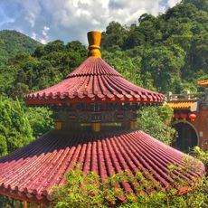
Tai To Yan, Mountain summit in northern New Territories, Hong Kong.

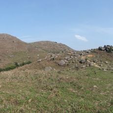
Tai To Yan is a mountain summit in the northern New Territories of Hong Kong, known for its sharp ridge and several exposed rocky peaks along the top. The trail passes through forested lower slopes before opening onto the open ridge, where the path links the different high points one after another.

The name Tai To Yan comes from traditional Chinese geographical naming and refers to the blade-like shape of the ridge. This way of naming hills and peaks was common across the rural parts of the New Territories, where the form of the land guided how places were called.

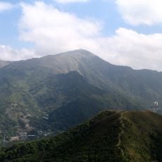
Tai To Yan draws local hiking groups who come back regularly, often using the ridge walk as a way to connect with the open countryside north of the city. The exposed sections of the trail offer clear views toward the Chinese mainland, which gives the walk a feeling of being far from urban life.

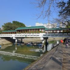
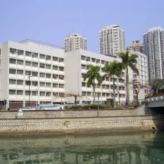
The trail starts near Kadoorie Farm and ends close to Fanling MTR station, making it easy to use public transport at both ends. The open ridge sections have no shade, so an early start is a good idea, especially in warm months.

The descent from the main peak follows one of the longest continuous staircase sections found on any hiking trail in Hong Kong, dropping steeply without much break. Walkers who do the route from start to finish often find that their legs feel the stairs more than the climb by the time they reach Fanling.

The community of curious travelers

AroundUs brings together thousands of curated places, local tips, and hidden gems, enriched daily by 60,000 contributors worldwide.

Start exploring
Location
Elevation above the sea
566 m
GPS coordinates
22.45111,114.11819
Latest update
March 3, 2026 10:08
Reviews
Share your experience

No review yet

Discussions
Start a discussion...

No discussion yet

« Tai To Yan - Mountain summit in northern New Territories, Hong Kong » is provided by Around Us (aroundus.com). Images and texts are derived from Wikimedia project under a Creative Commons license. You are allowed to copy, distribute, and modify copies of this page, under the conditions set by the license, as long as this note is clearly visible.

Discover hidden gems everywhere you go!

From secret cafés to breathtaking viewpoints, skip the crowded tourist spots and find places that match your style. Our app makes it easy with voice search, smart filtering, route optimization, and insider tips from travelers worldwide. Download now for the complete mobile experience.

Around Us App Screenshot

A unique approach to discovering new places

Le Figaro

All the places worth exploring

France Info

A tailor-made excursion in just a few clicks

20 Minutes

Around Us
Travel Guide & Maps
Download

Send to your phone

QR Code
1

Open the camera app on your mobile.

2

Point at the QR code with your camera. A notification will appear.

3

Tap the notification to open the link.