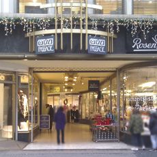
Planken, Principal shopping street in Mannheim, Germany
Planken is a shopping street stretching over 800 meters through central Mannheim, connecting the water tower with Paradeplatz and serving as the main east-west commercial corridor. The eastern portion functions as a pedestrian zone while allowing streetcar passage, lined with retail shops and daily foot traffic.
The street name originates in the 17th century from wooden palisades that once stood on sandy ground between the citadel and the city center. This early defensive structure later evolved into the area that became Mannheim's primary commercial route.
The street functions as the living center of Mannheim's distinctive grid layout, where buildings carry alphanumeric codes instead of conventional street names. Locals and visitors naturally gather here, experiencing the city's most recognizable public space within this organized urban pattern.
The eastern half, including the extended Planken to the water tower, is a pedestrian zone; trams run through the western section. The 2019 redesign added new paving, benches and lamps, and upgraded the tram stops. The central Paradeplatz marks the crossing with the Breite Straße.
The narrow section at squares P 5 and P 6, about 11 metres wide against roughly 27 metres elsewhere, still shows in the bend of the tram tracks. It was widened between 1934 and 1939: 18 houses were demolished, among them the old Mannheim mint at the corner of P 6.
The community of curious travelers
AroundUs brings together thousands of curated places, local tips, and hidden gems, enriched daily by 94,467 contributors worldwide.