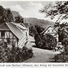
Hoher Meissner, Mountain massif in Werra-Meißner-Kreis, Germany.
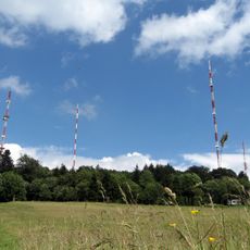
The Hoher Meißner is a forested massif about 10 km long and 5 km wide in the Fulda-Werra hill country, its crest crowned by a broad high plateau. The highest point, the Kasseler Kuppe, was re-measured by the HLBG in September 2025 at 751.2 m; official maps still show 753.6 m. A 220 m lattice mast of the transmitter stands on the ridge, and the Kalbe lake fills a former open-cast pit.
The mountain has a long coal extraction history that began in 1560 when coal fragments were discovered in a stream and continued until 1929. Mining operations were closely tied to salt production in neighboring regions and shaped the area's economic development.
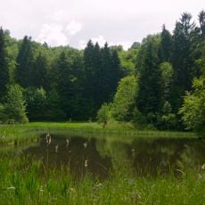
The massif is named after Frau Holle, the figure from the Grimms' tale who shakes out her feather bed to make it snow; the old name Wissener, first recorded in 1195, probably meant "the white one" because snow lies long on the ridge. The Frau-Holle-Teich pond and the Frau-Holle-Land nature park carry her name, and the Frau-Holle-Land geo-nature park covers the massif together with the Kaufunger Wald, Söhre and Ringgau.
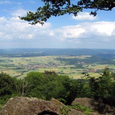
The Kalbe lookout at about 720 m can only be reached on foot, for example via the path starting at the Frau-Holle-Teich. Schwalbenthal, roughly 100 m lower, is easier to reach and has a parking lot at 620 m. From the Meißnerhaus parking lot near the Naturfreundehaus, views open to the southwest toward the Kellerwald, Habichtswald and Kaufunger Wald.
The Stinksteinwand on the east face above Schwalbenthal is the visible trace of sub-surface coal mining: the seams there were prone to spontaneous combustion, and for centuries people have seen and smelled the smoke. Attempts to extinguish the fires have failed, so a sulfur-like smell often hangs over the Schwalbenthal parking lot.
The community of curious travelers
AroundUs brings together thousands of curated places, local tips, and hidden gems, enriched daily by 93,964 contributors worldwide.