Einödriegel, Mountain summit in Grafling, Germany
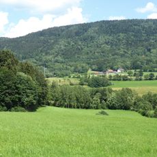
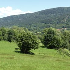
Einödriegel is a mountain summit in the Danube Hills area, standing at 1,121 meters high. It sits within the Vorderer Wald region, positioned between the Danube and Regen river valleys.
Local geographical records from 1982 established the mountain as part of the Vorderer Wald region. This classification formed the basis for understanding it within the broader landscape between the two rivers.
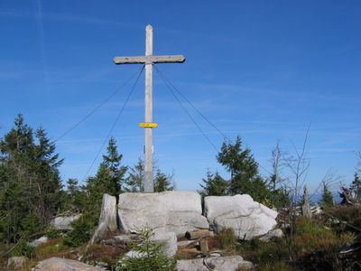
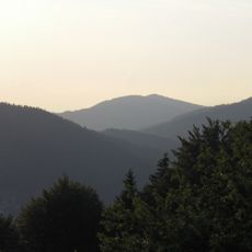
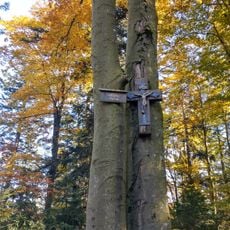
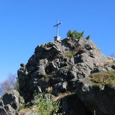
The summit cross and wooden benches invite visitors to pause and take in the landscape around them. These simple features are well-used stops where walkers naturally gather to rest and look out over the valleys.
A ski lift operates from Unterbreitenau during winter months, connecting the mountain to the Geißkopf skiing area. Visitors should expect uneven paths and changing elevations, so sturdy footwear is advisable for any season.
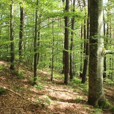
The actual highest point sits about 100 meters south of the summit cross that marks the site. Dense trees surround this true peak, making it easy to miss even for regular visitors.
Location: Deggendorf
Location: Grafling
Elevation above the sea: 1,121 m
GPS coordinates: 48.92816,13.02776
Latest update: December 13, 2025 11:42
Bavarian Forest Railway
5.2 km
Geißkopf
840 m
Teufelstisch
2.7 km
Kloster Gotteszell
6 km
Breitenauriegel
2.4 km
Vogelsang
6.2 km
Sender Deggendorf/Hochoberndorf
6.1 km
Osterbrünnl-Kapelle
6.2 km
Geißriegel
3.1 km
Cultural heritage D-2-7044-0001 in Bischofsmais
6.5 km
Sankt Laurentius in Ruhmannsfelden
6.8 km
St. Petrus und Paulus (March)
6 km
Unsere liebe Frau vom Berge Karmel
6.3 km
Katholische Wallfahrtskirche St. Bartholomäus
3.4 km
St. Jakobus der Ältere
4.1 km
Alte katholische Pfarrkirche St. Andreas
5.5 km
Ruhmannsfeldener Leite
6.4 km
Kalvarienberg
6.3 km
Wiesen und Triften um Rohrmünz, Grafling und Frath
5.3 km
Teisnach zwischen Gotteszell und Ruhmannsfelden
5.7 km
Gipfelgrat des Teufelstischs NW von Bischofsmais
2.8 km
St. Bartholomäus
3.4 km
Kalvarienberg Gotteszell
6.3 km
Marktbrunnen
6.9 km
Osterbrünnl-Kapelle
6.2 km
Eisenbahnbrücke
6.7 km
Deggendorfer Vorwald
3.8 km
Bergwiesen und -weiden im Vorderen Bayerischen Wald
5.5 kmVisited this place? Tap the stars to rate it and share your experience / photos with the community! Try now! You can cancel it anytime.
Discover hidden gems everywhere you go!
From secret cafés to breathtaking viewpoints, skip the crowded tourist spots and find places that match your style. Our app makes it easy with voice search, smart filtering, route optimization, and insider tips from travelers worldwide. Download now for the complete mobile experience.
A unique approach to discovering new places❞
— Le Figaro
All the places worth exploring❞
— France Info
A tailor-made excursion in just a few clicks❞
— 20 Minutes