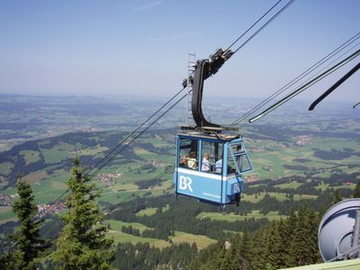
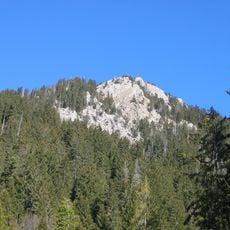
Grüntenseilbahn, Aerial lift in Rettenberg, Germany.
The Grüntenseilbahn is an aerial cable system crossing the Allgäu landscape and connecting the valley station at 743 meters (2437 feet) elevation with the mountain station at 1685 meters (5528 feet). The system operates with two cabins using 28-millimeter support cables and a 16-millimeter pull cable while traveling at 18 kilometers (11 miles) per hour.
The system was constructed in 1971 to serve both public transport and material supply for the Bavarian Broadcasting facilities on Grünten mountain. Over time it became primarily used for operational and maintenance work related to broadcast equipment rather than passenger service.
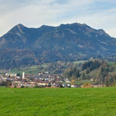
The aerial lift once bridged the valley and mountain experience for visitors to the Allgäu region, offering advance bookings as an unusual way to reach higher elevation. This made climbing Grünten accessible without a long hike, connecting lowland residents to the peaks in a different way than traditional foot paths.
The ride requires sure footing when boarding and exiting since cabins hang high above the ground below. Keep in mind that the system no longer offers regular passenger service, and rides are typically reserved for personnel conducting maintenance work at the summit.
The system is supported by a single 27-meter tower, a remarkably slender structure for a mountain cable system. This engineering detail made it possible to fit the installation into the steep terrain with minimal ground disruption.
The community of curious travelers
AroundUs brings together thousands of curated places, local tips, and hidden gems, enriched daily by 60,000 contributors worldwide.