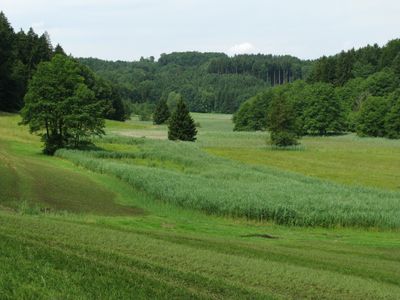
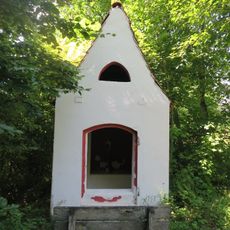
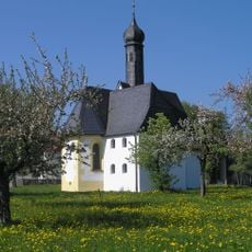
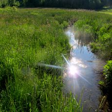
Kupferbachtal bei Unterlaus, Protected area in Feldkirchen-Westerham, Germany.
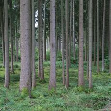
Kupferbachtal is a protected nature reserve near Munich that contains wetlands, meadows, and forested areas across roughly 45 hectares. The Copper Creek runs through the valley and connects the surrounding communities of Feldkirchen-Westerham, Aying, and Glonn.
The valley took its current shape during the last ice age roughly 16,000 years ago when meltwater from the Inn-Chiemsee glacier carved the landscape. The area has been under active management and care by conservation groups since 1994.
The name comes from the Copper Creek that flows through this valley and shapes the local landscape. People who visit here value the chance to experience a natural area that remains largely undisturbed by development.
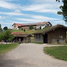
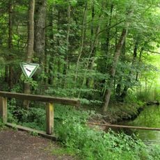
The reserve offers several walking paths that lead through the valleys and meadows with gentle terrain suitable for most visitors. Spring through autumn provides the best conditions for exploring, as trails remain dry and accessible during these seasons.
The valley is home to rare plant species including Bavarian spoonwort, which exists in only a handful of places worldwide. These special plants are a key reason why this area receives legal protection.
Location: Feldkirchen-Westerham
Location: Aying
Location: Glonn
Inception: 1983
GPS coordinates: 47.94810,11.84690
Latest update: December 14, 2025 13:06
Bergtierpark Blindham
3.4 km
Stollwerck-Mausoleum
3.4 km
Piusheim
3.7 km
St. Emmeram
3.2 km
Cultural heritage D-1-8036-0143 in Aying
2.7 km
Feldkapelle (Blindham)
3.3 km
Kirchenruine St. Jakobus
4.3 km
St. Johannes der Täufer (Münster, Egmating)
2.7 km
Mariä Geburt
4 km
St. Laurentius
4.3 km
St. Koloman
4 km
St Andreas in Lindach Egmating
3.9 km
St. Vitus (Unterlaus)
1.5 km
Mariä Verkündigung
2.5 km
Münchener Straße 8
4.3 km
Kapelle
3.9 km
Hl. Dreifaltigkeit
4.3 km
Kapellennische Großhöhenrain
4.3 km
LSG Toteiskessellandschaft Kastenseeon im Markt Glonn und der Gemeinde Egmating
4.3 km
LSG Kupferbachtal und Umgebung im Markt Glonn und der Gemeinde Egmating
712 m
Inschutzstellung des Kupferbachtales als LSG im Landkreis Bad Aibling
563 m
Westerhamer Straße 1
4.3 km
Sühnekreuz
4.1 km
Kapelle
3.4 km
Einfirsthof
1.9 km
Bildstock
2.3 km
Rosenheimer Straße 1
4.3 km
Wohnhaus
4.3 kmVisited this place? Tap the stars to rate it and share your experience / photos with the community! Try now! You can cancel it anytime.
Discover hidden gems everywhere you go!
From secret cafés to breathtaking viewpoints, skip the crowded tourist spots and find places that match your style. Our app makes it easy with voice search, smart filtering, route optimization, and insider tips from travelers worldwide. Download now for the complete mobile experience.
A unique approach to discovering new places❞
— Le Figaro
All the places worth exploring❞
— France Info
A tailor-made excursion in just a few clicks❞
— 20 Minutes