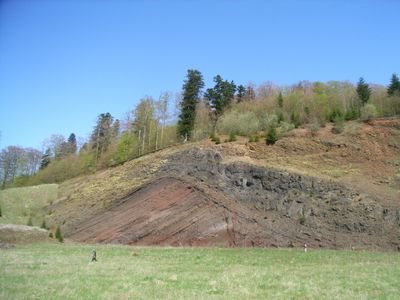
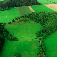
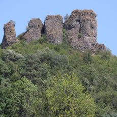
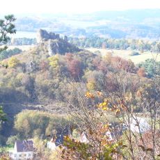
Rockeskyllerkopf, Mountain summit in Vulkaneifel, Germany
Rockeskyllerkopf is a mountain summit reaching approximately 555 meters in the Volcanic Eifel region, formed by multiple interconnected cinder cones. These cones built up through repeated volcanic eruptions that left layered deposits of volcanic material stacked on top of each other.
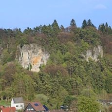
The summit formed about 360,000 years ago during the Quaternary period, beginning with steam explosions followed by sustained volcanic eruptions. This long history of volcanic activity shaped the entire Volcanic Eifel landscape.
The mountain sits within the Volcanic Eifel Nature Park, where the volcanic past shapes how locals and visitors understand the landscape. People come to experience the terrain that reveals the region's geological story through its visible rock formations and terrain.
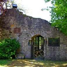
The summit is accessible via local roads near Gerolstein, with a hiking trail leading up to the plateau that offers broad views across the surrounding Volcanic Eifel. A mountain hut sits nearby and serves as a natural stopping point for visitors.
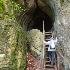
The summit contains rare nephelinite lava formations with melilite-bearing minerals that are unusual in this combination across Europe. These distinctive rocks formed under specific conditions during the volcanic activity that built the peak.
The community of curious travelers
AroundUs brings together thousands of curated places, local tips, and hidden gems, enriched daily by 60,000 contributors worldwide.