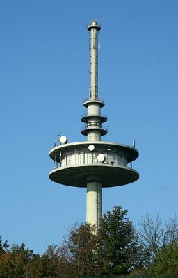
Fernmeldeturm Hoherodskopf, Telecommunications tower in Schotten, Germany.
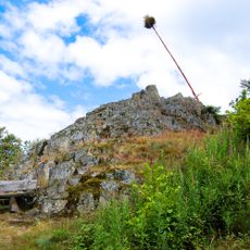
Fernmeldeturm Hoherodskopf is a concrete broadcasting tower standing 144 meters tall on its namesake mountain, transmitting radio and mobile phone signals. It was built at an elevation of about 763 meters and operates as a transmission facility for various communication services.
The Deutsche Bundespost built this tower from 1976 to 1977 to replace an older steel lattice tower that previously occupied the site. The new concrete structure was designed to provide improved transmission capacity and more reliable broadcasting infrastructure.
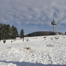
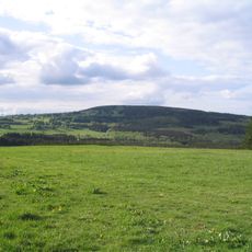
The tower serves as a visible landmark for the region and has shaped the Vogelsberg landscape for decades. Locals use it as an orientation point when navigating the surrounding area.
The tower is not open to the public and is accessible only to maintenance staff for operational work. Its location at an elevated position makes it visible from many points across the surrounding area.
Until 2008, this tower held the distinction of being the tallest structure in the Vogelsberg region, until two wind turbines surpassed its height. Despite this shift, it remains an important visual anchor in the landscape.
Location: Hesse
Height: 144 m
Made from material: concrete
GPS coordinates: 50.51100,9.22661
Latest update: December 14, 2025 09:45
Hoherodskopf
48 m
Taufstein
1.1 km
Bilstein
2.4 km
Herchenhainer Höhe
4.5 km
Sieben Ahorn
2.8 km
Bismarck Tower
1.1 km
Hoherodskopf
63 m
Evangelische Kirche Busenborn
3.3 km
Evangelische Kirche Rudingshain
3.9 km
Evangelische Kirche Burkhards
5.7 km
Evangelische Kirche Breungeshain
1.5 km
Evangelische Kirche Feldkrücken
5.5 km
Evangelische Kirche Michelbach
4.8 km
Der Bilstein bei Busenborn
2.4 km
Naturschutzgebiet Oberes Niddatal/Forellenteiche
1.6 km
Wannersbruch
3.7 km
Brücken über die Nidder
4.7 km
Naturschutzgebiet Ernstberg bei Sichenhausen
4.2 km
Blockfelder am Taufstein
1.1 km
Am Bilstein bei Breungeshain und Busenborn
1.9 km
Naturschutzgebiet In der Breungeshainer Heide
2.6 km
Naturschutzgebiet Auf der langen Galle bei Rudingshain
4.1 km
Niddahänge östlich Rudingshain
2.2 km
Die Uhuklippen von Ilbeshausen
5.6 km
Linde am tiefen Weg
6 km
Vogelsberg
5.2 km
Das Gesicht, Felsgruppe bei Grebenhain
4.8 km
Die Bonifatiuskanzel von Herchenhain
4.8 kmVisited this place? Tap the stars to rate it and share your experience / photos with the community! Try now! You can cancel it anytime.
Discover hidden gems everywhere you go!
From secret cafés to breathtaking viewpoints, skip the crowded tourist spots and find places that match your style. Our app makes it easy with voice search, smart filtering, route optimization, and insider tips from travelers worldwide. Download now for the complete mobile experience.
A unique approach to discovering new places❞
— Le Figaro
All the places worth exploring❞
— France Info
A tailor-made excursion in just a few clicks❞
— 20 Minutes