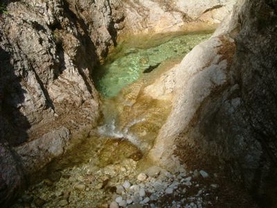
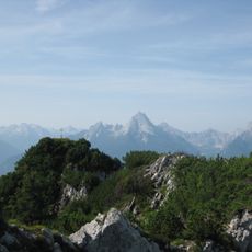
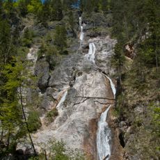
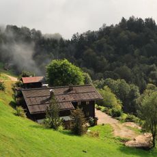
Almbachklamm, Natural canyon in Schellenberger Forst, Germany.
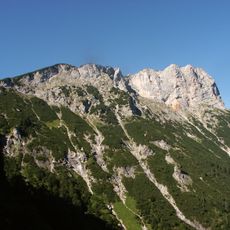
The Almbachklamm is a narrow slot canyon in Schellenberger Forst that stretches for 2700 meters through limestone formations carved by water. The creek flows through rock passages and past several waterfalls, creating a steep and intricate natural pathway.
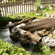
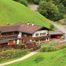
The gorge took shape over thousands of years as the creek gradually cut through limestone layers by natural erosion. A historic mill dating to the 1680s at the entrance demonstrates how people traditionally harnessed the stream's water power for processing local stone.
The gorge holds meaning for the people who live nearby, representing their connection to the mountain landscape. Visitors can observe how the canyon has been woven into local identity and the way the community relates to this natural space.
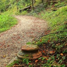
Sturdy hiking boots are essential for navigating the many stairs and narrow, slippery paths along the rock walls. The best time to visit is during dry weather, since wet surfaces make the route considerably more difficult and hazardous.
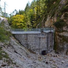
Nineteen numbered bridges are built into the route, allowing hikers to track their progress and cross different sections of the canyon safely. These markers help visitors navigate through the most complex passages without getting confused.
Location: Schellenberger Forst
Elevation above the sea: 580 m
Length: 2,700 m
Width: 100 m
GPS coordinates: 47.67020,13.01830
Latest update: December 8, 2025 13:42
Berchtesgadener Hochthron
3.5 km
Wallfahrtskirche Maria Gern
2.2 km
Kneifelspitze
1.3 km
Wallfahrtskirche Mariä Heimsuchung (Ettenberg)
850 m
Untersberger marble ball mills
938 m
Schloss Adelsheim
3.4 km
Großer Rauhenkopf
3.1 km
Theresienklause
1.5 km
St. Nikolaus
3.5 km
Sulzer Wasserfall
602 m
Hilgerkapelle
3.5 km
Hofkapelle des sogenannten Hilgerlehens, St. Maria-Dorfen
3.5 km
Katholische Filialkirche St. Maria am Berg
3 km
St. Nikolaus
3.5 km
Katholische Wallfahrtskirche Maria Gern
2.2 km
LSG Untersberg mit Randgebieten, Gemeinde Bischofswiesen, Markt Berchtesgaden und Markt Marktschellenberg sowie das gemeindefreie Gebiet Schellenberger Forst
3 km
Schloss Adelsheim, jetzt Museum
3.4 km
Ehemals Landhaus für Prinzessin Mathilde v. Waldenburg, sogenannte Villa Alpenruhe bzw. Stöhr-Schlössl
3.4 km
Fluchthäusl
2.2 km
Schusterlehen, Zwiehof
1.9 km
Hofkapelle
1.4 km
Untersberglehen
1.6 km
Gollenbachkreuz
3.1 km
Untersberg
3.2 km
Obersommerau-Lehen
2 km
Fendtleiten-Lehen
2.3 km
Kneifllehen, Bauernhaus
2 km
Sogenannte Wassersäule
2.4 kmVisited this place? Tap the stars to rate it and share your experience / photos with the community! Try now! You can cancel it anytime.
Discover hidden gems everywhere you go!
From secret cafés to breathtaking viewpoints, skip the crowded tourist spots and find places that match your style. Our app makes it easy with voice search, smart filtering, route optimization, and insider tips from travelers worldwide. Download now for the complete mobile experience.
A unique approach to discovering new places❞
— Le Figaro
All the places worth exploring❞
— France Info
A tailor-made excursion in just a few clicks❞
— 20 Minutes