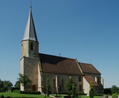
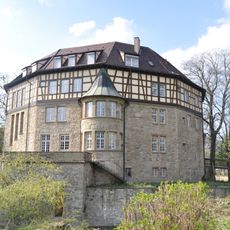
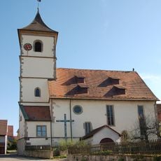
Frauenkirche Unterriexingen, Gothic church in Markgröningen, Germany.
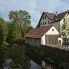
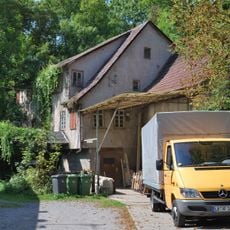
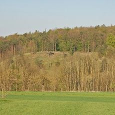
Frauenkirche Unterriexingen is a Gothic church situated on a hilltop between the Enz and Glems valleys. The building displays fully restored sections alongside areas that retain their historic ruined appearance, reflecting different phases of its preservation.
The building started in the 13th century as a pilgrimage chapel and underwent significant expansion during the 14th century. It served as the parish church until 1628, when its role shifted.
The church takes its name from its location in Unterriexingen and served as a focal point for the community over many centuries. Visitors can still see inscriptions and gravestones left by local noble families, reflecting the connections between the building and the region's past.
The site is located outside the village center on elevated ground, which should be considered when planning a visit. After extensive renovation work between 1999 and 2003, the church is now accessible in good condition.
The church received the Monument Protection Prize of Baden-Württemberg in 2004, an honor recognizing its successful restoration. This award demonstrates how the region valued the careful preservation of its historic fabric.
Location: Markgröningen
Architectural style: Gothic architecture
GPS coordinates: 48.93211,9.04997
Latest update: December 9, 2025 20:22
Schloss Unterriexingen
1.1 km
Altsachsenheim
3 km
Leudelsbachtal
2.6 km
Schloss Großsachsenheim
3.4 km
Helene-Lange-Gymnasium Markgröningen
3.6 km
St. Fabian und Sebastian
3.2 km
Enz Viaduct
3.7 km
Bachmühle
755 m
Mills in Markgröningen
3.6 km
Enztal zwischen dem Leinfelder Hof und Bietigheim-Bissingen sowie Glems- und Leudelsbachtal unterhalb Markgröningen mit angrenzenden Gebieten (insbesondere Ottern-, Berg- und Siegental, Muckenschupf und Rotenacker Wald)
664 m
Pfarrkirche Unterriexingen
633 m
Wasserturm Markgröningen
2.9 km
Bannwald Rotenacker
2.5 km
Wimpelinhof Markgröningen
3.6 km
Sachsenheim-Ring
1.8 km
Untere Kelter (Markgröningen)
3.7 km
Landesfruchtkasten
3.6 km
Altes Pfarrhaus
607 m
Pflanzenstandort "Bühl"
1.7 km
Oberes Tor
3.6 km
Hammelrain/Oberer Wannenberg
2.3 km
Hohlweg "Frauenklinge"
195 m
Rotenacker
2.8 km
Sukzessionsfläche und Tümpel "Ob dem Hart"
2 km
Tümpel beim ehem. Remmigheim
2.2 km
Enzinsel "Wörth" mit Altarm
2.3 km
Marktplatz 4
3.7 km
Marktplatz 2
3.7 kmVisited this place? Tap the stars to rate it and share your experience / photos with the community! Try now! You can cancel it anytime.
Discover hidden gems everywhere you go!
From secret cafés to breathtaking viewpoints, skip the crowded tourist spots and find places that match your style. Our app makes it easy with voice search, smart filtering, route optimization, and insider tips from travelers worldwide. Download now for the complete mobile experience.
A unique approach to discovering new places❞
— Le Figaro
All the places worth exploring❞
— France Info
A tailor-made excursion in just a few clicks❞
— 20 Minutes