Pegel Kaub, Stream gauge in Kaub, Germany
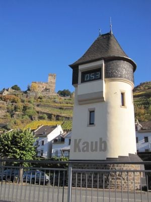
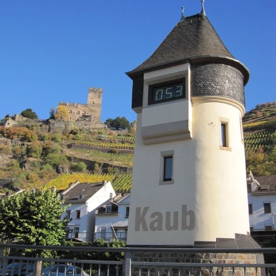
Pegel Kaub is a cylindrical tower with a pale cream facade on a dark stone base, standing at Rhine-kilometre 546.3 on the right bank. Large grey letters spelling Kaub are painted above the base, and a dark digital display beneath the conical grey roof shows the current level, such as 053. Two small vertical windows with dark frames sit on the curved surface.
A staff gauge was first installed at Kaub in 1856, still measured in Nassau decimal feet. Prussia built the present tower, opened on 18 May 1905 with a level recorder and a large mechanical indicator; the display was electrified in 1951. Remote data transmission followed in 1967, a measurement announcement device in 1968, and in 2011 paper recording was replaced by a second, redundant measuring device.
The tower's large mechanical gauge clock, electrified in 1951, shows the current level to passing skippers; the painted name Kaub and the digital display reading 053 mark it from the water. The site sits beside the Kaub ferry, the signal mast and the former pilot station, and its readings are checked on the ELWIS site.
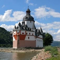
The gauge stands at Rhine-kilometre 546.3 on the right bank, a few metres downstream of Pfalzgrafenstein Castle, beside the Kaub ferry, the signal mast and the former pilot station. The tower is a listed monument; the digital display on its facade shows the current level, and readings can also be checked on the ELWIS site.
The gauge's zero point has been fixed at 67.669 m above sea level since 1 November 2019, and the equivalent water level of 0.77 m has applied since 1 January 2023. The highest water level recorded here was 8.25 m in 1883; shipping is banned above the second high-water mark of 6.40 m.
The community of curious travelers
AroundUs brings together thousands of curated places, local tips, and hidden gems, enriched daily by 92,660 contributors worldwide.