Chest opened
+${chestReward.xp} XP
Explorer
NOUVEAU ×${chestReward.collectible.quantity}
tapez pour fermer
Chest locked

Open chests in the app

Around Us is built for your phone — chests unlock when you walk, explore and capture nearby places.

Enable Location

We need your location to show you interesting places around you

Discover nearby places

Find interesting locations and hidden gems around you

Precise directions

Get accurate directions and distances to places

Your location is never shared with other users. It's only used when you tap the location button.

Log in to your account

Start exploring — it's free

Trusted by 72,886 travelers worldwide

Continue with Google
Continue with Apple
or

We will send you a code to connect

By continuing, you accept our Terms and Conditions and our Privacy Policy

Check your inbox

We've sent a pincode in your inbox. Please enter the code below.

Hohe Schaar
Discussion Reviews Photo
1.7k Popularity

Hohe Schaar, River island in Hamburg harbor, Germany

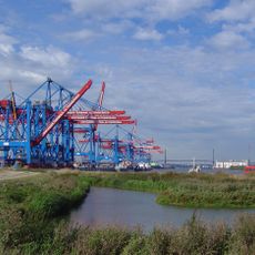
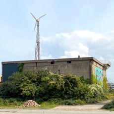
Hohe Schaar is a port island situated between the Süderelbe, Köhlbrand, Rethe, and Reiherstieg waterways. The area consists mainly of warehouse facilities, cargo terminals, and industrial structures that form part of the Hamburg harbor infrastructure.

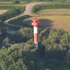
The island was home to a railway signal station from the early 1960s until the mid-1970s. This facility was important for controlling train movements in the Hamburg port region during that period.

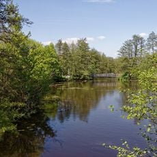
The island reflects Hamburg's maritime tradition through its working port facilities and cargo operations. Visitors can observe the rhythm of harbor commerce with ships, vehicles, and cargo movements that define the character of this working waterfront.

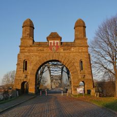
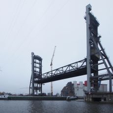
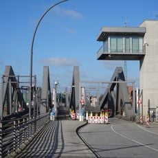
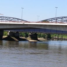
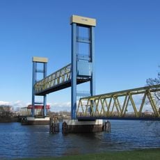
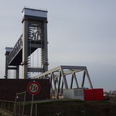
The island can be reached via the Rethe bascule bridge to the north, the Kattwyk bridge to the west, and Hohe-Schaar-Strasse to the southeast. This is an active port area, so visitors should be prepared for ongoing harbor operations and vehicle traffic.

The island hosts a specialized automotive terminal for vehicle cargo and multiple tank storage facilities operated by companies like Oiltanking Hamburg. These operations showcase the specialized handling capabilities that make this port globally important for trade.

The community of curious travelers

AroundUs brings together thousands of curated places, local tips, and hidden gems, enriched daily by 60,000 contributors worldwide.

Start exploring
Location
GPS coordinates
53.49222,9.96556
Latest update
December 21, 2025 16:05
Reviews
Share your experience

No review yet

Discussions
Start a discussion...

No discussion yet

« Hohe Schaar - River island in Hamburg harbor, Germany » is provided by Around Us (aroundus.com). Images and texts are derived from Wikimedia project under a Creative Commons license. You are allowed to copy, distribute, and modify copies of this page, under the conditions set by the license, as long as this note is clearly visible.

Discover hidden gems everywhere you go!

From secret cafés to breathtaking viewpoints, skip the crowded tourist spots and find places that match your style. Our app makes it easy with voice search, smart filtering, route optimization, and insider tips from travelers worldwide. Download now for the complete mobile experience.

Around Us App Screenshot

A unique approach to discovering new places

Le Figaro

All the places worth exploring

France Info

A tailor-made excursion in just a few clicks

20 Minutes

Around Us
Travel Guide & Maps
Download

Send to your phone

QR Code
1

Open the camera app on your mobile.

2

Point at the QR code with your camera. A notification will appear.

3

Tap the notification to open the link.