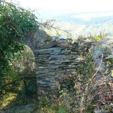
Ringwall Kautenbach, Celtic circular rampart in Kautenbach, Traben-Trarbach, Germany.
Ringwall Kautenbach is a circular fortification with multiple earth banks and stone walls located on elevated terrain near the Moselle valley. The concentric arrangement of structures follows the natural contours of the hilltop.
In 1973 the Traben-Trarbach artist and local historian Helmut Wendhut discovered the well-preserved rampart on the Gottwertshöhe. In a Mittelmosel-Zeitung article of 1 September 1978 he raised the question of whether it might be Celtic, and in March 1979 Reinhard Koch of the Rheinisches Landesmuseum Trier surveyed the site. The western wall is cut through at a height of 322 m.
The rampart's name comes from the nearby village of Kautenbach, 400 m to the southeast. Local artist and amateur historian Helmut Wendhut, from Traben-Trarbach, found the well-preserved earthwork in 1973 on the Gottwertshöhe and in 1978 asked publicly whether it might be Celtic. In March 1979 Reinhard Koch of the Rheinisches Landesmuseum Trier surveyed it.
The rampart lies 400 m northwest of Kautenbach, about 150 m northeast of the old sports ground, on a plateau of a spur above the Kautenbach valley. The wall foot is hard to make out on the steep south, east and north sides; the clearest feature is the gap in the west side at 322 m. The entrance was at the northwest, where a 4 m wide, 0.90 m deep ditch cuts off the outer bank.
The entrance lay on the northwest side, where an outer rampart created a passage flanked by banks on both sides. A 4 m wide, 0.90 m deep ditch in front of that rampart cut off access, backed by a slightly higher rock ridge.
The community of curious travelers
AroundUs brings together thousands of curated places, local tips, and hidden gems, enriched daily by 94,663 contributors worldwide.