Tamniès

Log in to your account

AroundUs is a community-driven map of interesting places, built by curious explorers like you. It grows with every review, story, and photo you share.
Connect to save your favorite spots, contribute locations, and create personalized routes.
By continuing, you accept our Terms and Conditions and our Privacy Policy

Tamniès, Rural commune in Dordogne department, southwestern France.

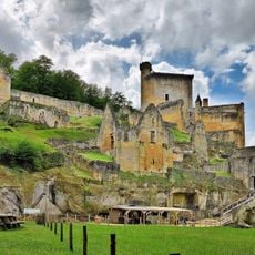
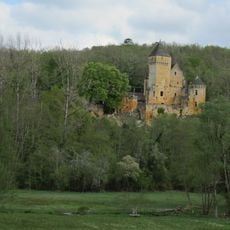
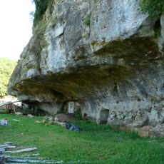
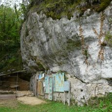
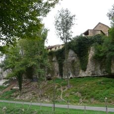
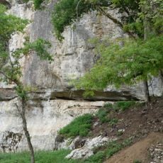
Tamniès covers approximately 119 square kilometers in the Dordogne region, situated at elevations ranging from 104 to 288 meters above sea level, featuring traditional stone architecture and rolling countryside landscapes typical of the Périgord Noir area.

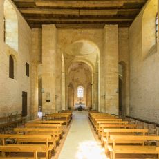
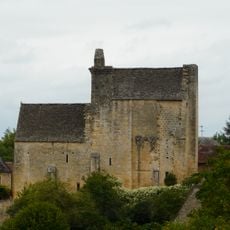
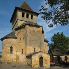
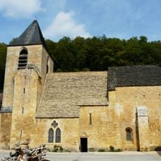
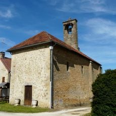
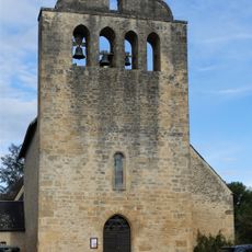
The village church dates back to the 13th century, representing medieval religious architecture with Gothic elements that served as the spiritual center for rural communities throughout the centuries, witnessing generations of local inhabitants and regional historical developments.

Local traditions remain alive through annual festivals celebrating regional gastronomy, folk music, and traditional dances that bring together residents and visitors, maintaining the cultural heritage of the Périgord region through community participation and shared celebrations.

Municipal offices operate Monday through Friday from 9:00 AM to 12:00 PM for administrative services, with the commune accessible via regional roads connecting to Sarlat-la-Canéda and neighboring towns in the Dordogne department.

NASA named a Martian exploration target after Tamniès in 2021, giving this small French commune international scientific recognition as part of space exploration missions conducted by the Curiosity rover on the red planet.

Location: Dordogne

Location: arrondissement of Sarlat-la-Canéda

Elevation above the sea: 198 m

Shares border with: Valojoulx, Sarlat-la-Canéda, Peyzac-le-Moustier, Sergeac, Marquay, Marcillac-Saint-Quentin, La Chapelle-Aubareil

Address: Le Bourg, 24620 Tamniès, France 24620 Tamniès

Opening Hours: Monday-Friday 09:00-12:00

Phone: +33553296895

Email: mairie.tamnies@wanadoo.fr

Website: http://tamnies.fr

GPS coordinates: 44.96583,1.14944

Latest update: August 19, 2025 10:50

Reviews

Visited this place? Tap the stars to rate it and share your experience / photos with the community! Try now! You can cancel it anytime.

« Tamniès - Rural commune in Dordogne department, southwestern France. » is provided by Around Us (aroundus.com). Images and texts are derived from Wikimedia project under a Creative Commons license. You are allowed to copy, distribute, and modify copies of this page, under the conditions set by the license, as long as this note is clearly visible.

Discover hidden gems everywhere you go!

From secret cafés to breathtaking viewpoints, skip the crowded tourist spots and find places that match your style. Our app makes it easy with voice search, smart filtering, route optimization, and insider tips from travelers worldwide. Download now for the complete mobile experience.

Around Us App Screenshot

A unique approach to discovering new places

Le Figaro

All the places worth exploring

France Info

A tailor-made excursion in just a few clicks

20 Minutes